

1. Recap of today's weather
2. 24 Hour Forecast: Cooler temperatures, winds finally easing overnight Monday, clouds burning off overnight. Tomorrow morning you will want to have a jacket ready.
3. Extended & 10 Day Forecast: Cooler temperatures to start the week with lots of sun and a gradual warm up. Near 0 rain chances for the extended forecast.
RECAP:
The cold front pushed trough Acadiana overnight. Thanks to a stable air mass in our mid-levels in the atmosphere, Acadiana was spared from the severe weather threat and received very little rain as well. This has allowed winds to shift from those southern winds bringing in that humid air mass, and brought winds to a Northwesterly direction, allowing temperatures to drop. Clouds linger as an upper level jet stays over Louisiana, but a building high pressure will soon clear those out.
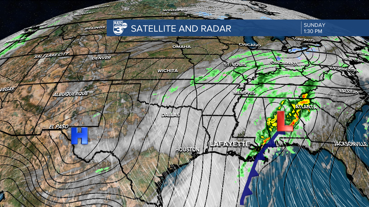

South Louisiana had no storm reports over the last 48 hours, we were very lucky. Our northern neighboring states were not nearly as fortunate as they went through days of severe weather outbreaks.

So many storm reports were made over the last 48 hours the map could not even resolve them all in detail.

There is a 20-25 degree temperature difference through Acadiana in comparison to yesterday after that strong cold front pushed through the area.

Tonight, you can expect much more mild conditions. Winds will hang around tonight with some isolated chances for light showers. Tomorrow morning will be chilly so be prepared.

24-Hour Forecast:
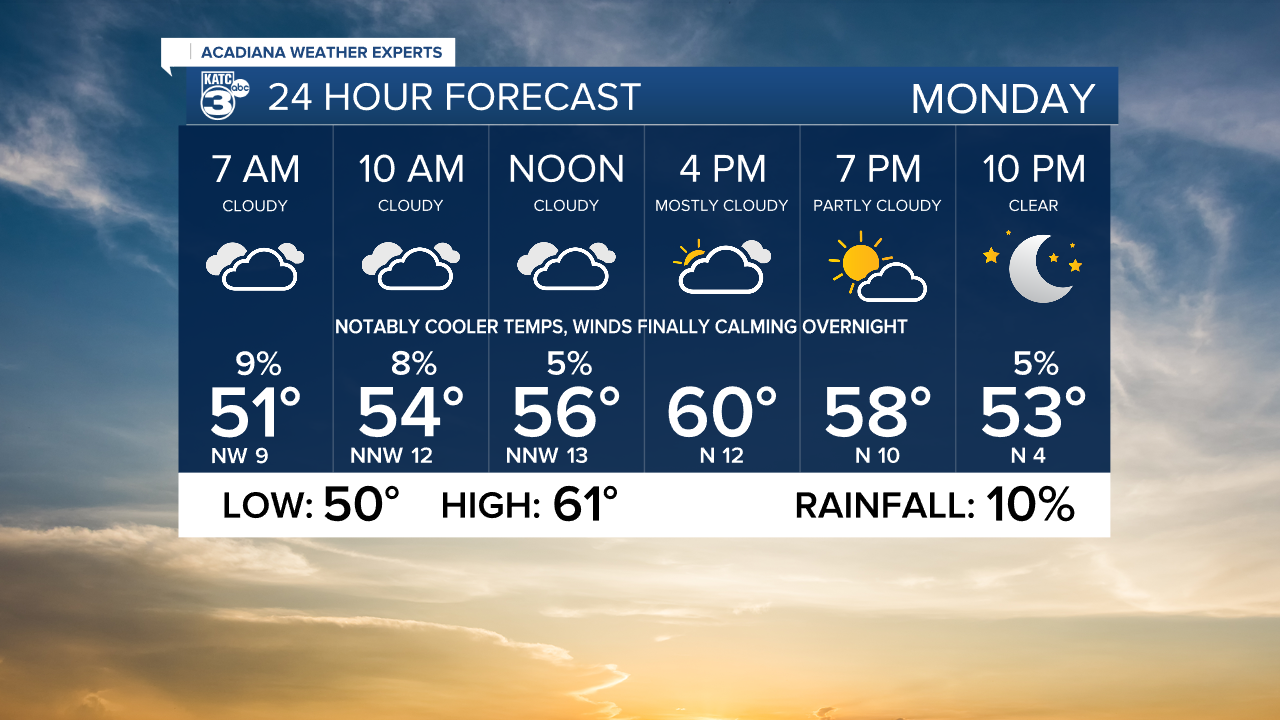
Tomorrow clouds will linger, and we FINALLY see winds calming through the overnight hours on Monday as the front pushes further from Louisiana and a surface high pressure builds in from our west.

Extended & 10 Day Forecast:


