


The recent wet and unsettled weather pattern is expected to continue for Acadiana for most of the upcoming week.

Plenty of available tropical moisture along with a nearly stationary weakness/upper level trough will continue to promote scattered showers and thunderstorms for the area, day and/or night at least through Thursday.
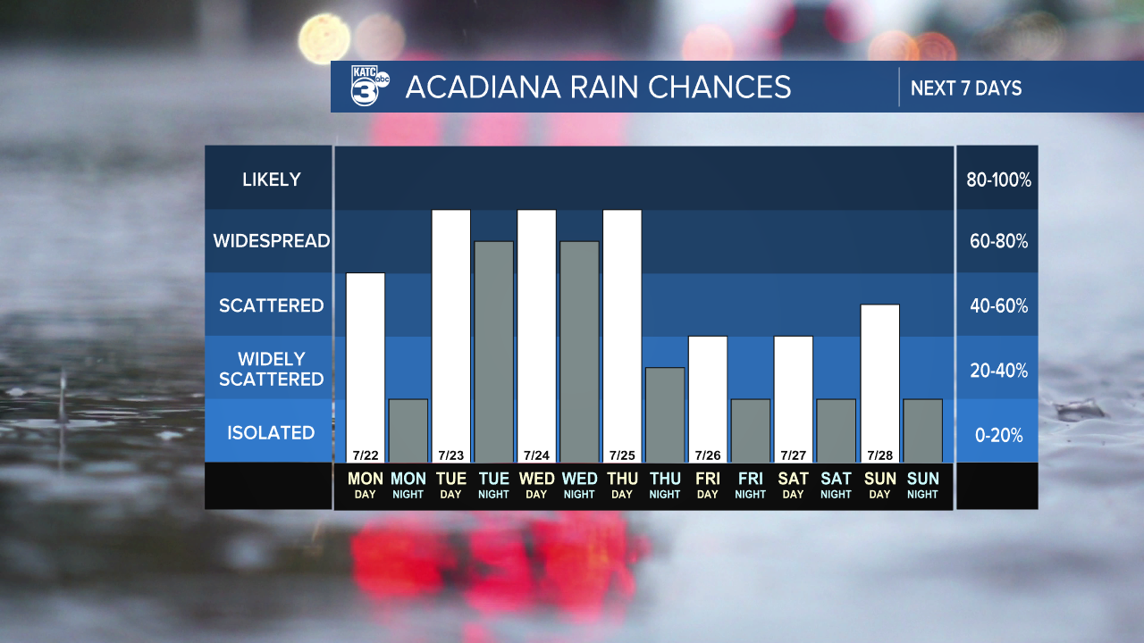
Thereafter, some slight high pressure ridging and reduction of available moisture should eas the pattern toward the end of the week, but the area will continue see the threat of scattered storms through the entire 10 Day Forecast.

Overall, we are expecting any organized severe storms, but healthy storms containing gusty winds, (maybe a funnel cloud or two especially with any activity mid-morning hours) and locally heavy downpours will be possible day and or night in the days ahead.
The deepest tropical moisture and highest rain chances this week should primarily be between Tuesday and Thursday.

Rain totals per the Weather Prediction Center (WPC) over the 7 days shows the likelihood of 2-4" for most of the area increasing to 3-5" for Southwest Louisiana back into Southeast Texas.
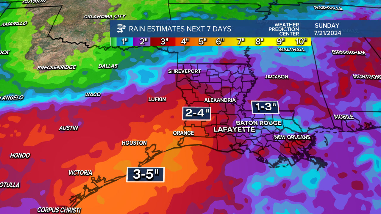
Per usual, double of the WPC amounts will be possible in isolated spots.
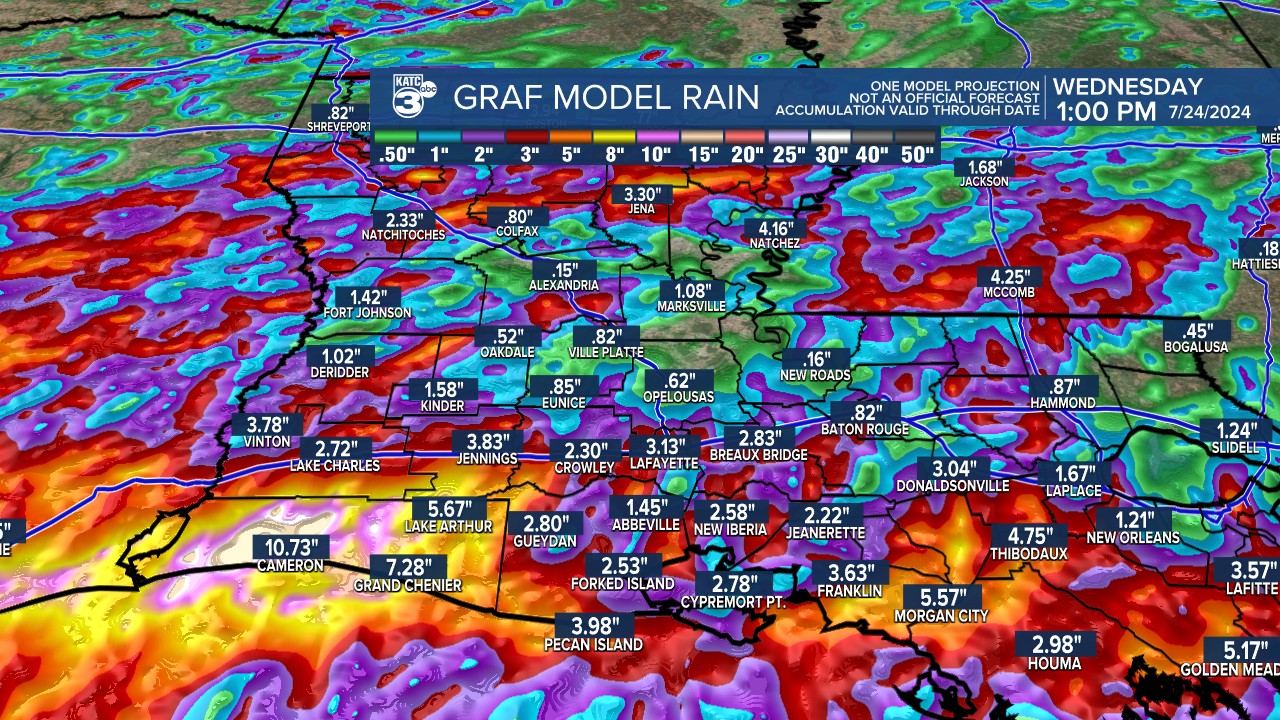
Given the latest GRAF Model output...soaking rains and storms will be possible for most of Acadiana in the days ahead, but there could be more isolated areas subject to localized flood over the next few days.
