


UPDATE MONDAY, SEPTEMBER 9TH, 10:00 AM:
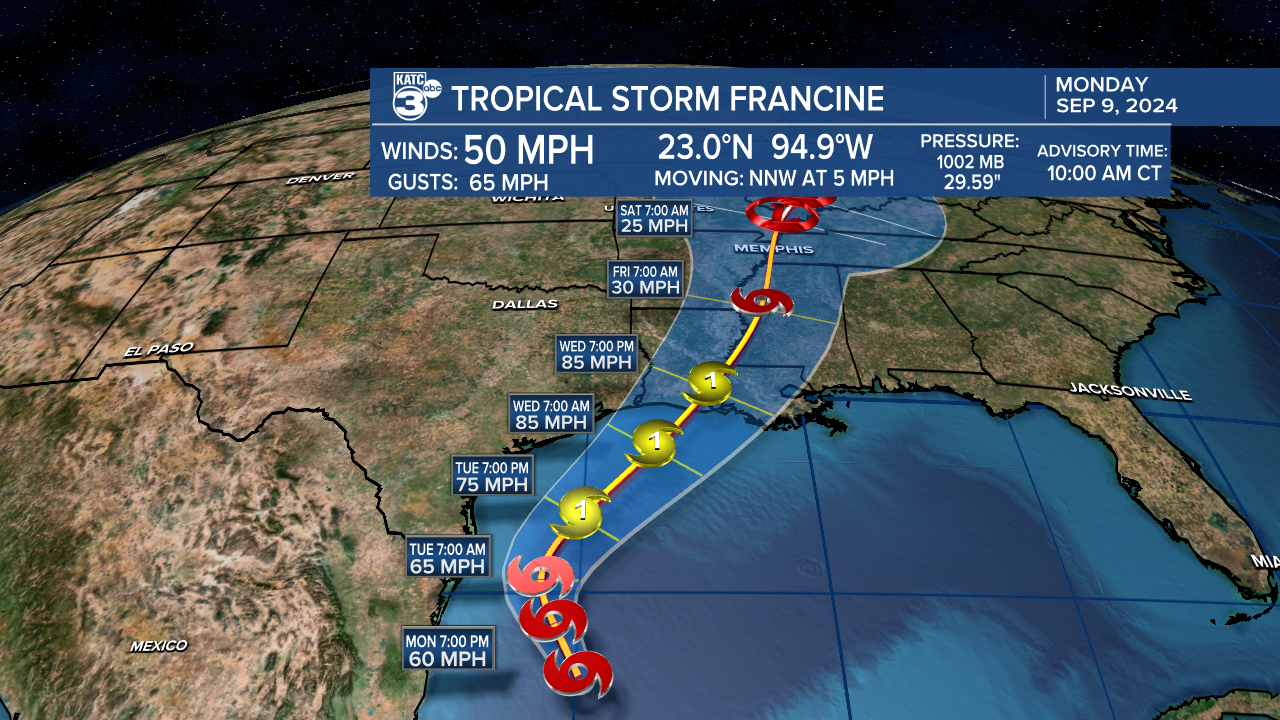
Since writing this article Francine has officially been given a name and has intensified slightly.
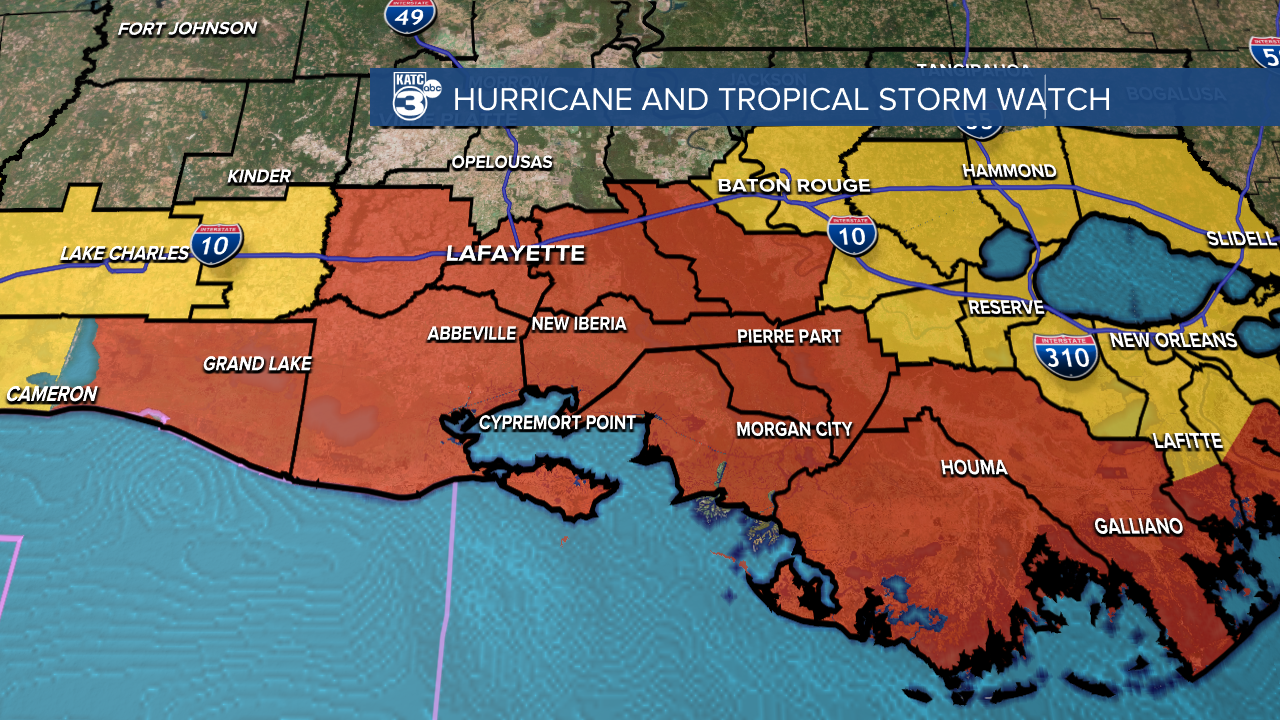
The rest of the article is still relevant but did want to add that hurricane watches and tropical storm watches have been posted in Acadiana.
A busy week is shaping up here in Acadiana with the high likelihood of a strong Category One storm arriving Wednesday night.
The system, which hasn't officially been given the name Francine, continues to fester in the Bay of Campeche as an elongated low.
A center is expected to emerge by the end of the day as PTC 6 slowly starts its northward crawl into the north Gulf of Mexico and toward Louisiana.
There's been a slight trend eastward with the cone and I would expect a slow drift to the east to continue per the latest model guidance.
It's important, however, not to focus too much on the center line as impacts will be felt through out Louisiana.
Until the center develops there's still some uncertainty regarding specific impacts for Acadiana so expect tweaks to the forecast over the next 24 hours.
That being said there's still a lot we can talk about and prepare for over the next 24-48 hours.
Impacts are going to get tweaked as we get a better sense of what this storm looks like as structure will be important in determining where the worst impacts will occur.
So as we go through the day Monday and Tuesday we'll be able to get a little more specific.
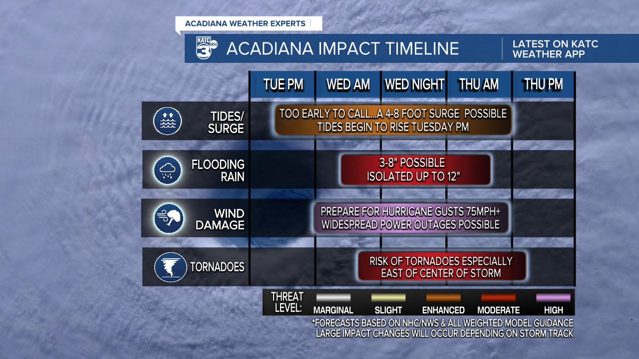
As of Monday morning it looks as if storm surge will be between about 4-8 feet with some of the highest surge expected along Vermilion Bay.
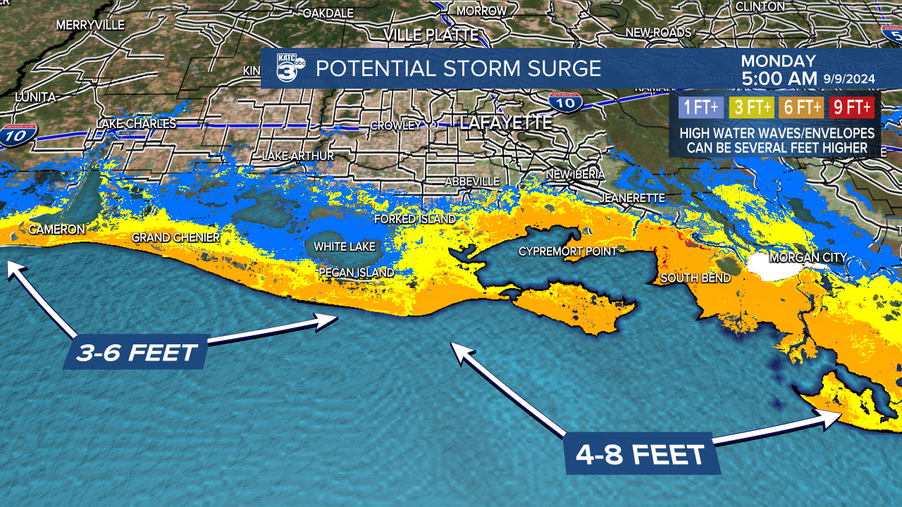
Tides will start to come up starting as early as Tuesday evening with surge really pushing across the area through the day Wednesday and into Wednesday night.
Surge should stay south of Highway 14 in Vermilion Parish and south of Highway 90 in Iberia and St. Mary Parish but in areas around Franklin it may get fairly close to the roadway.
Residents who live down along the coast should monitor for evacuation orders and heed those orders if they are in an evacuation zone.
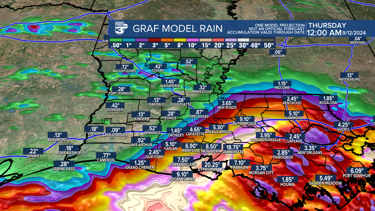
Showers will start to arrive as early as Tuesday afternoon with a few light bands pushing through and gradually seeing an increase in the rain through the day on Wednesday.
Totals will be between about 4-8" with some localized areas seeing a foot to a foot and half of rain which could lead to flash flooding.
The heaviest rain will occur just east of the center and the risk of flooding will be higher east of the eye.
Expect the corridors of the heaviest rain to wobble a little as models get a better sense of the track and try not to focus on specific numbers.
Winds around the center will be between 80-90 mph which will be enough to knock down trees, power lines, and cause damage to roofs.
Widespread power outages are expected Wednesday night so have your devices charged and your flashlights ready.
Tropical storm force winds will start to arrive Wednesday afternoon so have preparations wrapped up by Tuesday.
This is a first run through of impacts, we will be able to get a better sense of specifics later today and tomorrow as we get a better idea of what this storm will look like and where the center ends up.
There's going to be plenty of updates through the day and we'll get them out to you as quickly as possible.
