


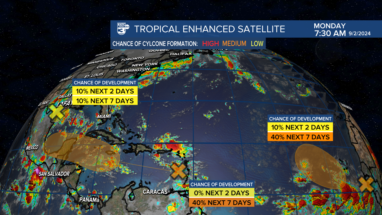
A series of waves across the Atlantic we're keeping an eye on as we get into the first week of September.
Out of the three only the one in the middle looks as if it has the potential to be of any interest to us along the Gulf Coast, so we'll do a deeper dive on that in just a moment.
The far eastern wave is continuing to receive good model support that development is possible down the road, but with that will come a curve out into the Atlantic.
There's a disturbed area off the Texas coast that continues to produce showers and storms in the Gulf of Mexico, but development into a full fledged tropical system is unlikely.
Those who work offshore are likely dealing with heavier winds and seas with thunderstorms clustering around the low.
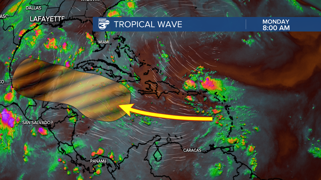
This brings us to the wave that is currently passing through the Leeward Islands and getting ready to move through Caribbean.
There's still a bit of dry air which will likely hinder development in the short term but there's some riper conditions closer to the Yucatan which could be the catalyst for some further development.
We've been watching this wave for almost a week now and despite plenty of ingredients in place for a developing storm it has simply meandered westward.
Models have tried to develop this system several times, and are still hinting at development down the road but the Atlantic remains hostile to these infant storms.
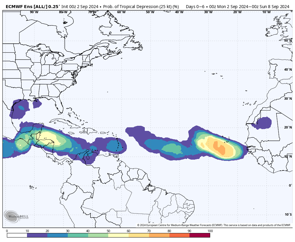
The EURO still believes in development around the Yucatan but the, usually aggressive, GFS seems to have written it off completely.
You never really want anything festering down there this time of year, so it's too early to ignore it completely but the longer it takes to get going likely means the better for Louisiana.
Weak, disorganized systems have a tendency to drift west instead of getting pulled up to the poles so if the wave never consolidates it may end up just drifting into Central America.
Again, it's too early to make any definitive statements about it but some of the doomsday scenarios that popped up during the weekend's model runs seem to be off the table.
It remains a bit of a mystery why storms have struggled so much to develop this season, and it could easily whiplash around and be a loaded back end to the season.
In the meantime though we can enjoy any week that doesn't bring us tropical weather.
I should mention a quick word of caution though that it's still too early to get complacent, there's a lot of moisture in the Gulf of Mexico and as I mentioned you don't want to see that stuff fester.
And besides if we only get one more storm this season and it's a major hurricane in Louisiana it won't feel like a quiet season despite the lack of storms.
As always things this time of year can change in a hurry but if they do we'll be the first ones to let you know.
