


UPDATE THURSDAY, JUNE 27TH:
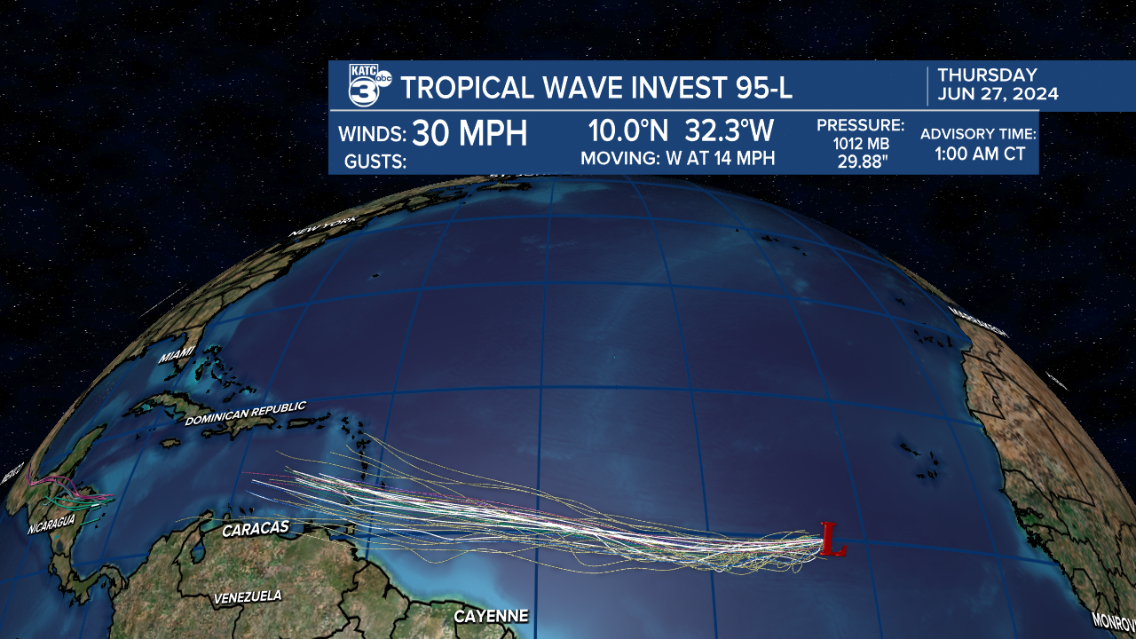
A few waves have popped up in the Atlantic that the NHC is monitoring for possible development, one of which looks pretty likely to develop over the next week.
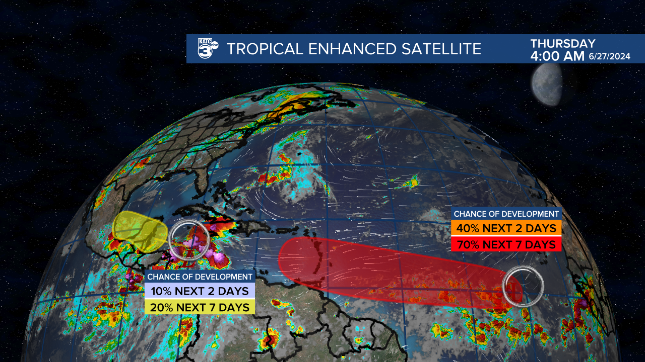
There's some model support for slow development of the Atlantic wave (Invest 95L) which will ride the southern part of the ridge into the Caribbean.
It's too early to tell the ultimate strength of the system but neither model has really tightened it up much, the GFS again the stronger of the two major models.
There's no immediate impacts to the Gulf Coast expected at this time, and long range models seem to think it'll continue on a southerly track.
As always we'll continue to monitor it and bring you updates as needed.
Tropical Outlook for the Week of June 24th through July 1st.
It'll be a much simpler and quicker outlook this week compared to the last few weeks as activity tropical activity has died down a little.
So let's start things off with our favorite graphic.
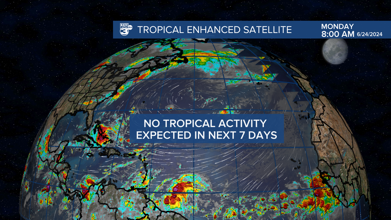
After a few weeks watching tropical waves in the Caribbean, and even our first named storm it seems the tropics have quieted down at least for the final week of June.
There's a few different features that have allowed for a quiet week, and while there's some tropical waves and a visible monsoon pattern in the Atlantic none of those will overcome the dynamics at hand.
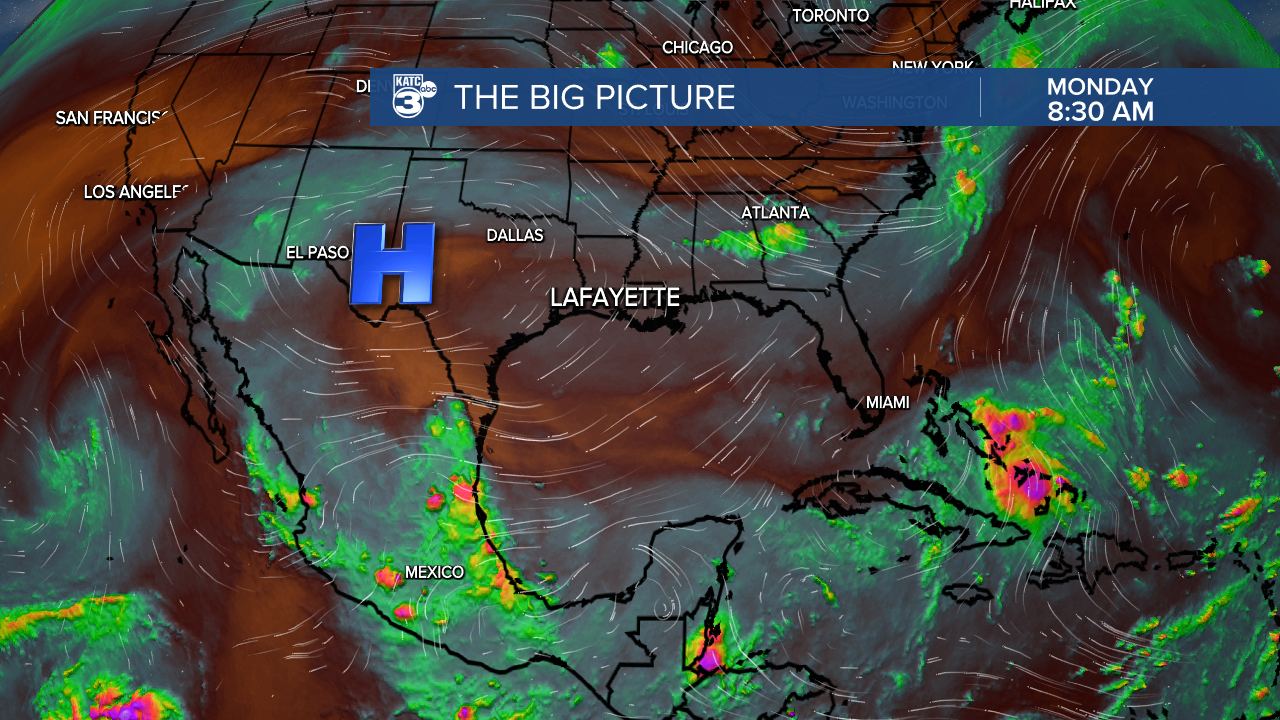
First we're in the middle of the Saharan dust season, with dry, dusty air dominating the eastern Atlantic.
In fact a large plume of dust is moving across the Atlantic and may be pushing into the Gulf of Mexico over the weekend so there may be some hazy days ahead.

There's also a large ridge of high pressure centered right in the middle of the Atlantic which is preventing any of the tropical waves in the tropics from becoming anything stronger.
Additionally there's a large area of high pressure centered over the American southwest with influence over the northern Gulf of Mexico.
Even looking off into the much more unreliable long term models there doesn't seem to be anything of concern or any features that need keeping an eye on.
Remember we're still in the early stages of the 2024 hurricane season, don't let a quiet June fool you the peak is still another month or two away.
But every time we get a week without any tropical activity we can count it as a small victory.
