


This outlook is valid for the week of July 29th through August 5th.

It should come as no surprise that as we wrap up July and head into August we will need to be paying attention to the tropics.
Most of July, with the exception of the first week, has been nice and quiet but it looks like the lull may be coming to an end.
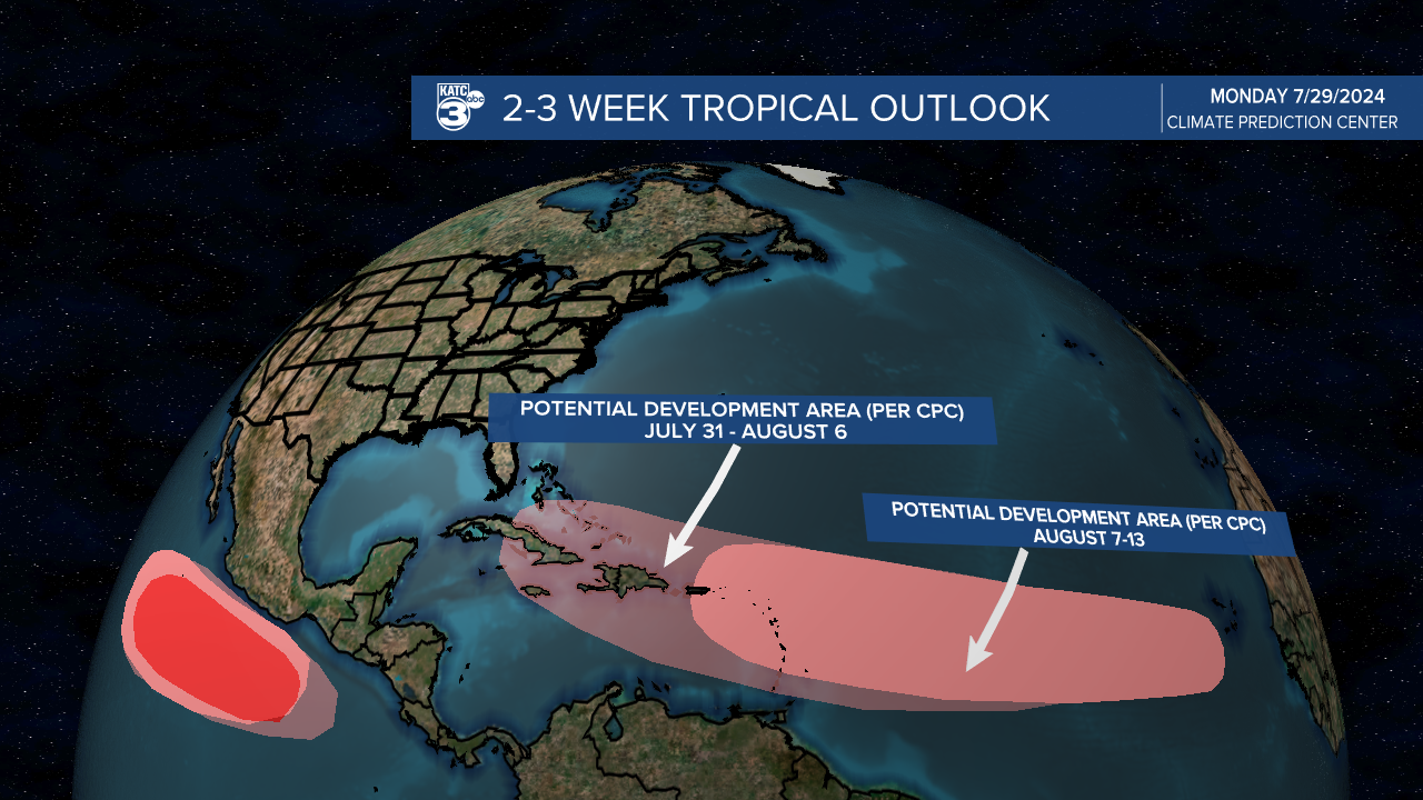
The NHC has given a disturbed area a 50% chance of development later this week as it moves into the northern Leeward Islands.
There's not a robust wave on the satellite which will make any initiation hard to pin down but there's been consistent model support for a few days that something will develop.
We'll get into a discussion on the models, but first the typical word of caution when it comes to using model data, they are a great and necessary tool but they all have their flaws.
It will be important to monitor the trends over the coming days to get a clearer picture of what may be going on in the Caribbean, and one particular model run doesn't make a forecast.
There seems to be two lines of thinking, the GFS isn't aggressive with tropical development and while a few runs over the weekend sparked a system it doesn't seem convinced that it will actually happen, the EURO on the other hand has consistently show development.

The above image is what's known as an ensemble and it's a collection of GFS model runs that change different factors to give an indication on the range of outcomes.
Since the GFS is a lot less clear on how this could play out the possibilities are a little further apart than the EURO.
In fact the EURO has remained remarkably consistent over the last several days, both in initiating a storm and having it turn up the east coast along the west side of the Bermuda High.

Notice how dense the collection of lows are on the EURO ensemble which indicates it's consistency run to run, and it's belief that there will be development in the future (especially compared to the unsure GFS).
These are absolutely subject to change and it's important to stress that until an actual low develops these models are limited in their ability to predict.
There's still a decent amount of dust out there which would inhibit development, so getting a low is far from a done deal, but there's enough signal out there to pay attention.
It's premature to start going through the nuances of individual model runs, especially the GFS since that's been changing every run, and at this point the ensembles are more useful.
Seeing activity increase this time of year, isn't out of the ordinary, in fact it's right on cue.
One of the climate indicators we monitor for development, an atmospheric wave known as the MJO, is hinting that this is in fact the tropical season switching "on".
The MJO is an area of extra cloudiness and rain that circles the globe along the tropics, when this area moves along the Atlantic during the tropical season it can increase the likelihood for development.
That's what will be happening over the next several weeks, it's not a guarantee of development and we still can't pinpoint that far out where, when, or if storms form.
But it's another tool we can use to point us in the direction of places to monitor.
Regardless of what happens this week this is the time to review your hurricane preparedness plan and be ready for the back half of the season.
As we talked about a few weeks ago a quiet start to the season isn't an indicator of things to come, and quiet Junes and Julys can be expected.
There will almost certainly be updates through the week and I'll be sure to add them to the top of this article if needed.
