


Let's start this week's tropical outlook by acknowledging that this has been an absolutely bizarre season.
This is not a complaint, just an observation.
There was a lot made during the start of the season regarding how busy this year was going to be, and there were a lot of good reasons why it looked like that would be the case.
It still may end up that way, let's not pretend that September and October don't loom large, but coming through August it is genuinely surprising that we haven't seen more systems.
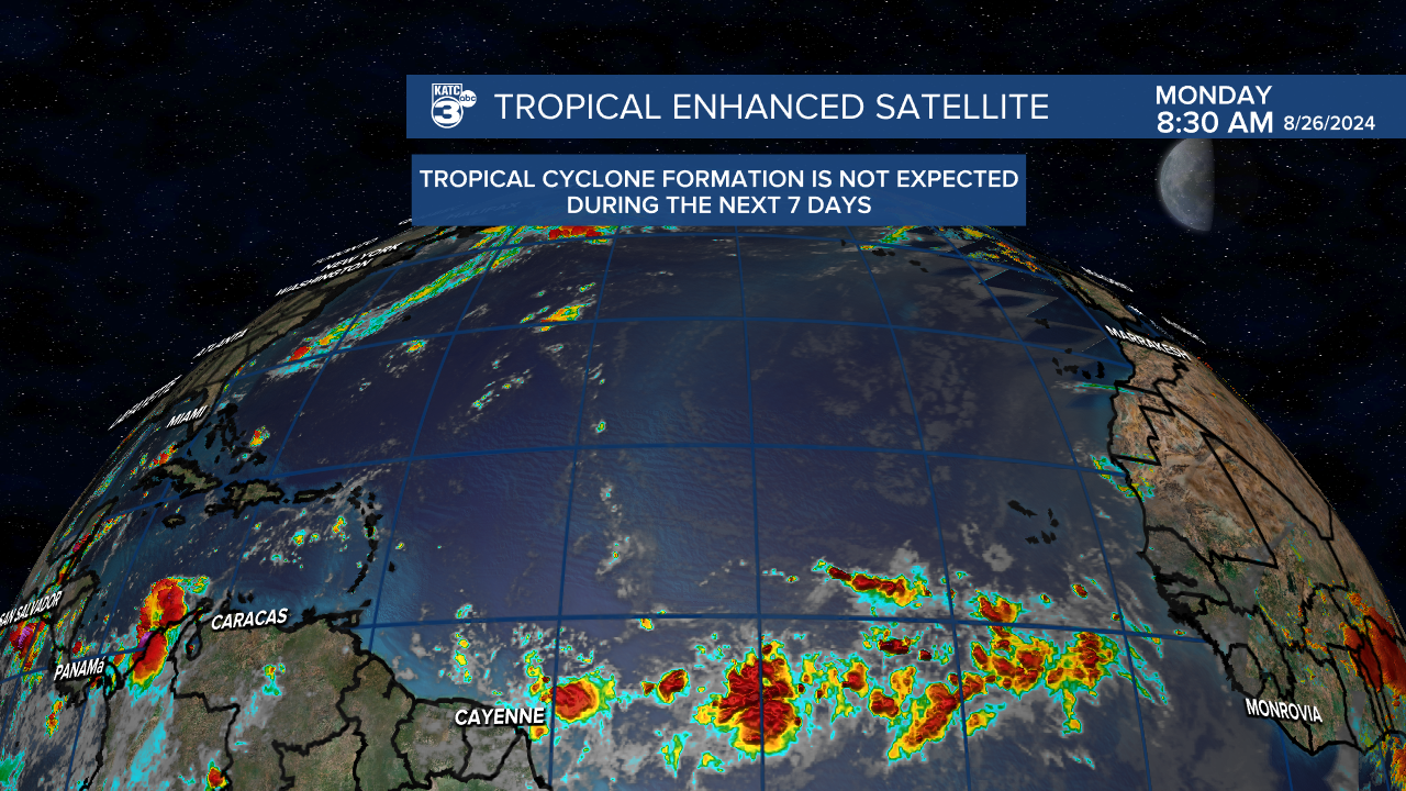
As you've probably gathered by now there's not much in the forecast for this week and it looks right now that we'll close out August with out any more named storms.
Models spent the first part of the month indicating that the season would be switching on by now, but that hasn't been the case.
I know it's really hard to stay vigilant when things have stayed so quiet, and while models have missed a lot this season we still need to take the signals seriously until they're proven to be wrong.
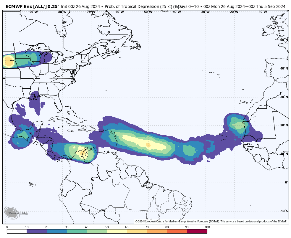
That being said, the EURO is hinting at some potential development sometime next week, GFS hasn't been as bullish.
Since we've got the time let's talk a little about models and some of the stuff that goes into them which may explain these phantom storms they've been picking up on.
These models digest huge amounts of data that they feed into various atmospheric physics equations to come up with a prediction for future weather, different data is weighted differently which is why models are always different.
One of the factors they consider is climate and try and use past events to help give us an idea of future events.
This may be contributing to some of the false starts we've been seeing, because in a typical year with these weather patterns storms would be developing.
What the model struggles to account for, however, is that this has not been a typical year.
So the question remains: Why aren't we seeing more storms? (Again because I can't stress this enough this is not a complaint).
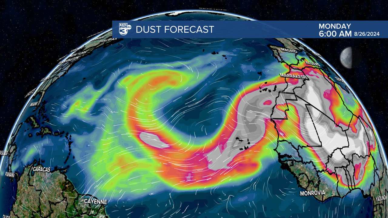
One of the main culprits this season seems to be an extraordinary amount of Saharan dust that hasn't eased up at all.
Remember this is rare.
Dust isn't that uncommon in the early part of the season June and July can be very dusty but normally by late August it's not prevalent.
The dust does a couple of things one it's very dry which is the enemy of tropical systems which thrive in moisture rich environments.
The other is that it's reflecting more sunlight back to space and cooling down the water slightly which may be just enough to prevent waves from taking off.
Most of this is speculation and thinking out loud, meteorologists who are smarter than I will spend the year figuring out exactly what is choking off the storms, but the thought process makes sense.
We spoke last week that African waves were coming off the coast a little too far north, ejecting out into cooler waters which prevented them from getting going.
That still seems to be the case.
It could all change in September and October and we could look back on this discussion and think how foolish it was we were talking about a slow tropical season.
So we're not going to take our eyes off the ball because we are rapidly approaching the peak season and a flare up in the Caribbean or the Gulf of Mexico is all it takes and can happen quickly.
I think back to Hurricane Michael in 2018, a fairly quiet year got upended in a three day time period when a small wave near the Yucatan flared up into a Cat 5 in about 72 hours before devastating north Florida.
The point in bringing that up isn't to say that will happen, but that it can so fight back complacency no matter how hard it can be.
