


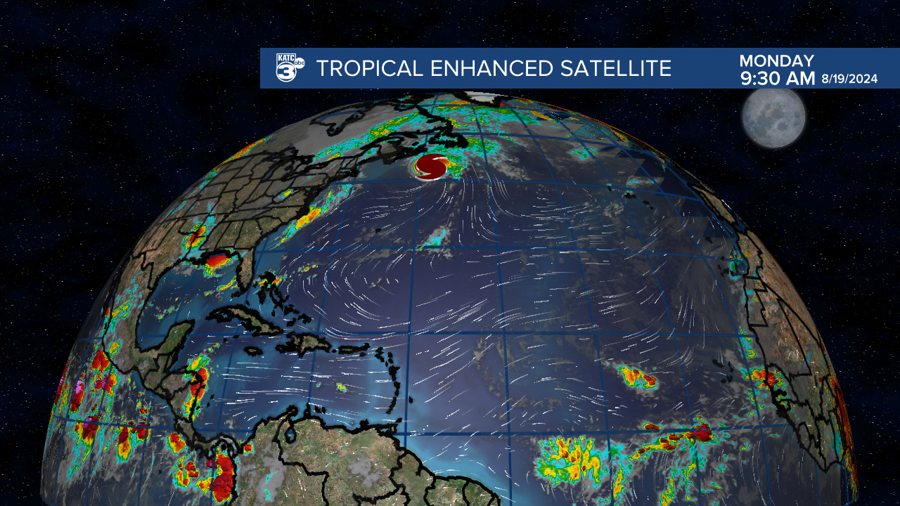
The tropics continue to be mostly quiet with the exception of Hurricane Ernesto off in the north Atlantic.
There doesn't seem to be any activity pending this week, and it looks like we'll stay pretty quiet going into September.
While this is certainly welcome news it is a little puzzling that the Atlantic has struggled to produce more storms this season.
Almost all the indicators would point to a very active period in the tropics but so far we've seen dust linger and waves struggle to develop.
That isn't to say that we won't see the tropics switch "on" in the coming weeks, historically September is a busier month than August, but for at least another week the Gulf Coast won't have to worry about the tropics.
So let's take a look and discuss what it is we are seeing and what this may mean for future development.
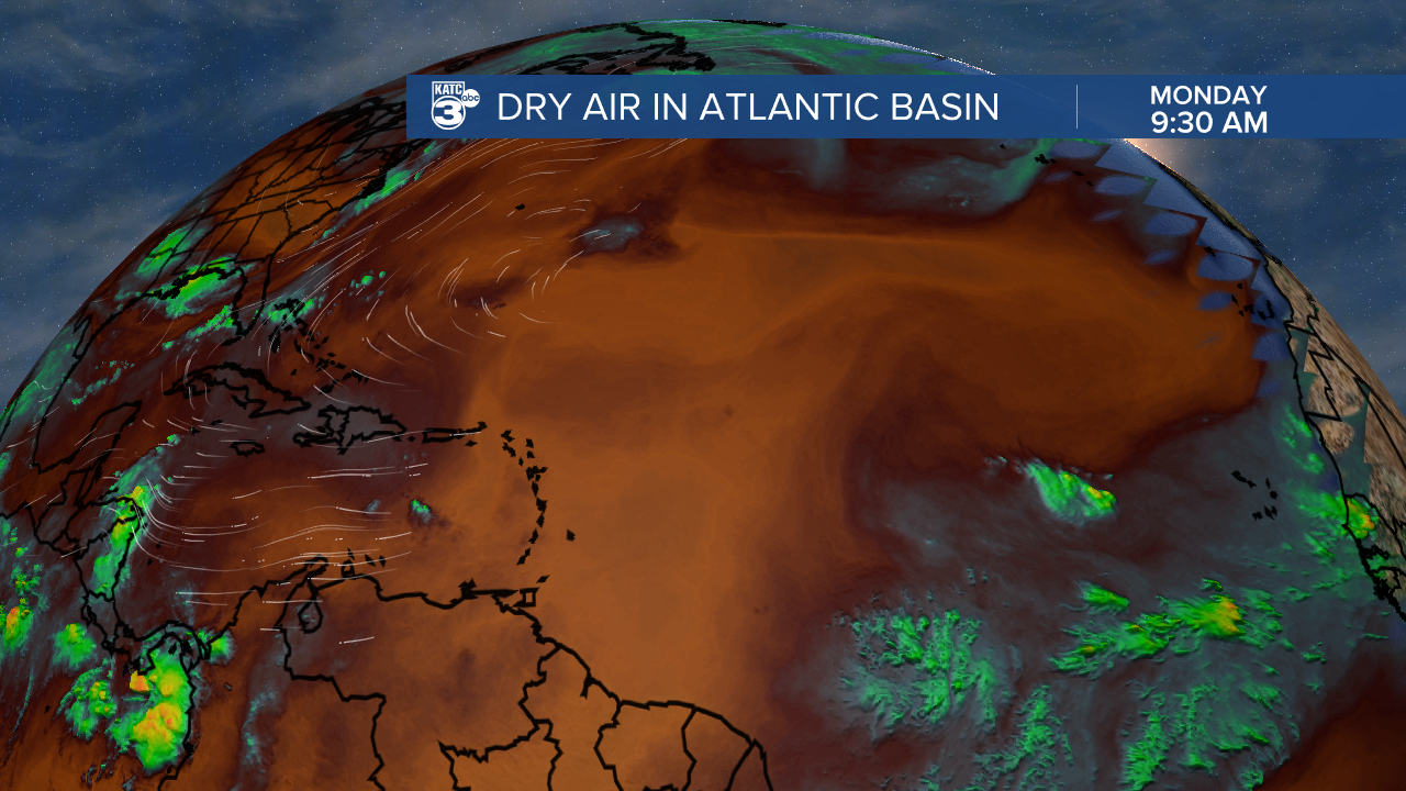
The first thing that jumps out is the dry air that has taken over most of the Atlantic Basin, you can see a few waves trying to come off of Africa but that's a pretty hostile environment.
Typically we a series of late summer waves coming off the African coast eat away at the dry air and that hasn't happened to far this season.
Even the stronger looking waves coming off of Africa have flat out struggled to get going, but there seems to be a reason for this and a reason why that may be changing.
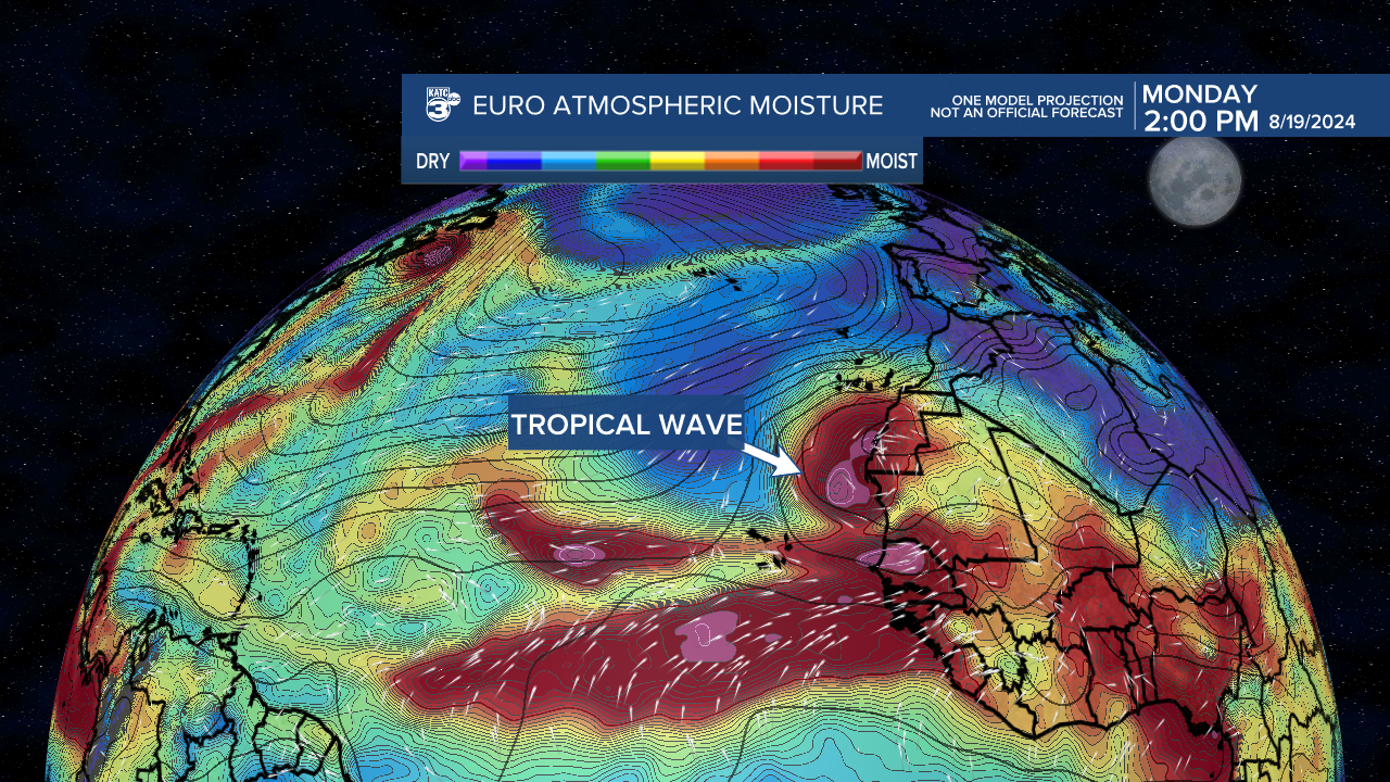
Notice how far north that tropical wave is as it comes off of Africa, ordinarily those types of waves are being ejected near or south of the Cape Verde Islands.
This is doing two different things:
First, that wave is being ejected into much drier,dustier air, look back at the water vapor satellite and it's clear that the muggier air remains south.
Second, waters in that part of the Atlantic aren't as warm as they are in the MDR (main development region) so immediately that wave has less fuel to utilize.
While models keep the next week quiet there are hints that in the closing days of August those African waves will start to slide a little further south.
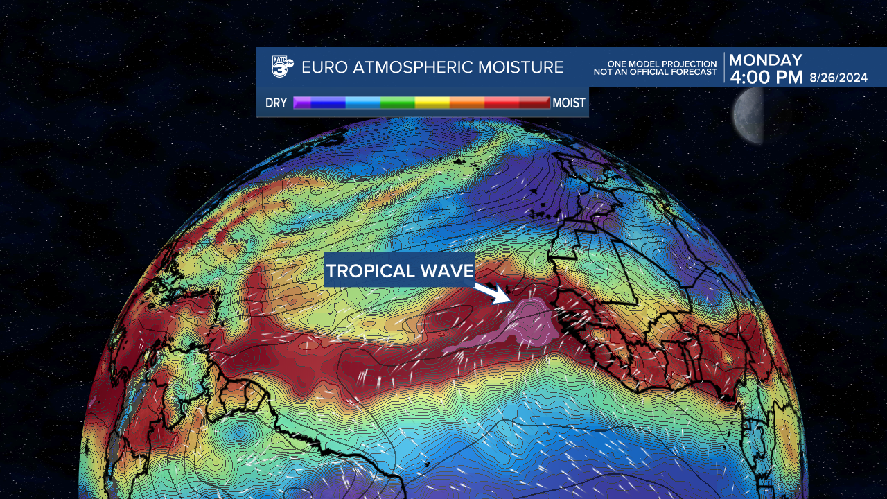
It's a long way out and a lot can change but the EURO Model and the GFS indicate that these waves will start to emerge in an area that would allow them to fester and strengthen.
That's not to say that they survive the whole journey across the Atlantic but it's an acknowledgment that we could see activity picking up as we enter September.
The emergence of La Nina continues to look likely next month which will further enhance the ability for storms to develop in the later part of the season so it's still way to early to let our guards down.
We say every year that there's so much that goes into predicting these storms, and just getting one to develop means a thousand little things have to be in perfectly in place.
So far, despite plenty of pieces being perfectly lined up, they haven't all come together.
Let's hope it stays that way
