


After a seasonably cool start Tuesday, expect a warming trend for Acadiana through mid-week, followed by a cool front Thursday that will bring our temperatures temporarily back to a January reality.
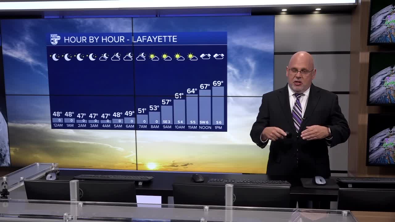
In the near term expect lows overnight closer to the mid-40s in most spots, and per usual, it will be a bit chillier in the northern-most areas of Acadiana.

Generally fair skies will turn partly to mostly cloudy by morning along with the chance of some patchy fog by daybreak.
The risk of fog looks more substantial for periods of time Tuesday night into Wednesday morning but breezier southerly winds might become a mitigating factor.

Partly to mostly cloudy skies accompanied by temperatures topping out in the lower 70s, some 10° above normal are expected Tuesday as southeasterly winds return to the area.
This winds will hold hour temperatures in the 60s Tuesday night along with the aforementioned fog threat, and perhaps some misty sprinkles.

It will become breezy and warmer Wednesday out ahead of our next storm system and cool front.
And depending on winds and possible intervals of sun, our temperatures Wednesday will threaten the record of 78° set back most recently in 2005.

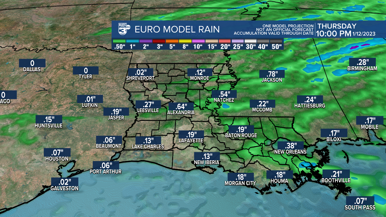
Our next weather maker will bring the chance of showers and a few embedded storms to the region late Wednesday night into Thursday morning.
The system has been looking not as robust per the recent model trends, but there could be a few strong storms possible...a severe weather threat, should one develop, should be north of Acadiana early Thursday.
Rain amounts look to be tentatively set in the 1/2" range or less Thursday...but that might change in the days ahead.
And with any luck, showers and storms should be limited to the morning hours Thursday with drier/chillier conditions returning behind the front Thursday night, Friday and into Saturday.
Our high temperatures should cool closer to the lower 60s Friday and Saturday while overnight lows could dip into the mid-upper 30s to lower 40s for a couple of nights.
Milder weather will return toward the end of the weekend with highs back into the 70s Sunday, and for what appears to be, a good part of next week.
See the KATC 10 Day Forecast for the latest.
For now there are no deep freezes in the forecast for Acadiana over the next two weeks, but longer range models do show some below normal temperatures toward the last week of January through the first week of February...thereafter, winter will just have a few more weeks to work with!
And it may turn out that the coldest weather will see all winter long might be the deep freeze we already experienced Christmas week...we'll see!
------------------------------------------------------------
Stay in touch with us anytime, anywhere.
To reach the newsroom or report a typo/correction, click HERE.
Sign up for newsletters emailed to your inbox. Select from these options: Breaking News, Evening News Headlines, Latest COVID-19 Headlines, Morning News Headlines, Special Offers
