


The threat of severe weather for Acadiana will increase Friday evening and continue well into the night-time hours before a more sedate weather pattern arrives for this weekend.
As of late Friday afternoon, the Storm Prediction Center (SPC) had issued a Tornado Watch for much of the western and central parts of Louisiana, including portions of Acadiana northwest of Lafayette through 9:00 pm.

A vigorous upper level system accompanied by a strong jet stream aloft will work in tandem to produce strong thunderstorms in the region early this evening...especially from Southwest and Western Louisiana through Central Louisiana.

The SPC does have much of the Acadiana hatched in for an "enhanced risk" of severe storms overnight from the I-10 parishes northward, a level 3 out of 5.
The primary concerns will be for storms that could contain large swaths of damaging winds and a few isolated strong tornadoes...some hail cannot be ruled out either.
Initially Friday evening, the strongest storms will be advancing northward through Central Louisiana as a warm front moves northward...some storms may become severe in this region between 7-9 pm...

Meanwhile, the models remain split on whether most of Acadiana will see a significant severe weather threat later tonight with the GRAF Model leaning toward a squall line pushing through all of Acadiana between 11pm and 3am, while the HRRR model keeps the bulk of the severe weather threat well into the central and northern part of the state.

Either way, it appears that the brunt of this weather event will impact Central Louisiana the hardest with the threat of localized flooding rainfall of up to 3-6" or more possible where storms may tend to train.

A Flood Watch has been issued by the National Weather Service from Northern Acadiana into Central Louisiana.
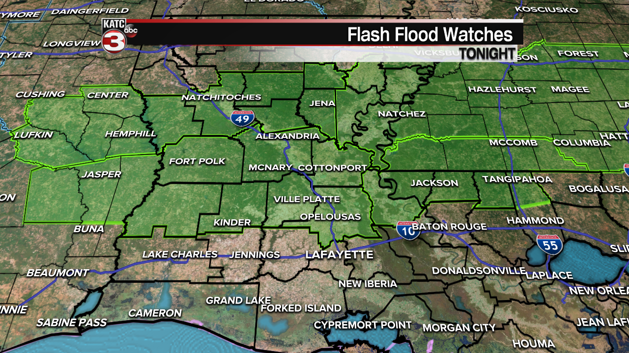
The vulnerable Acadiana parishes to the strongest storms and heavy rainfall will be Allen, Evangeline, St Landry and Avoyelles.

For now, we'll say that most of the rest of Acadiana should receive and inch or less or rain.
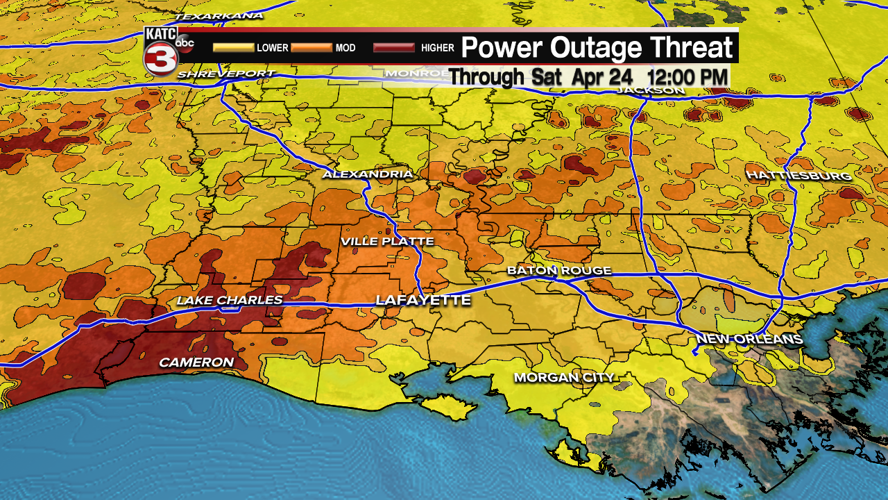
Winds will also get cranking from the south across most of Acadiana Friday evening with gusts approaching the 35-45 mph range feeding into the storms to the north.

So in addition to the severe threat of damaging winds with any storms, there could be enough wind gustiness to allow for some sporadic power outages, so keep that in mind.
Please stay weather "aware" tonight and have the KATC Weather App handy for the latest watch, warning and radar information.
The good news is that some sun and warm temperatures should return by Saturday afternoon with some spectacular weather Sunday into early next week.
Our next weather/rain-maker should arrive by Wednesday night and/or into Thursday...but it remains unclear as to whether this will bring another severe weather threat.
See the KATC 10 Day Forecast for the latest.
------------------------------------------------------------
Stay in touch with us anytime, anywhere.
To reach the newsroom or report a typo/correction, click HERE.
Sign up for newsletters emailed to your inbox. Select from these options: Breaking News, Evening News Headlines, Latest COVID-19 Headlines, Morning News Headlines, Special Offers
