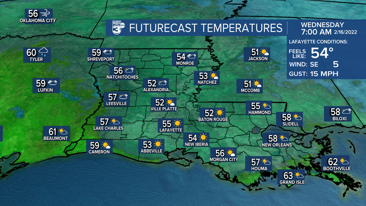
Spring-like temperatures are expected for Acadiana Wednesday, while we remain on track for a good chance of showers and storms into Thursday.

In the near term, a southeasterly breeze from the Gulf of Mexico will bring milder temperatures in the area with readings holding in the low-mid 50s overnight.

Expect some cloud cover highlighted by a full "snow" moon.
It will become breezy and warmer Wednesday with temperatures pushing well into the mid-70s under a cloud and sun mix.

There might be a quick, passing shower Wednesday afternoon/evening but chance of measurable precipitation will be near 20% or less.

Breezy conditions are expected into Wednesday afternoon with southerly winds near 15-25 mph and a few higher gusts.

Clouds will thicken and southerly winds will stay fresh Wednesday night into Thursday morning as temperatures hold closer to the mid-60s...look for some of our local pavement to become "sweaty" in this scenario into Thursday as chilled ground temperatures allow for moisture condensation.
A strong cold front will approach the area by Thursday afternoon with an excellent chance of showers and storms during the midday into the mid-afternoon hours.
As expected, the Storm Prediction Center pared the severe weather risk farther north to just include the northern-most fringes of Acadiana.

Nonetheless, a few storms may contain strong and gusty winds...farther north there could be the risk of an isolated severe cell capable of producing damaging winds and/or an isolated tornado.
Most areas should see less than an inch of rain with the showers and storms Thursday.

Temperatures Thursday will reach the mid-70s before another winter chill arrives Thursday night.
Breezy, cool and dry weather is expected Friday into the weekend with temperatures beginning to moderate again Sunday afternoon.
Next week looks quite spring-like with highs approaching the upper 70s to 80° through much of the week before our next front arrives next Thursday.
And with the spring temperatures, some spring showers are expected...especially Monday, with the pattern overall looking a little more active with regard to rain chances as we finish out the month and head into March.
See the KATC 10 Day Forecast for the latest.
------------------------------------------------------------
Stay in touch with us anytime, anywhere.
To reach the newsroom or report a typo/correction, click HERE.
Sign up for newsletters emailed to your inbox. Select from these options: Breaking News, Evening News Headlines, Latest COVID-19 Headlines, Morning News Headlines, Special Offers


