


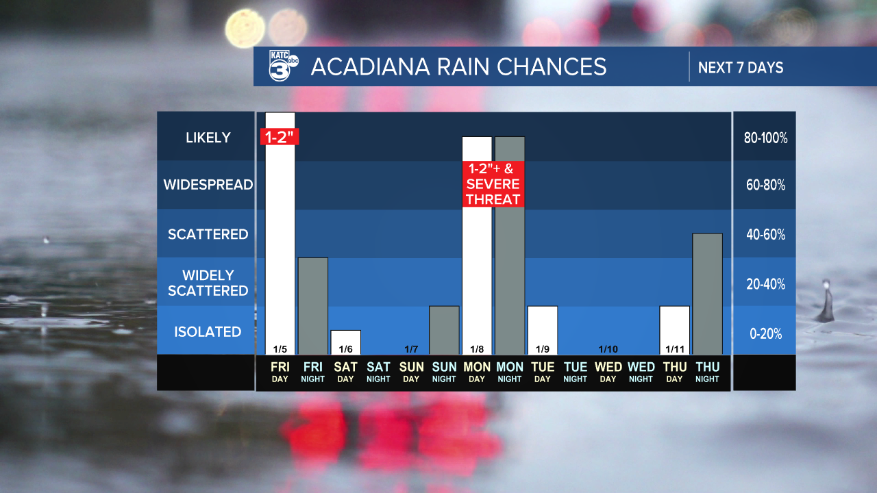
Acadiana is in for some soaking rain events to finish this week and at the start of next week, while in between it should be a cool, dry, albeit "cloudyish" weekend.
In the near term, expect fair and chilly conditions for most of our Thursday night with clouds and an east-southeasterly breeze developing toward daybreak.
Temperatures will drop into the low-mid 40s overnight...not as cold as last night.

Clouds will thicken Friday with rain and storms developing from west to east from mid-morning into the afternoon hours, with locally heavy downpours, and a few embedded thunderstorms possible.
The Storm Prediction Center (SPC) has areas along and south of the I-10 corridor in Acadiana hatched in for a low end, marginal risk (level 1 out of 5), of a few isolated severe storms Friday.

The primary threat would be for storms that could contain damaging winds, perhaps an isolated tornado, but most of us will likely just get a good soaking.
The rain and storms should taper by Friday evening. Highs Friday will be in the upper 50s to lower 60s.
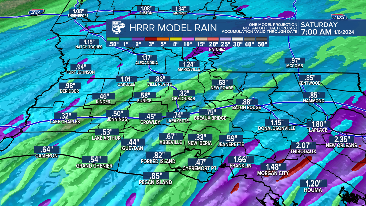
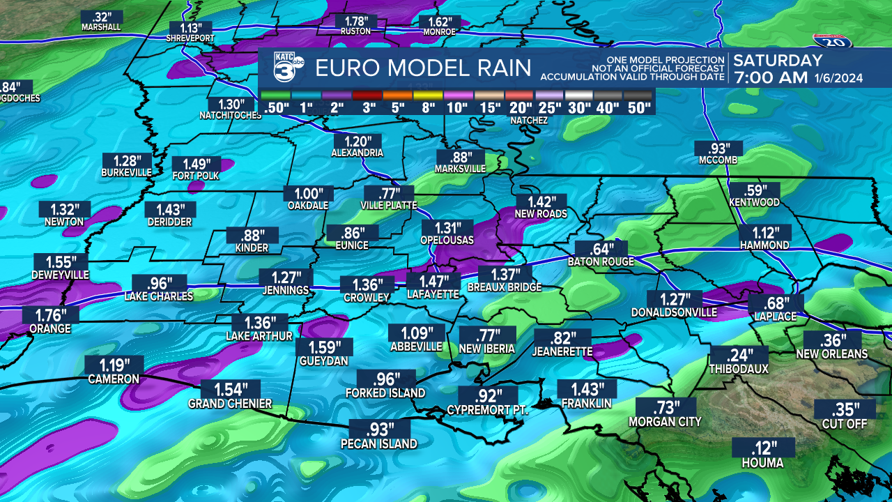
In general, 1-2" of rain will be possible for most of Acadiana Friday...give or take an inch in spots.
Thereafter, the pattern looks dry and cool into the weekend, but residual clouds may persist Saturday, with the addition of high clouds Sunday ahead of our next weather-maker early next week.
Rain and thunderstorms are expected to develop again Monday into Monday night with our next storm system, with the possibility of at least 1-2" of rain along with more robust dynamics that could lead to a few severe storms, and perhaps isolated areas of 3-4" of rain...or more.

The SPC has all of Acadiana hatched in for a slight risk, a level 2 out of 5, for severe storms later Monday, with a potential threat of storms that could be capable of producing damaging winds, a few isolated tornadoes, and perhaps some hail.

As usual, severe weather dynamics may stay offshore and/or develop east of the Acadiana area...

Either way, Monday's system will be more potent producing gusty winds, even away from the storms, with strong and gusty southerly winds ahead of the system, and blustery west-northwesterly winds, possibly gusting to 35-40 mph to follow Tuesday as we dry out.
Mid-next week should be dry, but an unsettled pattern with rain chances should return by the end of the week, with the following weekend remaining unsettled.
See the KATC 10 Day Forecast for the latest.
------------------------------------------------------------
Stay in touch with us anytime, anywhere.
To reach the newsroom or report a typo/correction, click HERE.
Sign up for newsletters emailed to your inbox. Select from these options: Breaking News, Evening News Headlines, Latest COVID-19 Headlines, Morning News Headlines, Special Offers
