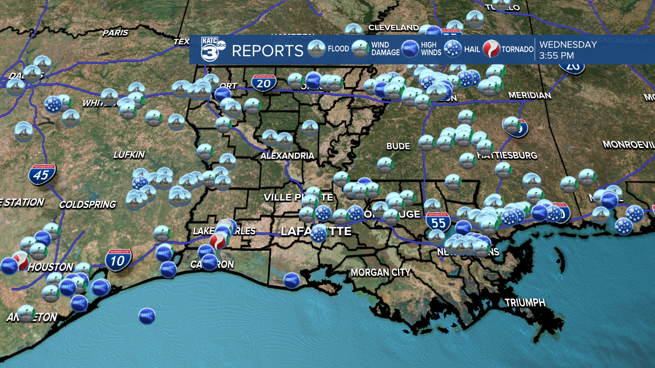
Wednesday morning storms across Acadiana certainly delivered on their potential severity with dozens of preliminary severe weather reports in the area.

Preliminary National Weather Service (NWS) surveys indicated an EF2 tornado with 115 mph winds impacted the Lake Charles area, along with numerous reports of 70-80 mph+ winds, better than quarter size hail, and localized flooding through portions of Acadiana primarily along and north of the I-10 corridor.

Wind gusts reached 48 mph at both the Lafayette and Acadiana Regional airports.
The NWS will be conducting additional storm surveys Thursday.
In addition to the severe storms, localized flooding occurred, especially farther to the north and west.
Area-wide totals were in the 2-4" range with higher amounts into the northern Acadiana parishes.

Flooding was common across portions of Eastern Texas into Western Louisiana where nearly a foot of rain was recorded in the last 24 hours.
The weather pattern moving forward looks much better, with windy and cooler conditions ahead overnight, and some nice spring days to follow for the rest of the week into the weekend.

Next week will be warmer and getting more humid with some low-end rain chances possible toward the following weekend.
See the KATC 10 Day Forecast for the latest.
------------------------------------------------------------
Stay in touch with us anytime, anywhere.
To reach the newsroom or report a typo/correction, click HERE.
Sign up for newsletters emailed to your inbox. Select from these options: Breaking News, Evening News Headlines, Latest COVID-19 Headlines, Morning News Headlines, Special Offers


