


Now that Acadiana's heat wave has broken...at least for now, all eyes will be on soon to be Hurricane Idalia that is expected to become a major hurricane in the Eastern Gulf of Mexico as soon as Tuesday night.
Idalia will not be any threat to Louisiana other than insuring breezy and dry conditions mid-week...which will also exacerbate our on-going fire danger in the region.
In the near term, the big story for Acadiana today, was that our temperatures were some 20° cooler than Sunday's all-time record heat and high of 110°.
Our cloud cover and relatively cooler weather is thanks to a frontal trough that sunk into the region (ultimately guiding Idalia toward Florida) has also produced some scattered shower and thunderstorms activity in portions of the state, with Southwest, and Eastern Louisiana seeing the best rain coverage.
KATC's Power Doppler 3 here.
We should see more of the same cloud cover accompanied by some chances of scattered showers and a few storms into Monday evening and then again possibly Tuesday afternoon.

It will be nice to get some more showers in the area, but most of us will likely not even see enough to wet the ground, whereas there could be a few nice isolated spots that get a good soaking.
Temperatures again Tuesday will be hard-pressed the lower 90s.
Thereafter later this week, look for breezy and dry conditions with daytime highs creeping back up into the mid-upper 90s while lows get rather comfortable in the low-mid 70s.
See the KATC 10 Day Forecast for the latest.
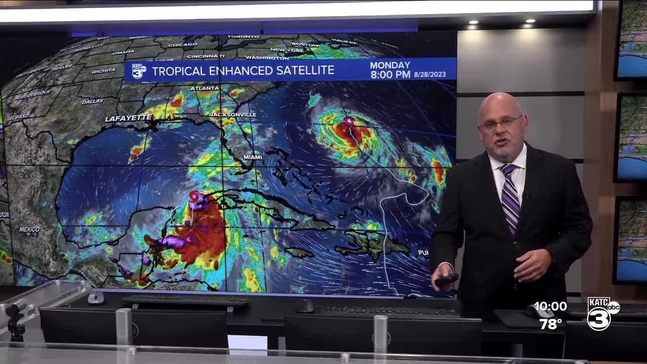
Meanwhile in the tropics, Major Hurricane Franklin sporting 145 mph winds Monday afternoon is expected to strengthen a little more prior to passing just west of Bermuda Wednesday.

The worst of Franklin should stay offshore from Bermuda, but tropical storm conditions will be likely for island into Wednesday.
Of greater interest and a direct threat to the U.S., Tropical Storm Idalia with 70 mph winds could become a hurricane by the time you read this...

Idalia is expected to intensify, and perhaps go through a rapid intensification cycle Tuesday with the National Hurricane Center upping the storm's potential intensity at landfall across portions of the Big Bend of Florida by or near daybreak Wednesday.
Current forecast has Idalia with 120 mph winds prior to landfall, but the storm could be a full category higher...

Idalia will bring tropical storm conditions minimally from Tampa/St Pete northward with hurricane conditions, extremely damaging winds, up to a 7-11 foot storm surge or more near the concave bend of Florida late Tuesday night into Wednesday.

The IBM GRAF Model does an excellent job in the tropics and see the imagery below.

Stay with KATC for the latest on this system.
Climate news: Lafayette's latest consecutive 100° day run came to an end Monday...after 11 consecutive days that followed a 17 day run!

All told to date, Lafayette has seen 30-100° days this summer...almost equal to all of the 100° days for the last 40 years, which is 32...a couple of more 100° will be possible either later this week or again toward the end of the 10 Day Forecast.
------------------------------------------------------------
Stay in touch with us anytime, anywhere.
To reach the newsroom or report a typo/correction, click HERE.
Sign up for newsletters emailed to your inbox. Select from these options: Breaking News, Evening News Headlines, Latest COVID-19 Headlines, Morning News Headlines, Special Offers
