


Acadiana's heat wave wave will persist into the weekend but relief is in sight with increasing chances of scattered afternoon showers and thunderstorms next week.

In the near term, the hot upper ridge of high pressure will dominate across the region allowing for our afternoon highs to reach 98-100° in many spots through Sunday, with maximum readings closer to the mid-upper 90s across the coastal parishes.

Heat advisories continue for the area Thursday, and likely into the weekend with afternoon heat indices remaining planted in the 110-115° range.

By Sunday into next week, the ridge of high pressure will flatten and eventually move off to the east, opening the door for a slightly more unstable atmosphere that should yield a few widely scattered afternoon storms early next week.

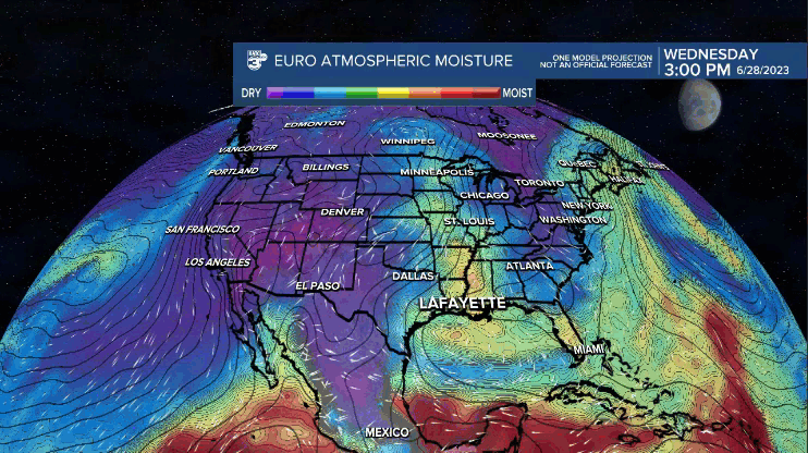
By mid-late next week tropical moisture should move into the Gulf of Mexico and contribute to better chances of scattered showers and thunderstorms, that may carry perhaps, into next weekend.
These changes will push our daytime highs downward into the mid-90s early next week, and lower 90s toward the end of the week.
See the KATC 10 Day Forecast for the latest.
------------------------------------------------------------
Stay in touch with us anytime, anywhere.
To reach the newsroom or report a typo/correction, click HERE.
Sign up for newsletters emailed to your inbox. Select from these options: Breaking News, Evening News Headlines, Latest COVID-19 Headlines, Morning News Headlines, Special Offers
