


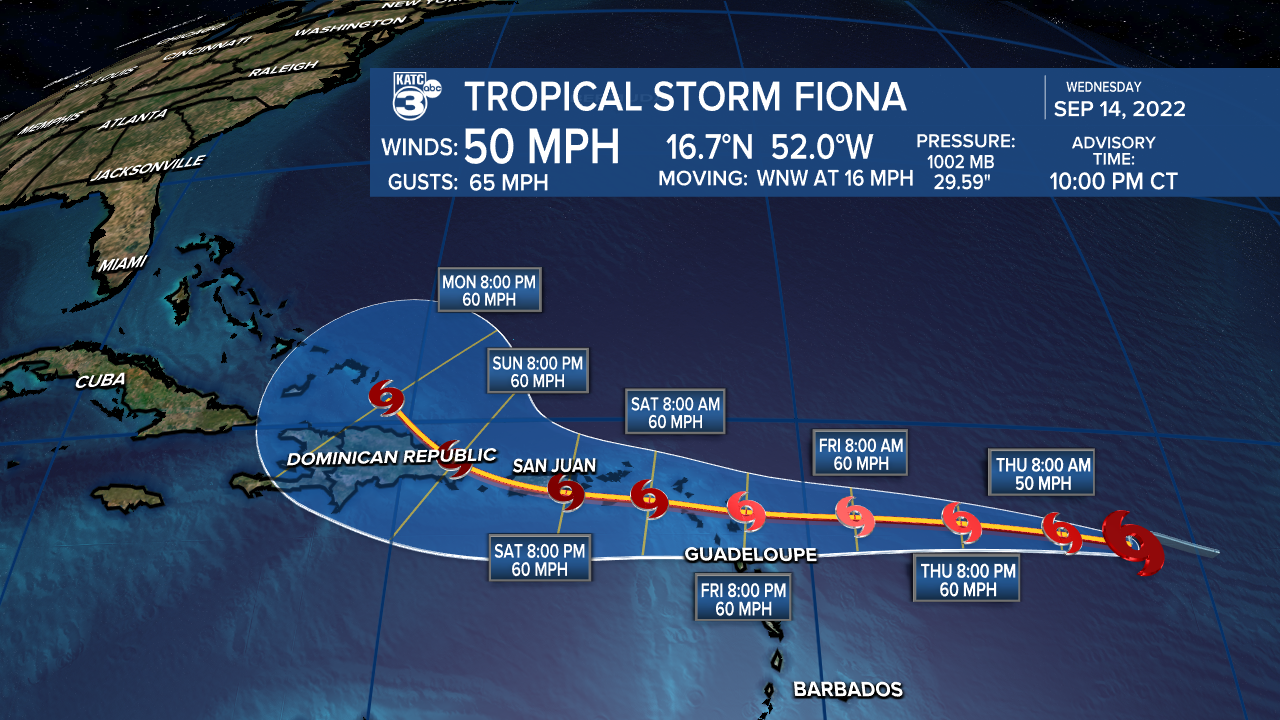
Story update for Tropical Storm Fiona...after looking healthier on satellite imagery this evening TD7 upgraded to Tropical Storm Fiona with 50 mph wind
—————————————————————————————
Wednesday's Weather Story:
The favorable weather pattern across Acadiana will begin to slowly warm into the weekend after another fresh start Thursday morning.
Look for Thursday morning temperatures once again to range in the upper 50s across the northern Acadiana parishes to the low-mid 60s farther south.

Plenty of sun remains in the forecast for our Thursday and Friday with afternoon readings reaching the upper 80s to near 90° Thursday and perhaps pushing the lower 90s Friday.

Some Gulf moisture in the form of higher humidity, partly cloudy skies and perhaps a few scattered showers are expected to ease northward into the area this weekend, but a drier pattern is anticipated to return into next week.
And Acadiana may not be done with afternoon temperatures in the mid-90s yet...but it should be a relatively dry heat into mid-next week.
See the KATC 10 Day Forecast for the latest.
Meanwhile in the tropics, Tropical Depression 7 formed in the Atlantic Wednesday morning roughly 800 miles east of the Leeward Islands in the eastern-most Caribbean.

Despite relatively hostile conditions, TD 7 is expected to gain tropical storm strength later Wednesday evening/night or into Thursday...if so, the name would be "Fiona".
This system is expected to approach and perhaps interact, primarily as a rain-maker, with the Eastern to Central Caribbean Islands including the U.S. Virgin Island, Puerto Rico and the Dominican Republic starting Friday and continuing through the weekend.

Both the Euro and GFS models thereafter suggest that the system may try to curve northward into the Atlantic.
Following the possible turn, there are hints the tropical system, while strengthening, could stall between the U.S. and Bermuda with high pressure possibly blocking the system from heading farther out into the open Atlantic.
If that were to become the case, it could ultimately force the system westward toward the east coast of the U.S.
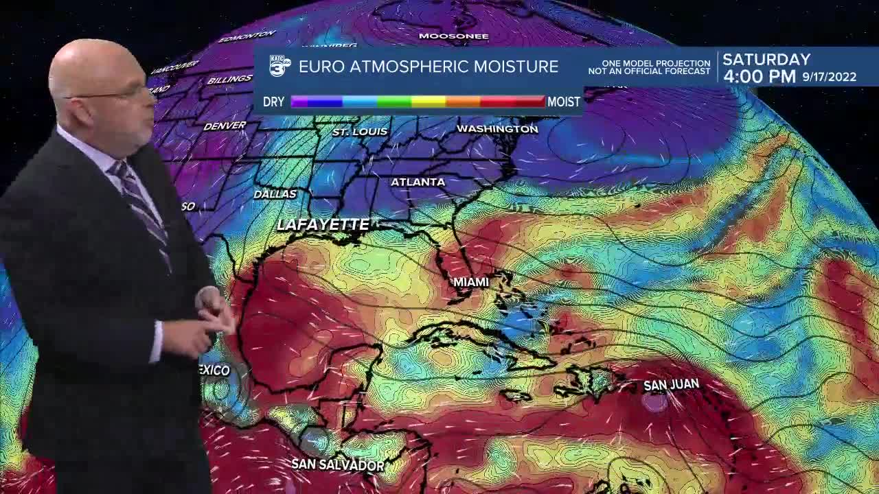
At this point, the system does not appear to be a threat to the Gulf of Mexico.
Lastly, set your phone/watch alarms for 8:30pm this Wednesday evening as Acadiana will have another good view of the ISS in Acadiana for 6 minutes!

There will be more good evening views Thursday, Friday and Saturday. Details available on NASA's site.
------------------------------------------------------------
Stay in touch with us anytime, anywhere.
To reach the newsroom or report a typo/correction, click HERE.
Sign up for newsletters emailed to your inbox. Select from these options: Breaking News, Evening News Headlines, Latest COVID-19 Headlines, Morning News Headlines, Special Offers
