


NEW: a HARD FREEZE WARNING has been issued for northern parishes. FREEZE WARNING will be in effect for the rest of the area through 10am Monday.
Who/what you'll want to protect:
FOR SURE:
-People-Pets-Plants
The big question regarding the pipes is just how long we see temperatures at or below freezing—winds will play a factor here as well as they could keep readings up just a bit.
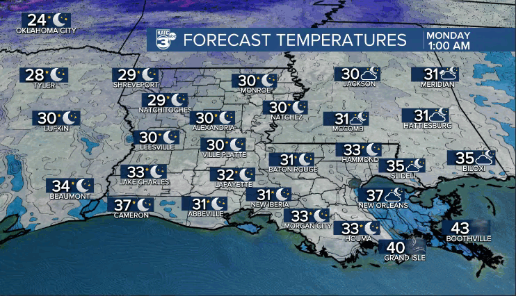
Slighter better chance of freezing temperatures for an extended period of time for areas north of the I-10 corridor.
So...TO BE SAFE:
You may want to protect exposed, outside pipes (particularly areas north of I-10)--warm ground temperatures will work in our favor.
WIND CHILLS in low-mid 20s tonight/tomorrow morning, so have the coats and jackets ready to go.
Despite full sunshine Monday, temperatures will only top out in the upper 40s/lower 50s.

We'll be heading for near-freezing once again Monday night/Tuesday morning.
Slightly milder, but still cool Tuesday afternoon as readings push the lower 60s.
Even milder into Wednesday (lower 70s) before another front arrives by Thursday.
Stay warm!
