In the wake of our wet weather system, a winter chill will return to Acadiana with temperatures very near the freezing mark over the next couple of nights.
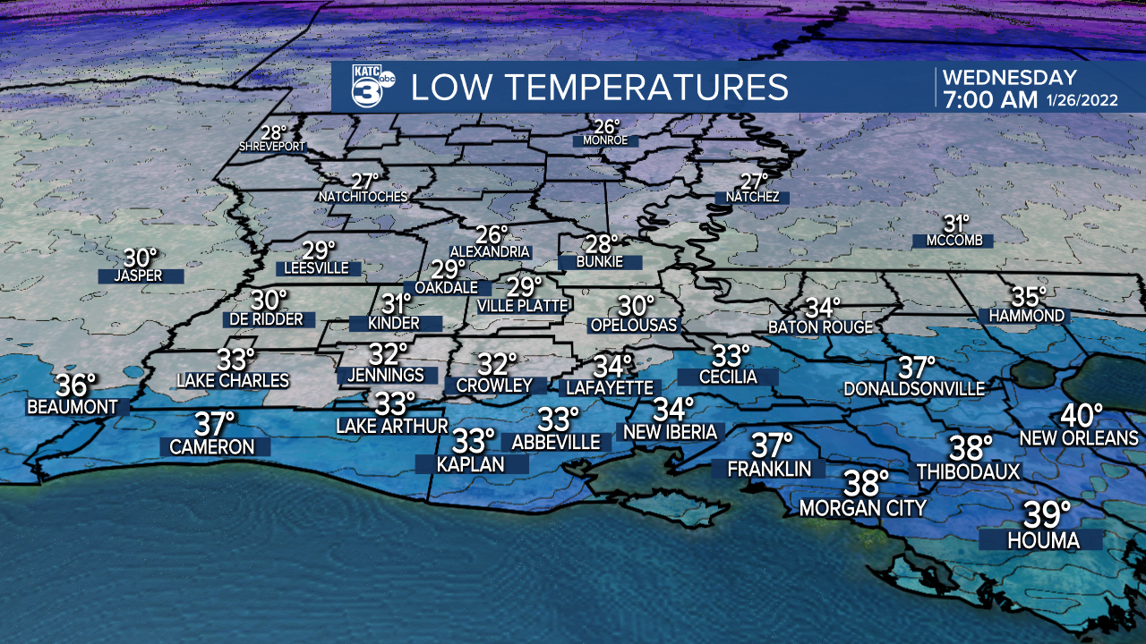
Look for breezy and colder weather overnight as clouds clear out by midnight.
Temperatures by morning should be in the low-mid 30s, so make sure the plants are covered and the pets have a warm place to stay.
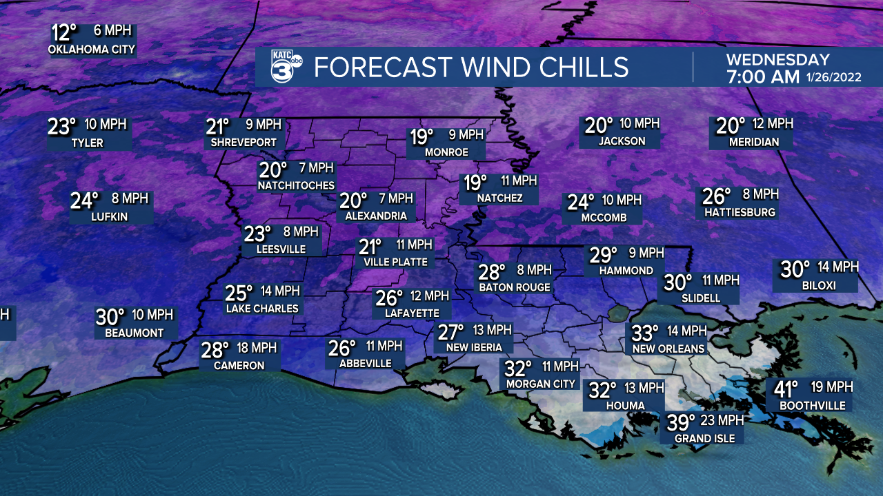
Breezy north-northeast winds will push our wind chills down into the lower to mid-20s by daybreak Wednesday so be bundled up!
At least we'll see mostly sunny skies for our Wednesday with highs in the lower 50s, but breezy northeast winds will keep a definitive chill in the air.

Winds will decrease Wednesday night into Thursday morning with temperatures dropping to the freezing mark, or perhaps a few degrees below.

Milder temperatures are expected Thursday with a slow increase in cloudiness developing as the day wears on. Highs Thursday will be near 60°.

An upper level disturbance will race southeastward toward our area Thursday night into Friday with the bulk of the dynamics, and the best chance of rains heading for the Gulf of Mexico.
There will be a lower end chance of precipitation during the aforementioned time-frame, but for now we are keeping rain chances no higher than the 20-30% range into early Friday.
Another surge of colder than normal air will advance into the region into the weekend with temperatures at or slightly below the freezing mark expected Friday night into Saturday morning.
The weekend is looking nice and chilly with highs only reaching the low-mid 50s Saturday but warming into the mid-60s Sunday.
Next week is looking milder overall, but with some shower and perhaps the chance of thunderstorm activity by mid-week.
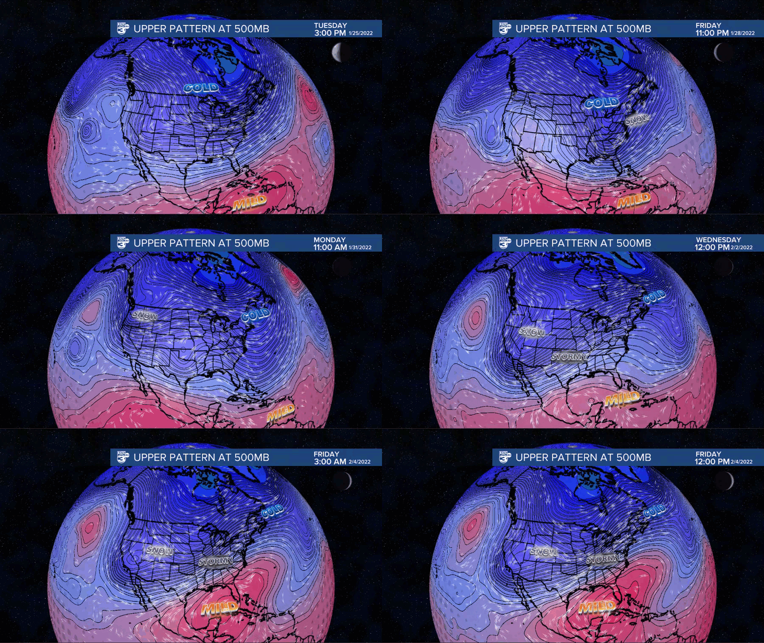
The upper pattern supports a big Northeast snowstorm and cold into the weekend with a shift to upper troughing and snows developing in the West next week.
This will induce ridging to surge northward toward the Gulf and allow for milder temperatures locally.
In between, could see some stormy (perhaps severe) weather develop for the Plains next week.
See the KATC 10 Day Forecast for the latest.
Climate Notes and Outlooks:
After back to back weeks of below normal temperatures for Acadiana (including this week), it appears the area and much of the Gulf South is looking at milder and slightly above normal temperatures into February.
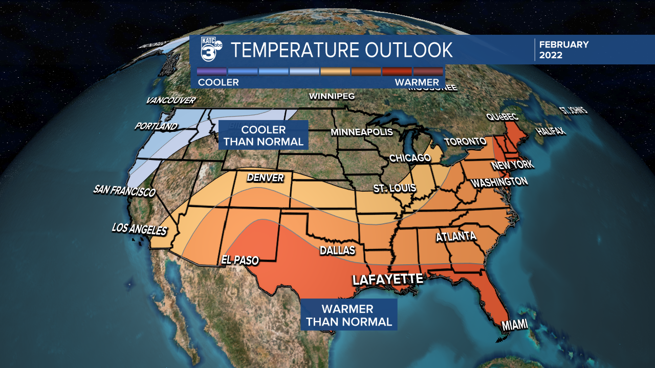
We'll still likely have some few chilly outbursts into February, but they won't last as long as what we've seen over the last couple of weeks...it's looking like short winter indeed given our warmest December.
A slightly drier than normal pattern is expected locally for February as well.
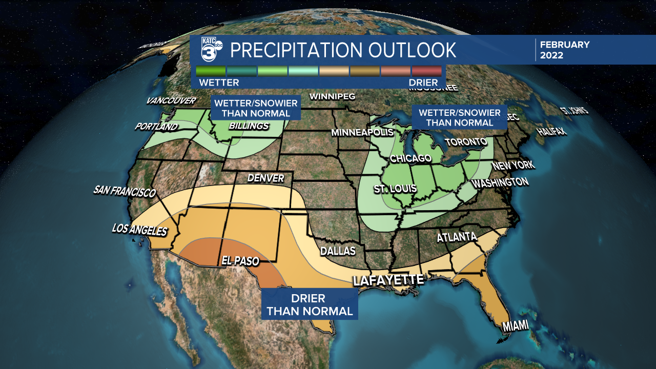
While we won't give up on a winter weather "event" for Acadiana quite yet, the lights appear to be dimming and almost off!
------------------------------------------------------------
Stay in touch with us anytime, anywhere.
To reach the newsroom or report a typo/correction, click HERE.
Sign up for newsletters emailed to your inbox. Select from these options: Breaking News, Evening News Headlines, Latest COVID-19 Headlines, Morning News Headlines, Special Offers


