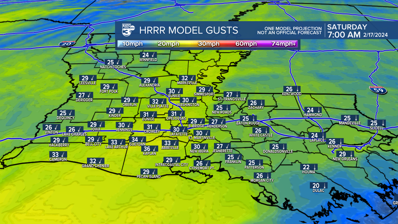
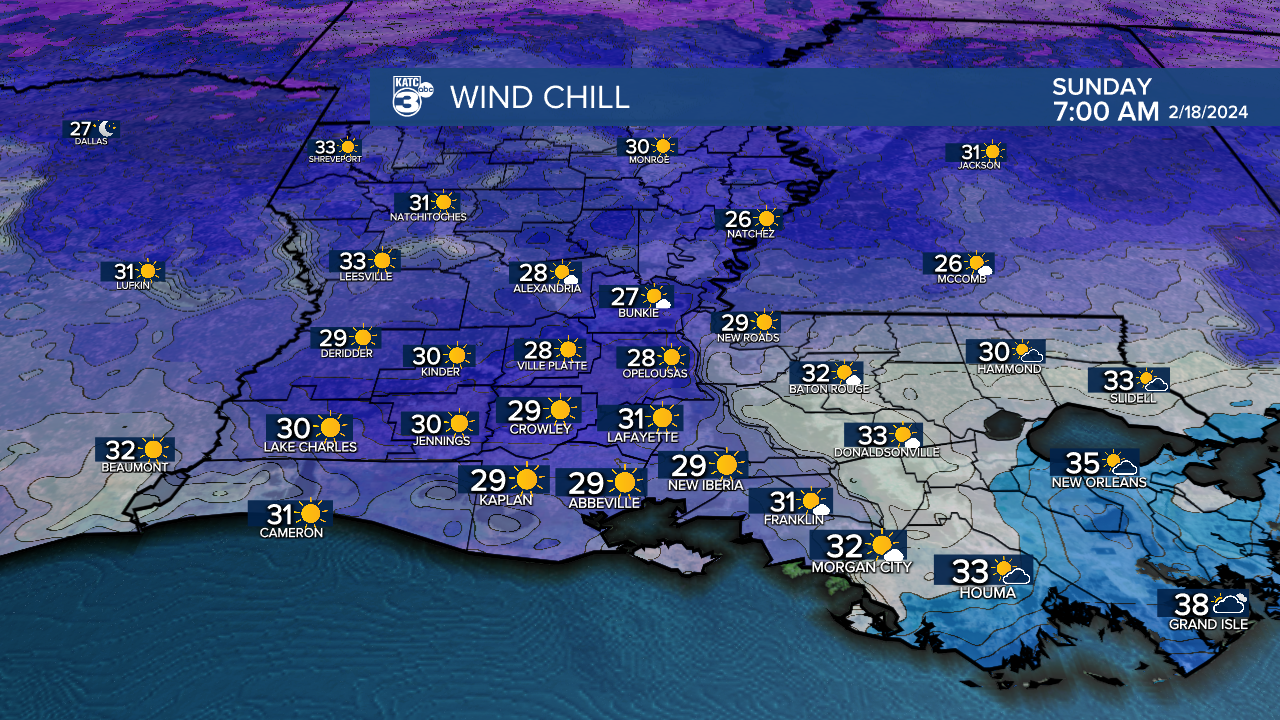
Acadiana is in for a brief winter blast this weekend as a strong cold front barges through during the wee morning hours Saturday.
In the near term, expect misty drizzles/light fog and mild temperatures in the 60s before the front arrives around 2:00 am for Lafayette...give or take a few hours, with an earlier passage to the northwest and later passage, closer to 4am, for say St Mary Parish.

The front may wake you as gusty northerly winds arrive overnight and increase to 15-25 mph with higher gusts.

Gusts during the day Saturday will be near 30-35 mph...thus a Wind Advisory is in effect for the area.

The big story will be the temperatures, as they drop into the mid-40s Saturday, and stay there all day under mostly cloudy skies.

Wind chills as a result, will be near the mid-upper 30s tomorrow dropping into the upper 20s Saturday night into Sunday morning.

Temperatures will likely drop into the low-mid 30s for both Saturday and Sunday mornings with the chance of light freezes for the northern Acadiana parishes.

A frost may be possible for all us with clear skies with lighter winds Sunday night into Monday morning.
Skies will clear Saturday night with full sun Sunday helping to get our temperatures back into the mid-upper 50s.
A sub-tropical ridge of high pressure aloft will develop next week allowing for temperatures to warm into the mid-upper 70s for mid-week before the next weak front arrives by the end of the week.
See the KATC 10 Day Forecast for the latest numbers.
------------------------------------------------------------
Stay in touch with us anytime, anywhere.
To reach the newsroom or report a typo/correction, click HERE.
Sign up for newsletters emailed to your inbox. Select from these options: Breaking News, Evening News Headlines, Latest COVID-19 Headlines, Morning News Headlines, Special Offers


