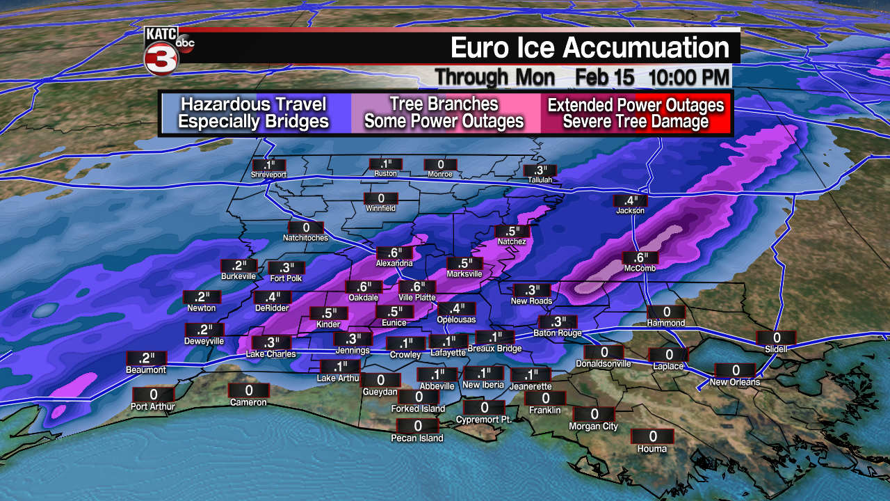
Well with winter precipitation becoming a real possibility here across Acadiana over the next few days, I thought I'd go over some forecasting techniques that we use right here in the weather lab to help us determine just what kind of precipitation we could be faced with.
Of course, it is all about examining the atmospheric column.
So I'm going to be going over four different precipitation types (or four different scenarios). It's important to keep in mind that for each scenario, the precipitation starts out as snow in the cold, upper parts of the atmosphere. That's where the coldest temperatures are found.
So it is pretty straightforward with Scenario number one: We have a warm layer of air that melts the snow as it falls through the column. As a result, we are left with liquid precipitation or rain at the surface. This is something that we're pretty accustomed to seeing here, across South Louisiana.
Scenario number two: We have a deep warm layer of air in the mid/upper parts of the atmosphere (below the snow higher up) that when the snow falls through that layer, it's going to eventually melt. However, it is then going to encounter a very thin layer of freezing temperatures just above the surface. It's not going to have enough time to completely re-freeze, but it will be able to freeze on contact with the surface, especially with temperatures at or below freezing.

That's our freezing rain solution and also the one that leads to those icy road conditions.

Kind of setting up treacherous travel conditions and really, this is the scenario we've been tracking over the last couple of days for our potential storm system on Monday. So, keep that in mind if you have any travel plans, especially late in the day on Monday going into Tuesday (Mardi Gras).

Remember that bridges and overpasses ice over quicker than the surface roadway.

That is because the ground provides insulation to the roads from below which keeps the road from freezing quite as quickly.
However, that is not the case for bridges and overpasses as cold air is able to circulate above AND beneath the bridge/overpass.
Scenario number three kind of flip flops from Scenario number two. The warm layer is not nearly as deep.. it's more shallow in nature so as the snow falls through the atmosphere, it's only going to partially melt, kind of becoming a slushy raindrop in nature.
It is then going to encounter a much deeper colder layer just above the surface, so it is actually going to be able to re-freeze. Now it’s not going to have the same shape or composition as the original snowflake, but rather it's going to be in the form of sleet. That's what we see at the ground.
And then of course Scenario number four: That's where our temperature profile remains below freezing throughout the column and that is a scenario you want to see if you're looking for snow. This one obviously we do not see a whole lot of down here.


