


The threat of more thunderstorm complexes will continue for Acadiana through the next few days, but lower rain chances and hotter temperatures are expected for the weekend.
Like the last few weeks, big storms complexes or MCCs (meso-convective complexes) are expected to continue to plague the region from Texas, to Oklahoma, to Arkansas and Louisiana.

The extremely difficult to forecast pattern is expected to continue, with models hinting at the risk of hefty storms sometime Tuesday, especially the afternoon hours, and then again for Wednesday afternoon/evening.
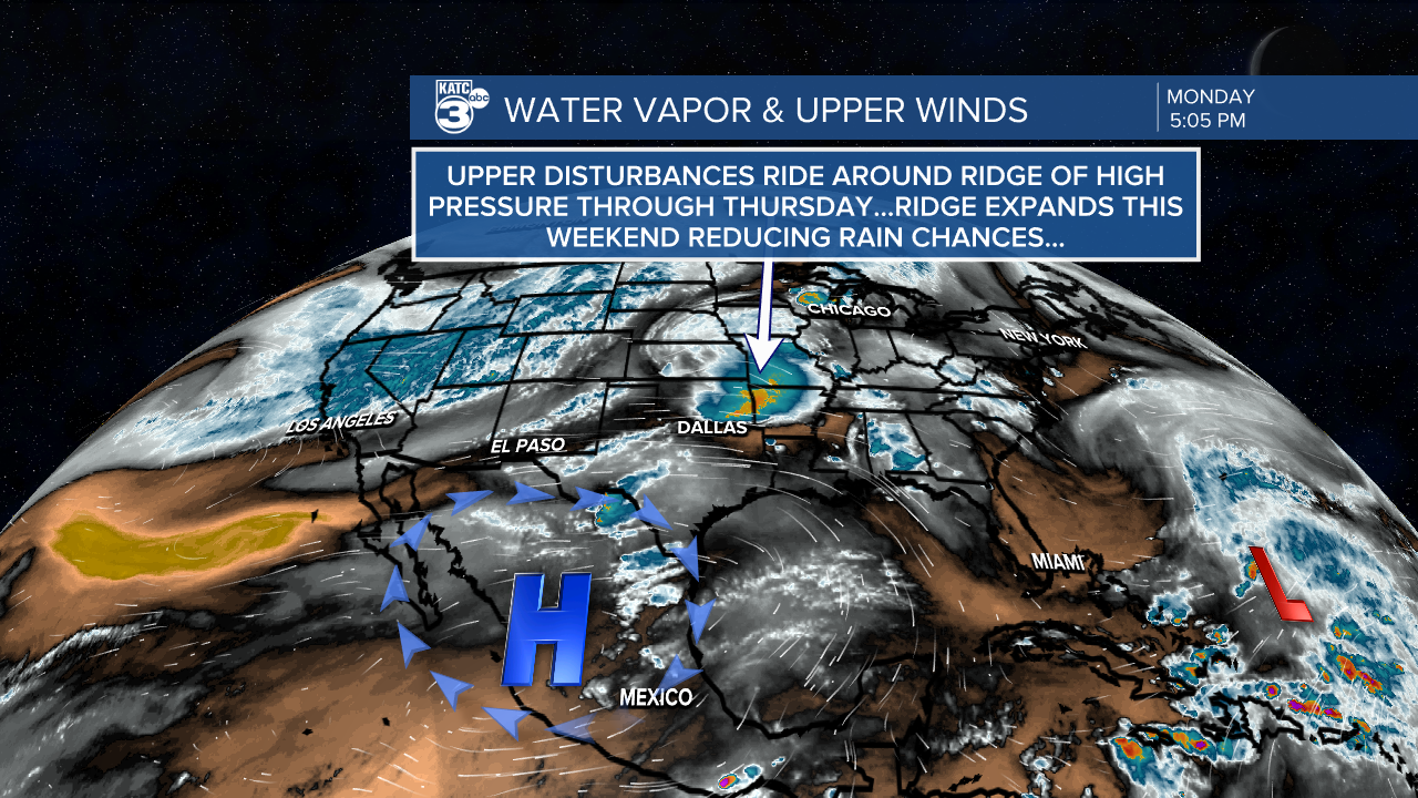
Even overnight tonight through Tuesday morning, we could see some storms slipping into the Acadiana area late as we watch the current storm complex by the ArkLaTex this Monday afternoon.
According to the Storm Prediction Center (SPC) we will continue to be in a low end marginal risk for severe storms mainly I-10 on northward...but these outlooks may change.

The primary concerns would be for storms that could produce damaging winds and hail...not unlike the last handful of weather systems to roll through the area.

While impossible to predict. and additional 1-2" of rain may be possible for some Tuesday and the same could probably be said for Wednesday.
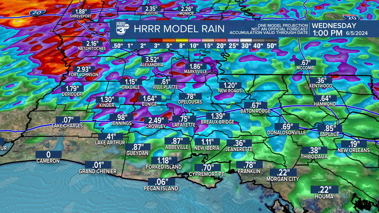
Higher amounts along with a higher risk of intense storms will likely occur from Central Louisiana on northward...we'll see.
Away from the storm activity, expect hot and humid conditions to continue with more sun as compared with recent days.
The pattern looks to finally change by Friday into the weekend with lower rain chances and hotter temperatures likely.
See the KATC 10 Day Forecast for the latest.
