3:15pm Tuesday update:
Latest video briefing from Rob regarding severe weather in Acadiana earlier today and a full tropical discussion:

There's not much change in the overall thinking of the storm from when we first started talking about it on Monday.
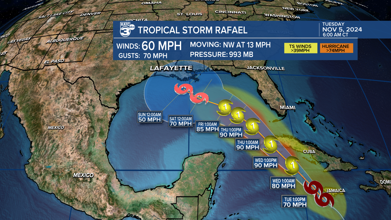
Strengthening is ongoing, as expected, with winds now around 60 mph and run to a strong Category 1 storm is underway.
Rafael will be a hurricane as it crosses Cuba and moves into the Gulf of Mexico where conditions are much more hostile for tropical systems.
Models still seem split on the path Rafael will then take and Tuesday hasn't provided much clarity as both the EURO ensembles and GFS ensembles seem to firmly be doubling down on previous runs.
The key to the forecast will be the strength of the ridge sitting in the southeast at the end of the week, a stronger ridge forces the storm to drift south and west and a weaker ridge allows it to move in along the coast.
Complicating thing even further is a trough digging in from the west which will directly impact the ridge's strength but that will depend on timing and strength of the trough.
The arriving trough will sharply increase shear across the western Gulf of Mexico and coupled with cooler sea surface temperatures it will cause Rafael to weaken regardless of track.
We're still not at the point we can talk about impacts because of the uncertainty surrounding the track, I will point out though that both models would keep almost all of the impacts east of the center.
The shear will make for a very lopsided system so "landfall" means less with a storm like this then other symmetrical storms.


