

Monday Morning brought with it not only the start of the work week, but a lot of severe weather, damage, more flooding, and even an EF-2 Tornado.
Thankfully, the middle of the week will be more mild, but will be hot, humid, and gusty.
Let's do a quick recap prior to your forecast.
Here are some rainfall totals for the past 72 hours. These are official observation numbers given to us by the National Weather Service. Large range of totals from a max of 13.55" in Rayne to simply 2.72" in Opelousas. This really highlights how varied rainfall totals can be when these tricky storm complexes come into the area and train over one location.

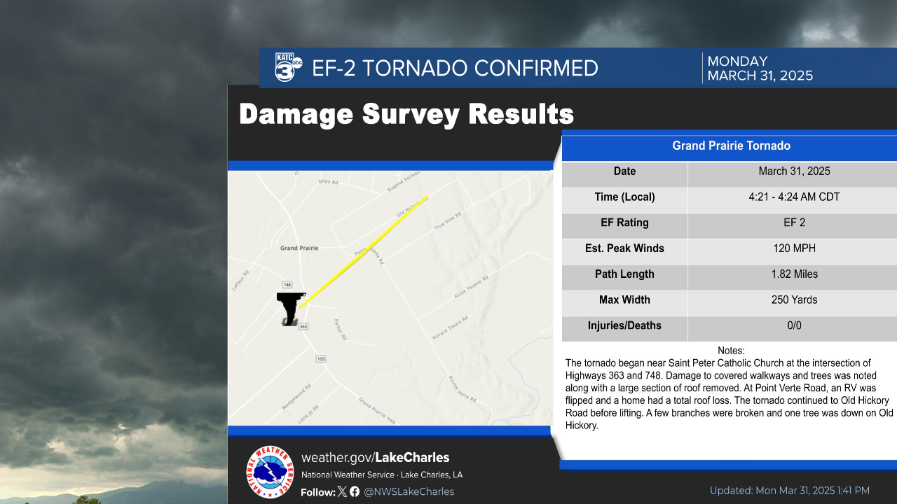
In the last 24 hours, on Monday, March 31, at about 4:20 AM an EF-2 Tornado briefing touched down in Grand Prairie traveling about 1.82 miles. Thankfully no injuries were reported with this early morning tornado.

Taking a look at the forecast ahead for this week:

High's will be in the 80s through much of the remainder of the midweek, with lows falling only into the 70s. Lots of onshore flow from the gulf will lead to humid conditions.

The SPC has us in a general thunderstorm risk to cover for areas that may see pop up thunderstorms thanks to really efficient daytime heating.

What is important to know and keep in mind is the wind gusts that will be expected through the next few days, with wind gusts up to 40 mph or even a bit higher on Wednesday.

Here's a full look at your 10 Day Forecast:

