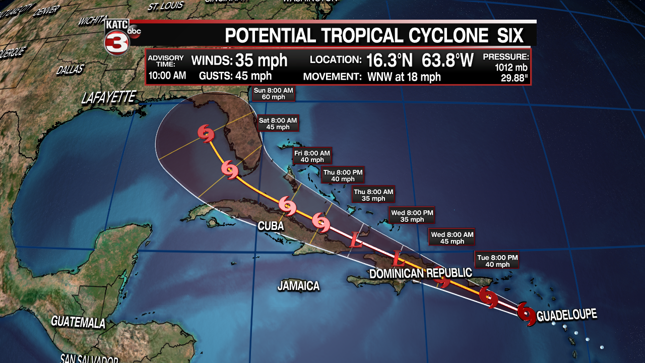
Potential Tropical Cyclone #6 continues to spin near the Leeward Islands in the eastern Caribbean. Advisories were hoisted Monday in advance of the development of the storm. This allowed Tropical Storm Watches and Warnings to be issued for some of the Caribbean Islands.

Fred, is the next name on the list if it becomes a Tropical Storm. It's moving toward the west-northwest at 18 mph. This forward movement is expected to continue today as it's moving around the periphery of a ridge of high pressure currently dominating the central Atlantic Ocean. Some strengthening can be expected early in the forecast as it moves between the Leeward Islands and the Virgin Islands and Puerto Rico.
After Wednesday, the center may be interacting with land along the coasts of the Dominican Republic and Haiti, eventually Cuba could inhibit further development. The forecast holds #6 as a weak tropical storm or even dropping back to a tropical depression. Mountainous terrain would give the system problems.

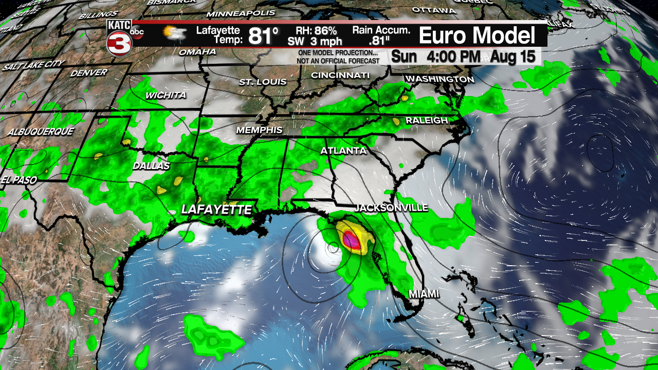
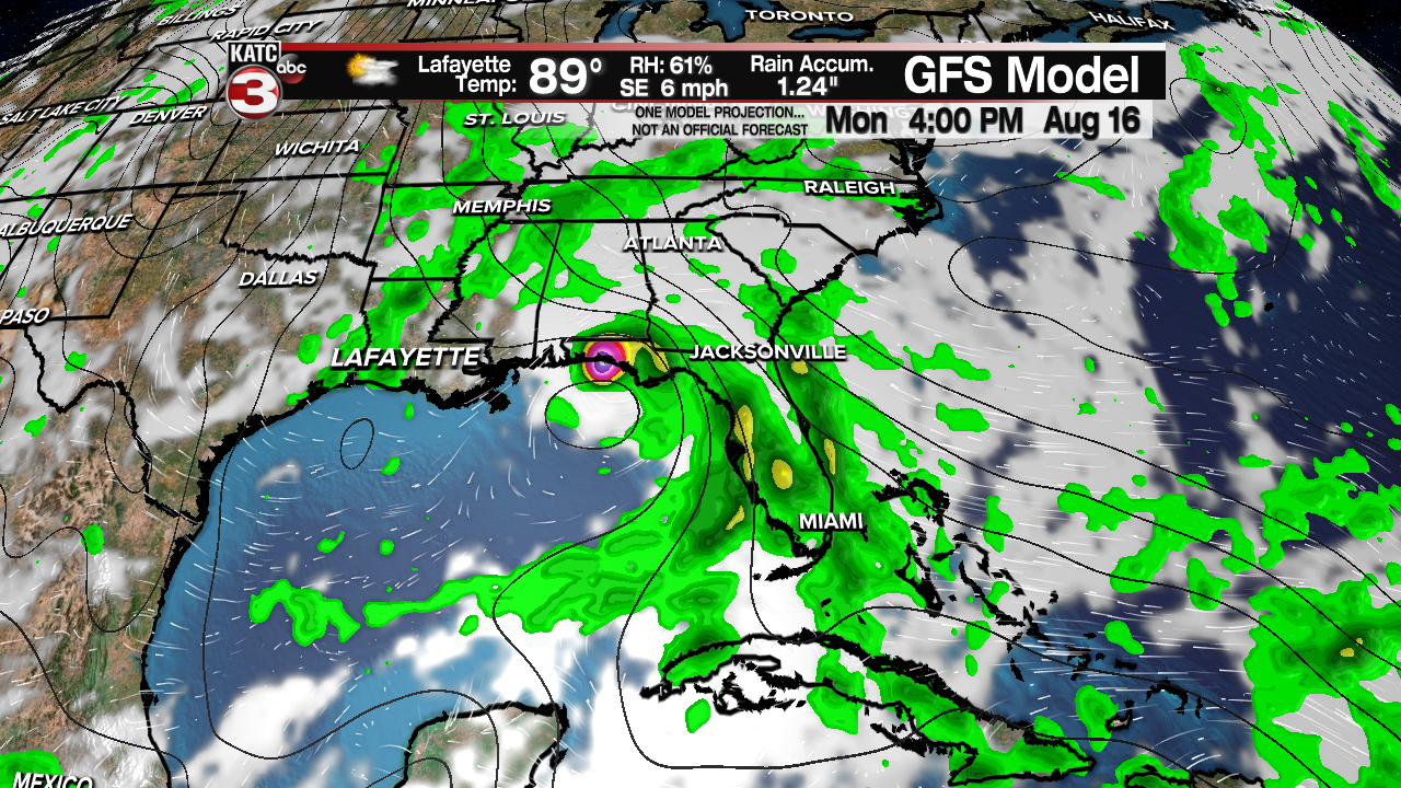
The extended forecast, going into the weekend, has the system starting to turn northwest toward the eastern Gulf of Mexico. Some additional strengthening is possible again once it's over water. Most models track it toward the west coast of Florida or perhaps the Florida panhandle toward the end of the weekend. Intensity models get it up to moderate tropical storm strength before landfall.


At this time it appears this will NOT be a threat to Acadiana. But models do diverge a bit by days 4 and 5, so keeping an eye on the latest forecast is advised this week. Any preparations should be ready to go since we're now in the third month of hurricane season, and typically August and September are the busiest months.


