Meteorological Summer (June-Aug) has started, but summer's heat has been hanging around for some time. It appears the first few days of June will continue to bring hot temperatures, but only a few isolated showers.
Lafayette Regional Airport recorded just under two inches of rain for the month of May, normal is about five and a half inches of rain. Some parts of Lafayette, Vermilion, and Iberia parishes seeing less than an inch of rain for the month, while parts of St. Mary and St. Landry stayed closer to normal for monthly rain.

The next few days look relatively dry. Rain chances will stay below 20% going into the weekend, with perhaps a few more summer type showers returning by Sunday. Afternoon highs will stay in the lower 90s, but thanks to slightly lower dew points, heat index values will stay around 95. Night time temperatures should drop into the lower 70s.

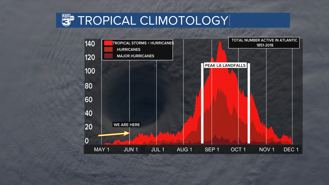
The first day of June is also the official start of Hurricane Season. After three years of La Niña, which can increase tropical activity in the Atlantic, we're heading into an El Niño pattern. El Niño is where waters in the Pacific Ocean off the west coast of South America start to warm. This pattern affects weather across the globe, but during El Niño conditions, vertical wind shear increases over the Atlantic basin. Vertical wind shear is the change in speed and direction of winds at different altitudes.

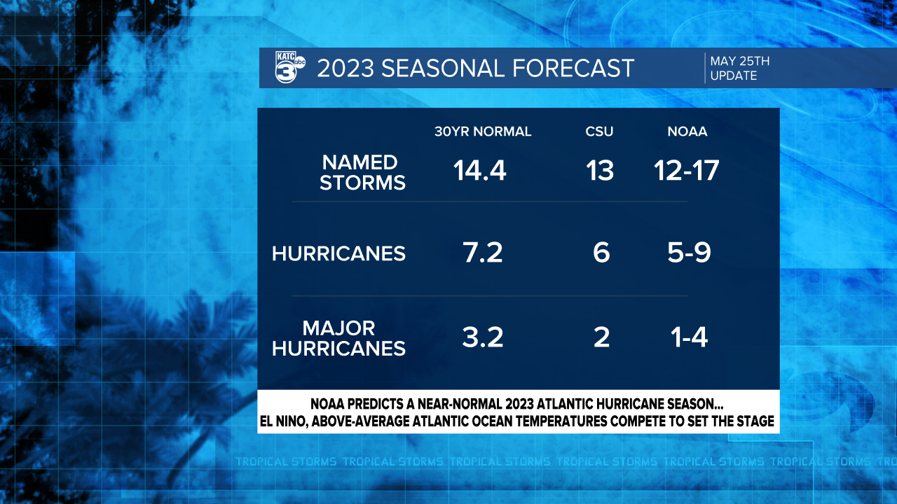
When you have high wind shear, it inhibits development of tropical systems when they're getting organized. Keep in mind, it won't deter ALL systems. Still, most forecasts are calling for a "normal" hurricane season. This would bring about 14 named storms, 7 becoming hurricanes and about 3 becoming "Major Hurricanes" which are Category 3 or higher.

We already have one suspect in the eastern Gulf of Mexico. Right now, the National Hurricane Center is giving it a 50% chance for development, but the possibility of development drops as the system moves toward Florida. Only a few isolated showers will drift westward toward Acadiana, so impacts locally will be minimal.


