Another hot day is expected across Acadiana with highs reaching the low to mid 90s and heat index values pushing toward 105 degrees. A deep southerly flow at the surface will keep dew points in the mid to upper 70s, and a weak ridge of high pressure aloft should keep most of the afternoon showers away. Only light breezes out of the south will cool you down. This pattern is expected to last through Wednesday, with a bit of weakening in the upper ridge by the end of the week. By Friday, and the weekend, rain chances will be back up for the afternoons.

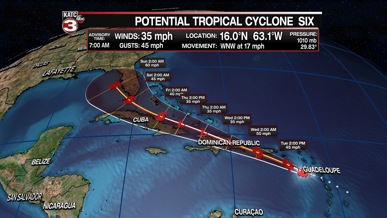
The big story continues to be tropical weather developing over the eastern Caribbean. Advisories were initiated for Potential Tropical Cyclone Six near the Leeward Islands. Even though it hadn't become a full tropical system as of Monday afternoon, the National Hurricane Center gave it the designation in order to put watches and warnings up for some of the Caribbean Islands. And this morning (7am) it's still not quite a tropical depression. When it does strengthen, it will be Tropical Storm Fred.

It is expected to strengthen, but how strong this system will get will depend on it's track. If it stays over water, it'll have a good chance at strengthening. But there's a lot of land in it's path. And not flat land, Puerto Rico, The Dominican Republic, and Haiti are quite mountainous. Moving over this terrain would have a significant impact on its development.

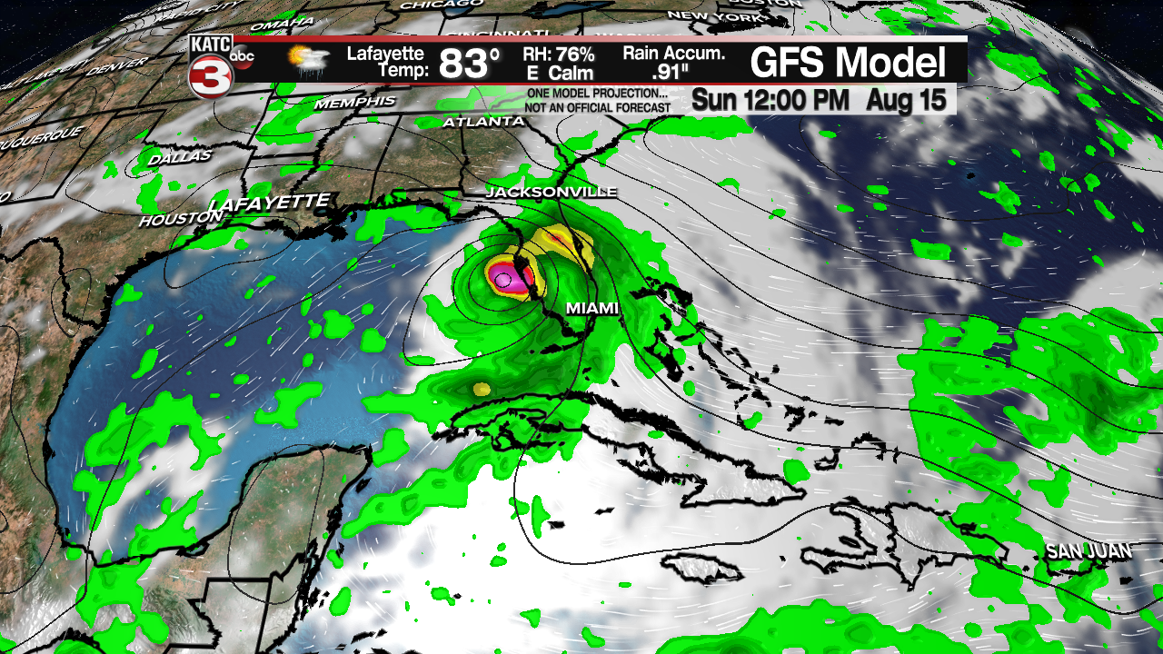
Most models are in agreement for a west-northwest movement, with a bit of a slowdown by day three. But Sunday, both the GFS and the EURO place a weak tropical storm near the Florida Keys, and into Monday curving it toward the west coast and panhandle of Florida. As of now, there is no threat to Acadiana, but this time of year you need to have plans in place.


