


Soaking rains and storms for Acadiana Friday into Saturday morning.

An upper level disturbance off the coast of California will run eastward this week and bring rain and storms to Louisiana and Acadiana by Friday afternoon, into Friday night, ending midday hours (for Acadiana) Saturday.

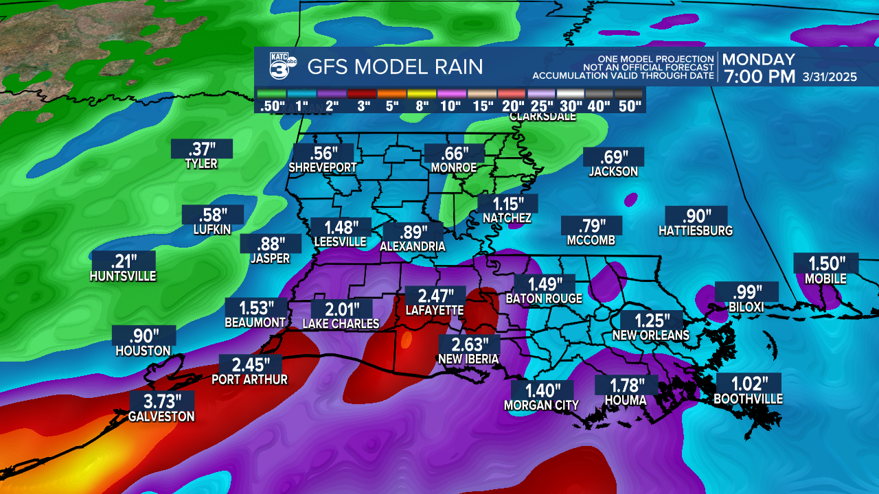
Soaking rains of a couple of inches will be possible for most of our area, with isolated amounts up to 3-5", or more may be possible.

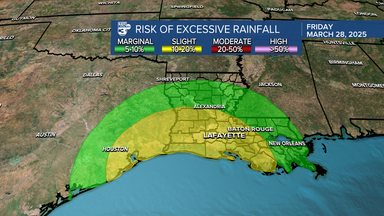
The Weather Prediction Center has all of Acadiana hatched in for a level 2 out of 4, "slight risk" for excessive rainfall from 7am Friday through 7am Saturday.
At this point, severe storms are not expected, but there could be isolated storms that could produce gusty winds and/or small hail.
Per the Storm Prediction Center: "the lack of robust CAPE (Convective Available Potential Energy) and shear likely to be associated with this feature suggests that severe potential should remain subdued".
In the near term, expect more warm spring-like temperatures and increasing humidity for our Wednesday with the threat of fog developing overnight through Wednesday morning.

Partly cloudy conditions will return for Wednesday afternoon with highs reaching the mid-80s.

Thursday will bring in high and mid-level clouds ahead of our Friday/Saturday weather feature, but for the most part, the day should be dry.
Showers and eventually embedded thunderstorms look to arrive by Friday afternoon with the heaviest rains likely overnight ending by midday Saturday.
With any luck, Saturday afternoon and all of Sunday should bring more favorable spring weather.
Another disturbance could bring some showers and a few storms to the region Monday, with more spring temperatures and undesirable spring humidity likely to follow much of next week.
See the KATC 10 Day Forecast for the latest.
Severe Storm Report from Monday:
The National Weather Service surveyed the wind damage that occurred with straight line/downburst winds Monday morning in rural Acadia Parish into Western St Landry Panhandle.

They found approximately 70 to 100 mph wind gusts damaged 13 large transmission lines, number of trees, power poles, and homes and outbuildings that were heavily damaged.
Width of the damage swath was approximately 3 miles and 14.7 miles long.
