


Soaking rain and storms are expected for Acadiana tonight followed by an arctic blast with couple of hard freezes to round out the week.

A coastal low pressure system will produce widespread showers and thunderstorms across the area tonight with a low end, marginal risk, per the Storm Prediction Center, for the possibility of a few storms capable of producing hail, and perhaps some strong winds, especially along the immediate coastal areas.

Look for a solid 1-2" rain in most areas...a few spots could catch up to 3", especially across the coastal parishes.
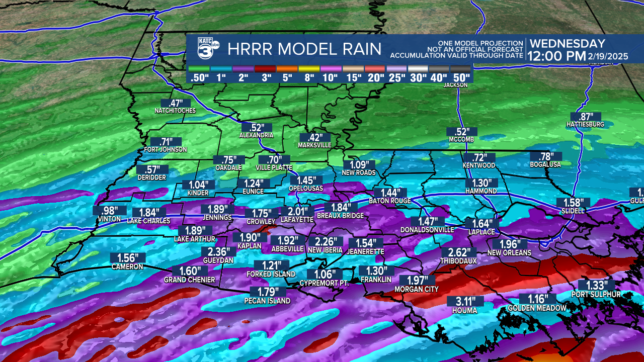
Rains will end well before daybreak.
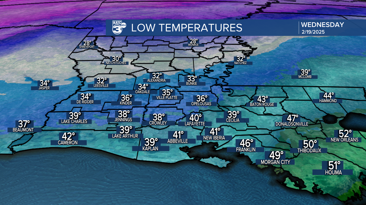
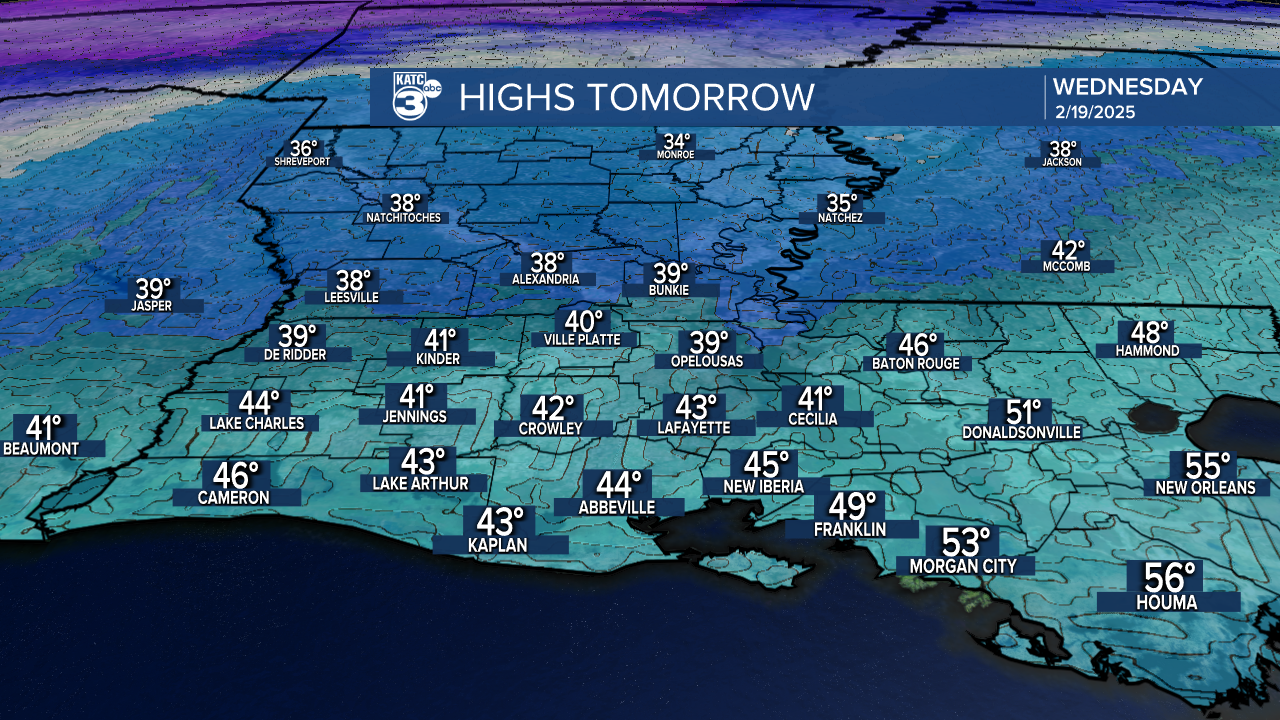
Thereafter, it's our second and likely, the last real arctic blast for the winter for the area with temperatures dropping into the upper s 30s to lower-mid 40s south, and it won't warm much at all Wednesday with lingering clouds likely.
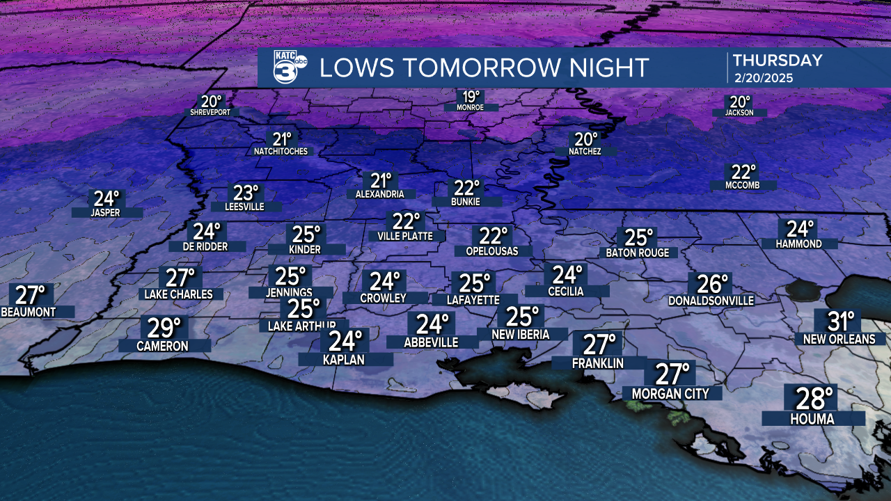
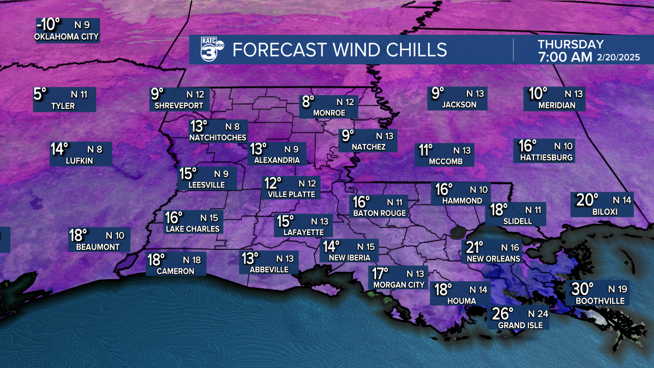
Wind chills stay are expected to stay in the 30s Wednesday and will drop into the mid-teens tomorrow night/Thursday morning as actual temperatures drop into the low-mid 20s!
Clouds could stay through Thursday morning with some clearing expected for the afternoon as temperatures hold in the lower-mid 40s.
Another hard freeze (with less wind) is expected Thursday night into Friday morning.
Thereafter, a very slow warming trend will ensue this weekend with periods of rain possibly developing by Saturday afternoon, continuing into Saturday night, and ending early Sunday.
Spring-like temperatures are expected to return to the area next week per KATC's 10 Day Forecast.
