


A complicated forecast Thursday morning with a pattern that could bring several rounds of severe weather to Acadiana stretched out over several days.
The first round is expected to move through Acadiana late Thursday night.
The primary threat with this first volley of storms will be hail and damaging winds but, as is typically the case with these systems, spin up tornadoes will be possible.
Heavy rain will accompany the storm with the heaviest showers falling in neighborhoods north of I-10.
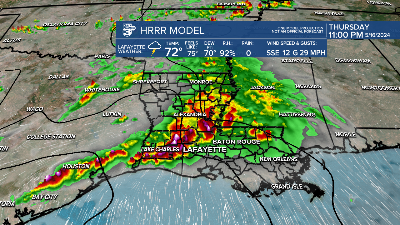
Severe weather dynamics looks like they will be strongest during this first round of thunderstorms, and Thursday night's storms look like the most violent of the bunch.
There's an Enhanced Risk of severe storms Thursday night in western Acadiana.

This doesn't mean, however, that we won't get severe weather Friday morning.
After a brief break in the very early morning hours the next round is expected to swing through around commute time on Friday.
Once again wind and hail will be the main issues with these storms, and keep in mind a lot of things got jarred lose on Monday so we may see a little more debris than typical.

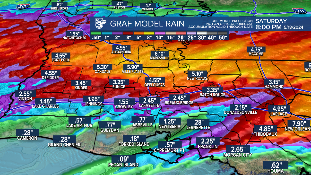
After a quick lull during the middle part of the day Friday we'll get yet another round of storms, however, this is when the flood threat will start to develop.
Severe dynamics won't be quite as robust but after several rounds of rain it will start to get harder for the ground to soak up the water.
Localized street flooding will certainly be possible and low lying areas will start to see the water pile up.
This will be particularly true in northern parts of Acadiana which will experience the majority of the rainfall over the next few days.
Rain totals will sit on average between 2-4" for areas along and north of I-10 but in places that receive the heaviest downpours the totals may be double in localized areas.
As a result a Flood Watch has been issued for the northern half of Acadiana.
Showers will persist into Saturday morning but they're not expected to be as strong.
Folks who may be headed to New Orleans for the weekend will want to keep in mind Saturday is when the flood threat develops in east Louisiana.
Once we're through the other side of this we will quickly flip the page to summer.
Highs next week will average 90 and lows will stay in the 70s, likely hanging there until September.
