


Acadiana is hatched in for up to a "slight", level 2/5 risk, of a few severe storms that could produce damaging winds and/or an isolated tornado.
The Storm Prediction Center (SPC) issued a slight upgrade for Acadiana regarding the severe weather threat Wednesday, with a few storms that could produce damaging winds and/or an isolated tornado.

Highest rain chances are expected during the afternoon into the evening hours with most activity ending by or shortly after midnight.
A few supercell storms may be possible....see storm timing below.

The greatest risk of heavier rains should remain just north of the Acadiana area.
A brief shot of much cooler air and breezy conditions is expect to follow Thursday with highs suppressed into the 50s while lows dip into the 40s Thursday night.
It will be warming back up into the upper 70s again Saturday ahead of our next storm system arriving, that could be accompanied by a slightly greater severe weather risk.
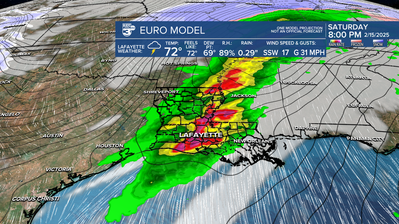
SPC hasn't outlined an area of concern for Saturday yet...but they probably will by tomorrow.
Thereafter, the pattern for Acadiana looks chillier and more February-like next week, and perhaps into the week that follows.
Acadiana's latest 10 Day Forecast
And follow the storms on Power Doppler 3
