September 10th 4:00 PM Tropical Update:
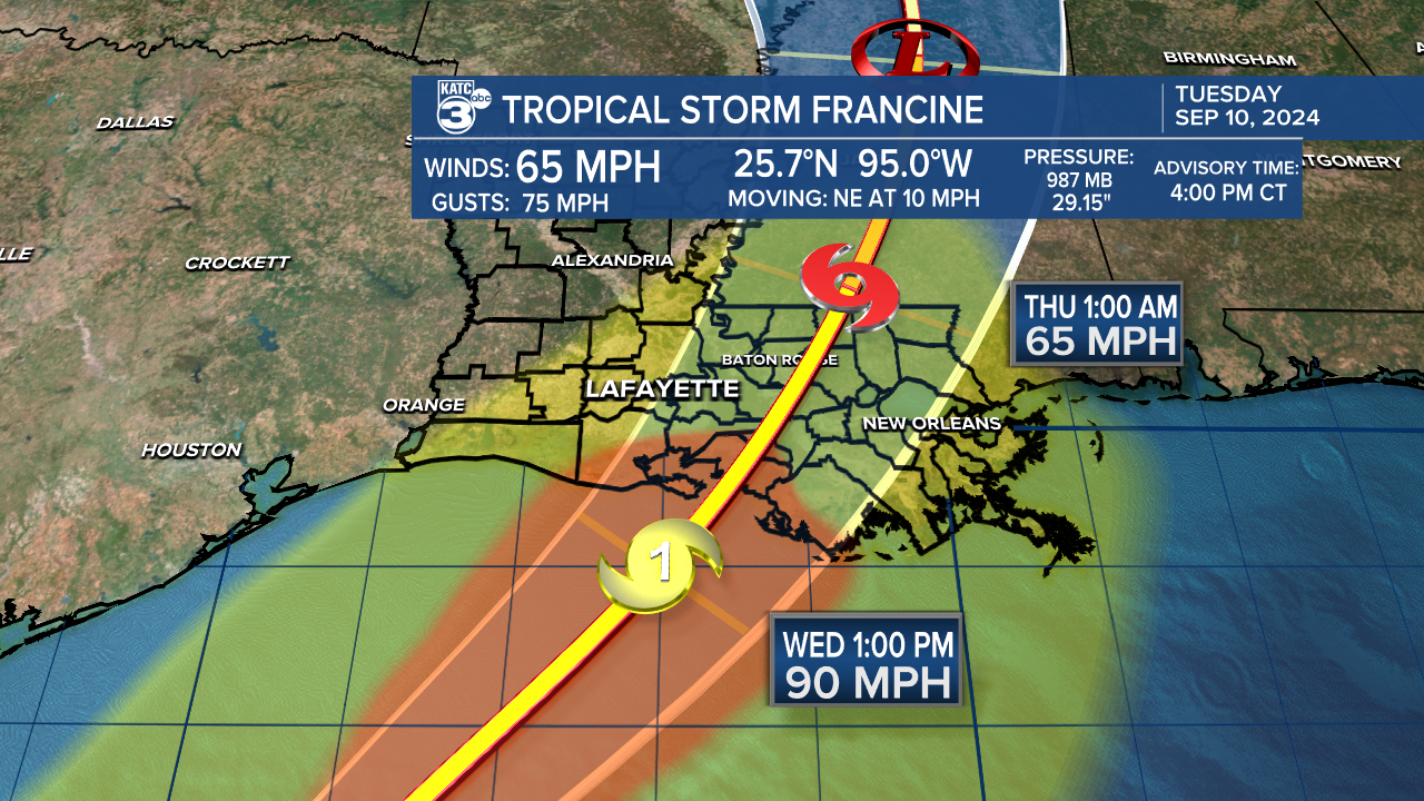
The National Hurricane Center has issued the latest advisory for Tropical Storm Francine. Francine still remains a tropical storm with wind speeds at 65 mph. The dry air and shear is helping to slow strength. It is likely to become a hurricane late tonight. Tropical storm conditions are expected early tomorrow morning. Francine can make landfall possibly as a high-end category one or low-end category two hurricane by the early afternoon. Conditions are expected to deteriorate throughout the day after landfall.

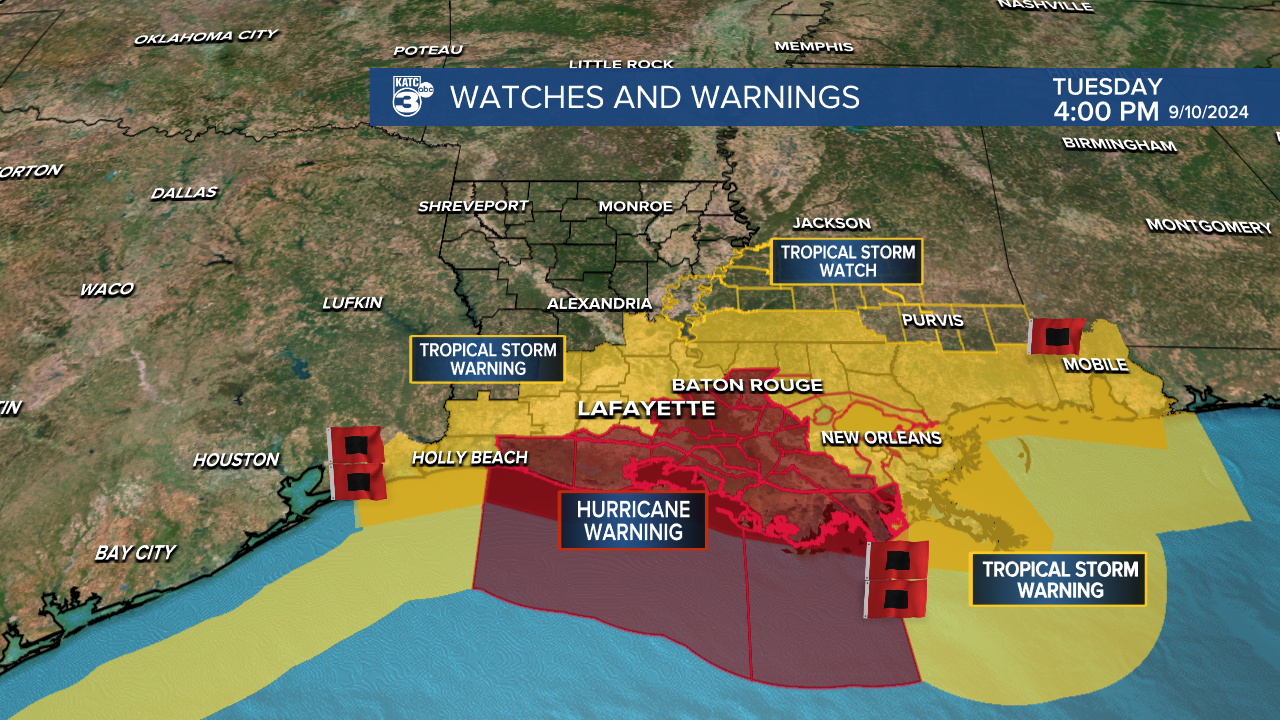
Tropical storm watches have been issued further north near Jackson, Mississippi as Francine continues on a northeastward track. Additionally, tropical storm warnings are in effect from Texas through southern Alabama, covering Allen, Evangeline, St. Landry, Avoyelles, Acadia, and Jeff Davis parishes. Furthermore, hurricane warnings are still in effect for Vermilion, St. Martin, St. Mary, and Iberia parishes.

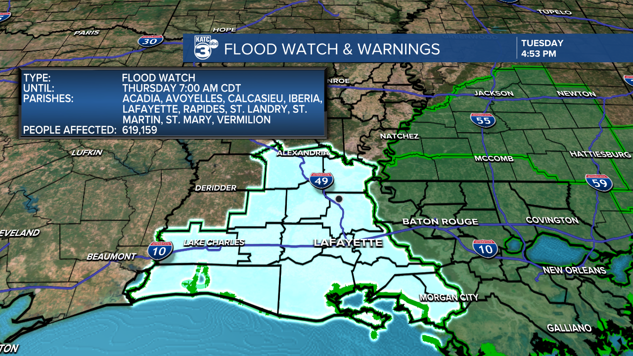
The most recent GRAF Model indicates that Francine is expected to make landfall further east, possibly near Terrebonne or Lafourche parishes. The next update at 10:00 PM will provide more information. It's anticipated that there could be lower wind speeds and reduced rainfall amounts for CENLA and Acadiana. However, a flood watch is still in effect for the entire Acadiana region through Thursday morning. Rainfall amounts between 4-8 inches are possible, with localized higher amounts of up to 12 inches.


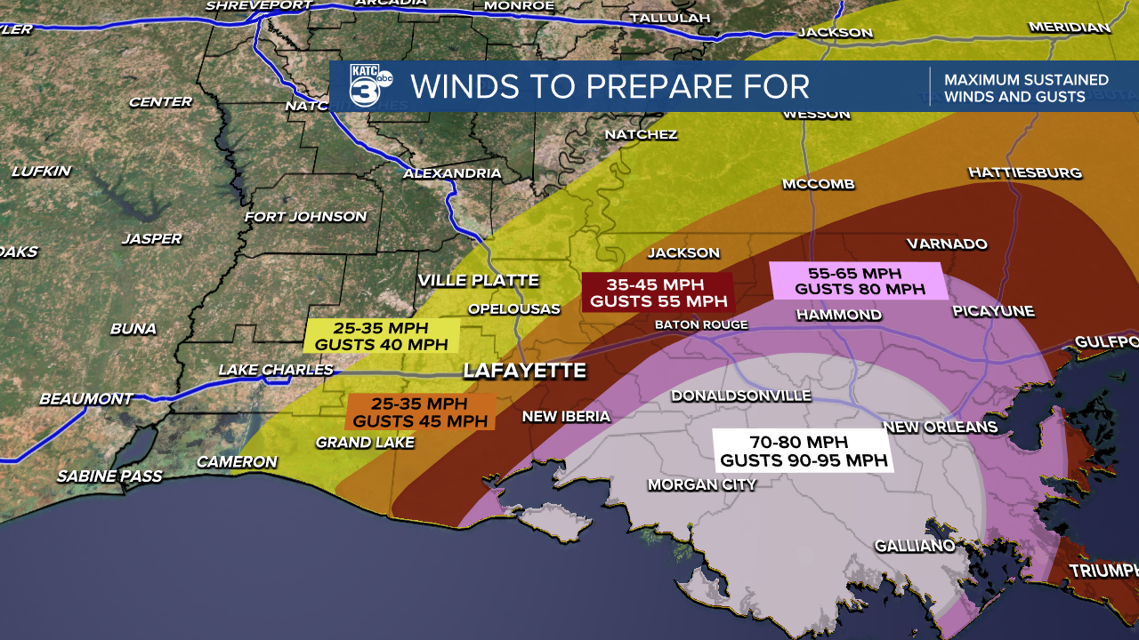
Prepare for gusty conditions tomorrow, depending on where you live in the state. Eastern and southern Central Louisiana and Acadiana can expect wind speeds between 25-35 mph, with gusts up to 45 mph. Further east, where Francine is expected to make landfall, stronger winds of up to 80 mph and gusts of up to 95 mph are anticipated.

Its best to stay up to date on the latest advisories for Tropical Storm Francine.
Follow Meteorologist Breyanna Lewis for further updates.


