


The hot and dry conditions will continue for the foreseeable future. A strong upper-level ridge will maintain hot and dry weather through the weekend, and the heat will spread eastward. Temperatures are expected to reach the upper 90s to low 100s today as the summer heat wave persists. Heat advisories have been issued due to the high temperatures and humidity, with heat indices reaching 113°. It's recommended to take care of outdoor activities in the morning or late evening when it's not dangerously hot. Unfortunately, there's no relief from the lack of rain in Acadiana as rain chances remain close to zero.


It's still two system in the tropics. The first is Tropical Storm Debby, which is still causing heavy rainfall and flooding in the southeast. The second is a tropical wave located just north of South America. The tropical wave is slowly developing as it moves over the southern Caribbean and is expected to eventually move into the Gulf. Due to a strong high-pressure system in the Great Plains, it is likely to be steered into Mexico, though it is still too early to be certain. It is important to stay updated on the system!
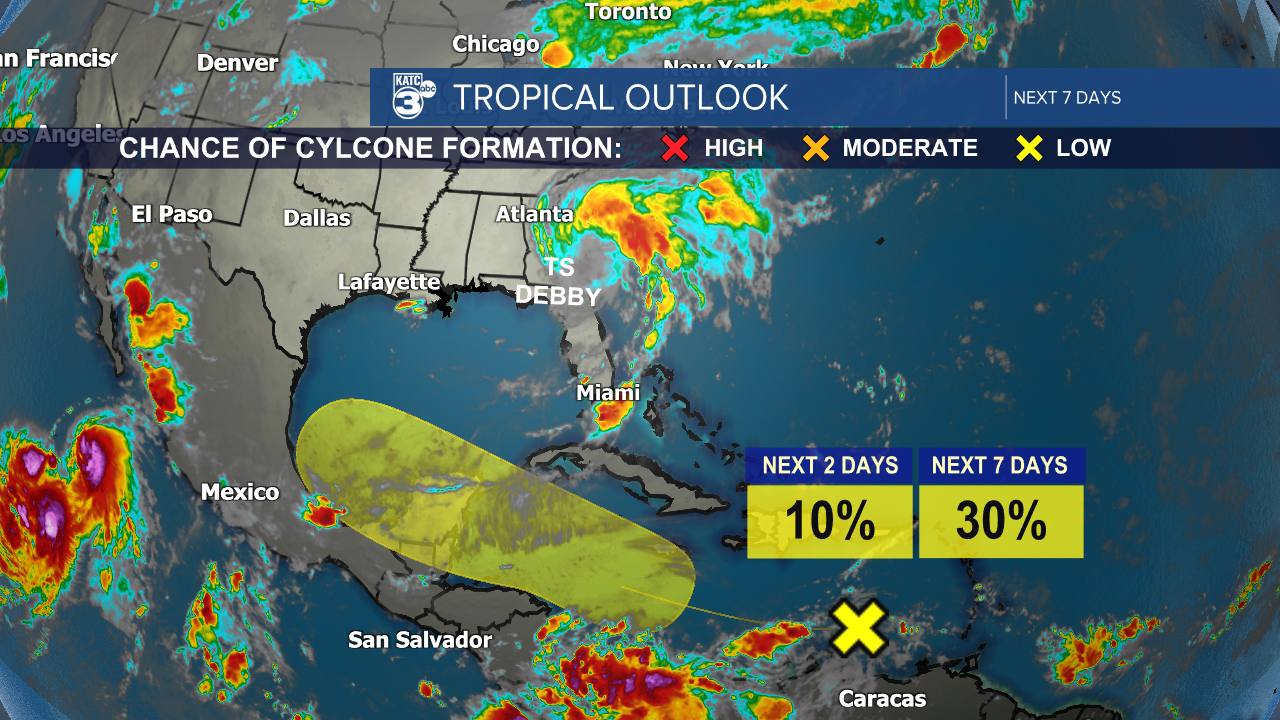
Tropical Storm Debby has slowed down as it moved inland, resulting in historic heavy rainfall and catastrophic flooding in the southeast. The storm has caused power outages and flooded areas, and unfortunately, it has led to five deaths. Debby is expected to move into the Atlantic, where it may regain strength before making a second landfall in South Carolina. Afterward, it is forecasted to move to the northeast by the weekend.

See the KATC 10 Day Forecast for the latest.
Follow Meteorologist Breyanna Lewis for further updates.
