


Someone please come write these discussions for me, it's been a long summer and I'm running out of ways to say the same thing every day.
The brave soul taking me up on this endeavor will receive no monetary compensation but you will be able to sleep soundly knowing you saved me from staring at a keyboard for 15-20 minutes at 3:30 a.m. (honestly that's better than money in my opinion).
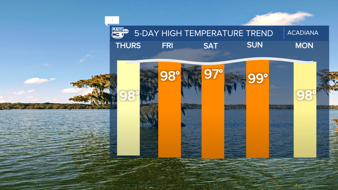
Two (deranged) sentences in you probably have a good feeling for the major talking points of this discussion which will once again center around heat.

Acadiana will once again be under a Heat Advisory, which will become an Excessive Heat Warning on the other side of the Basin.
The Heat Index will quickly be back in the triple digits and will top off around 112 again in the afternoon, at this point you don't need me to remind you to drink water, seek shade, etc.
If you think it's going to cool down at all through the extended forecast... GUESS AGAIN.
Temperatures through the next 10 days will average the upper 90s.
A few showers will be possible, especially Friday afternoon which may actually see a few more storms moving through the area.
These will all be pretty run of the mill summer showers, however, so won't do much to cool us down.
Now that we're getting to the back half of August we all start furiously staring at the horizon waiting for that first front to show signs of arriving.
Unfortunately it looks like we'll be waiting for a while.
