

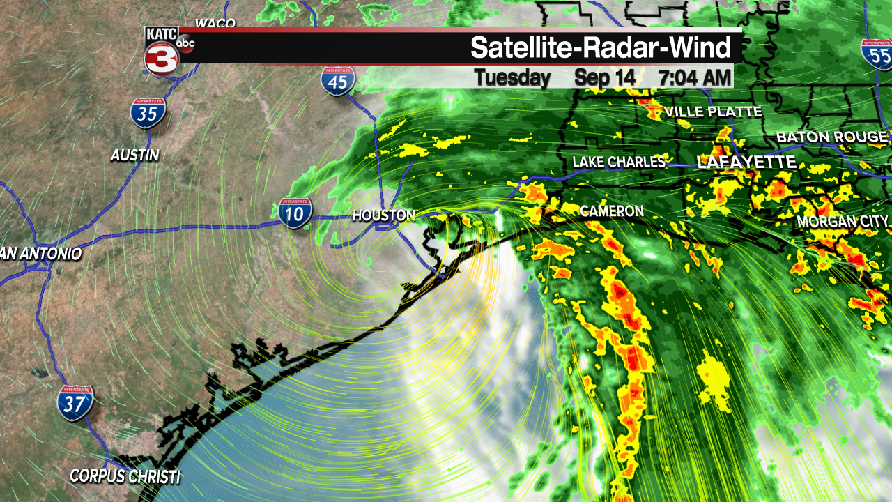
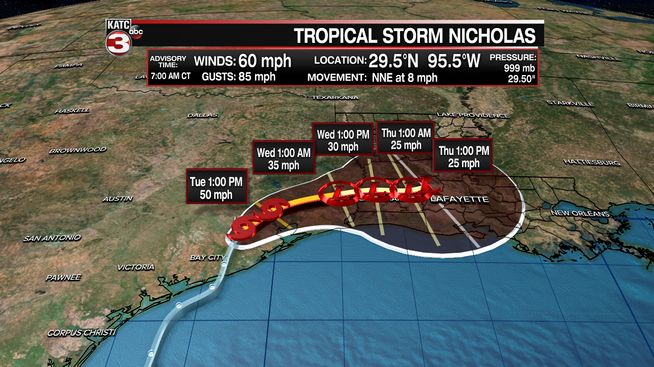
Very early Tuesday morning, Hurricane Nicholas came ashore along the upper Texas coast near Matagorda Peninsula with winds of 75mph. Even though the system is moving inland and has again weakened to a Tropical Storm, heavy rains will continue across much of the region through the rest of the week. Flood Watches have been posted for the entire region.
The eventual track of Nicholas brings it slowly inland toward Houston, then a gradual turn eastward toward Louisiana, then continuing eastward along the I-10 corridor. The center should remain over land, therefore no strengthening is forecast. By the end of the week, Nicholas is expected to be a remnant low pressure area. Unfortunately the slow movement may only get it to the Louisiana/Mississippi region, hence the prolonged heavy rain event.
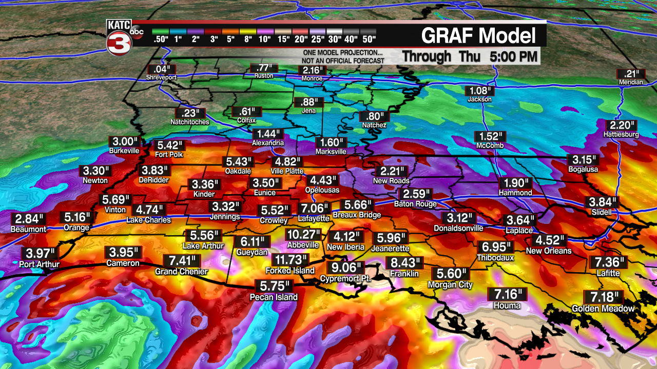
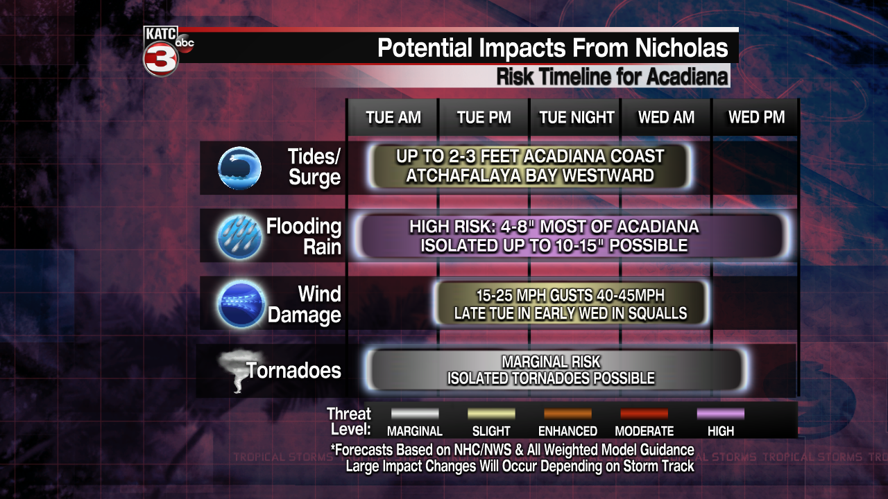
Most of Acadiana will be looking at 4-6 inches of rain through Thursday, but some areas that get in the line of "training rainfall" could see over a foot of rain. Winds won't be much of an issue. Some gusts along the coast could reach 40 mph, while inland areas western Louisiana could see gusts up to 30mph. The immediate Acadiana area should see winds up to 25mph.
Coastal flooding could also be an issue. Along the Cameron Parish coast, some coastal flooding will reach 3-4 feet, while Vermilion Bay and points eastward could see tides running about 1-2 feet higher than normal.
Later in the week, the rains should diminish, with summer like showers and storms returning by the weekend.
