An area of disturbance may move into the Gulf of Mexico later this week a more detailed forecast for that can be found here. While that system is the one that will be closer to home there are several other storms, a few major ones, that are spinning out in the Atlantic Basin. Most of these will have no impact on Acadiana but I’ll give you a rundown on each of them.
Hurricane Florence

Any discussion of the tropics must start with Hurricane Florence, the storm that poses the most threat to life and property. A major hurricane now, Florence is expected to hit the Carolinas as a Category 4 hurricane, and one of the most powerful hurricanes to hit that part of the country. This could be a disaster for the Atlantic seaboard and anyone with interests in this part of the country should be paying very close attention.

This storm is still days away from the coast and there’s still a little uncertainty with the exact track, but what is clear is that a dangerous situation will start to unfold later this week. Landfall is expected on Friday but impacts will be felt days before that, so if you have family and friends in that area make sure they are prepared for this storm.
Tropical Storm Isaac

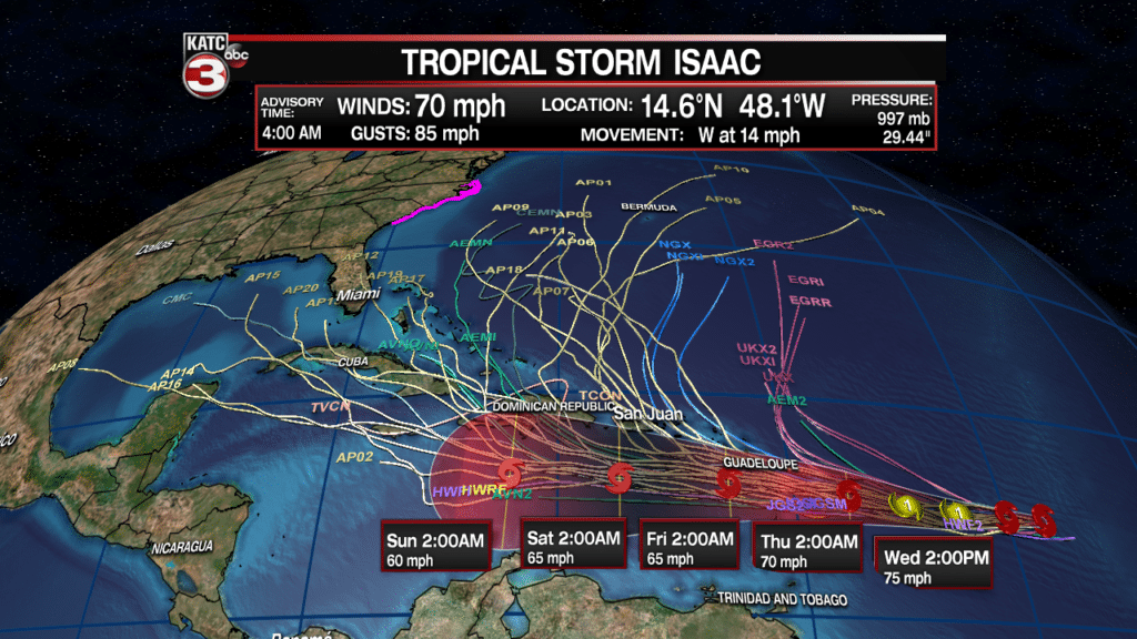
Tropical storm Isaac has had a rough 24 hours, downgraded from a hurricane to a tropical storm as it moves steadily westward. Isaac is a smaller storm and fluctuations like that often accompany smaller storms, so strengthening is certainly still on the table. The forecast currently calls for strengthening back into a hurricane, but that’s where it will peak this week.

The track will take Isaac over the Lesser Antilles later this week and into the Caribbean, which is when the uncertainty really begins. The most likely scenario is that it begins a gradual drift to the north and eventually fades. There is some chance, although slim, that Isaac makes a run into the Gulf of Mexico. The GFS in particular has hinted at this, although it should be noted the GFS hasn’t performed particularly well this season.

The above graphic gives you an idea of the kind of uncertainty that exits, and should help give you an idea how much stock to put into the turn to the north. This is a storm that should be watched and monitored although it is not a storm that is imminent. So we’ll keep an eye on it and bring you up dates as necessary.
Hurricane Helene

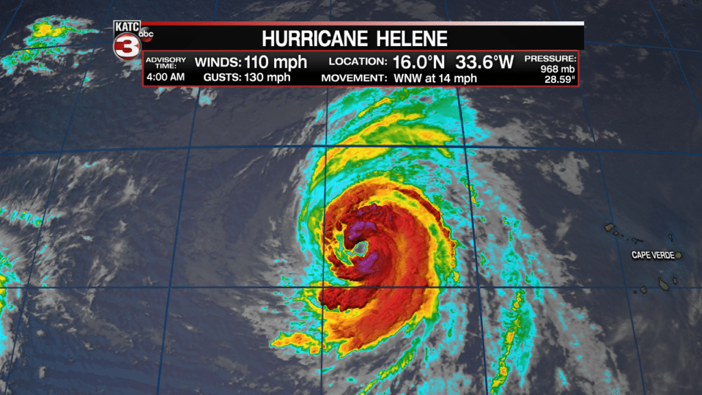
Hurricane Helene may be a very photogenic storm, and it’s expected to strengthen a little into a major hurricane over the next day. Helene, however, will be of little consequence to anyone as it will make a straight line north and die off in the Atlantic Ocean. Mariners will pay attention to Helene but it won’t threaten any coastlines.


