


High summer heat will continue for Acadiana well into next week, but scattered cooling Saturday afternoon/evening storms are expected.
Meanwhile, the National Hurricane Center began issuing advisories on a potential tropical cyclone, PTC#4, that will impact much of the Florida Peninsula through the Southeast U.S. Coast.
This system is not expected to impact Louisiana in any way shape or form.
Latest discussion regarding PTC4 here:
Locally, the first heat wave of the summer, which started with highs in the upper 90s Wednesday, will continue through the weekend into much of next week.

A weak frontal trough however, will bring the chance of scattered storms to the area Saturday afternoon/evening...but thereafter drier conditions with few showers should return Sunday and beyond.

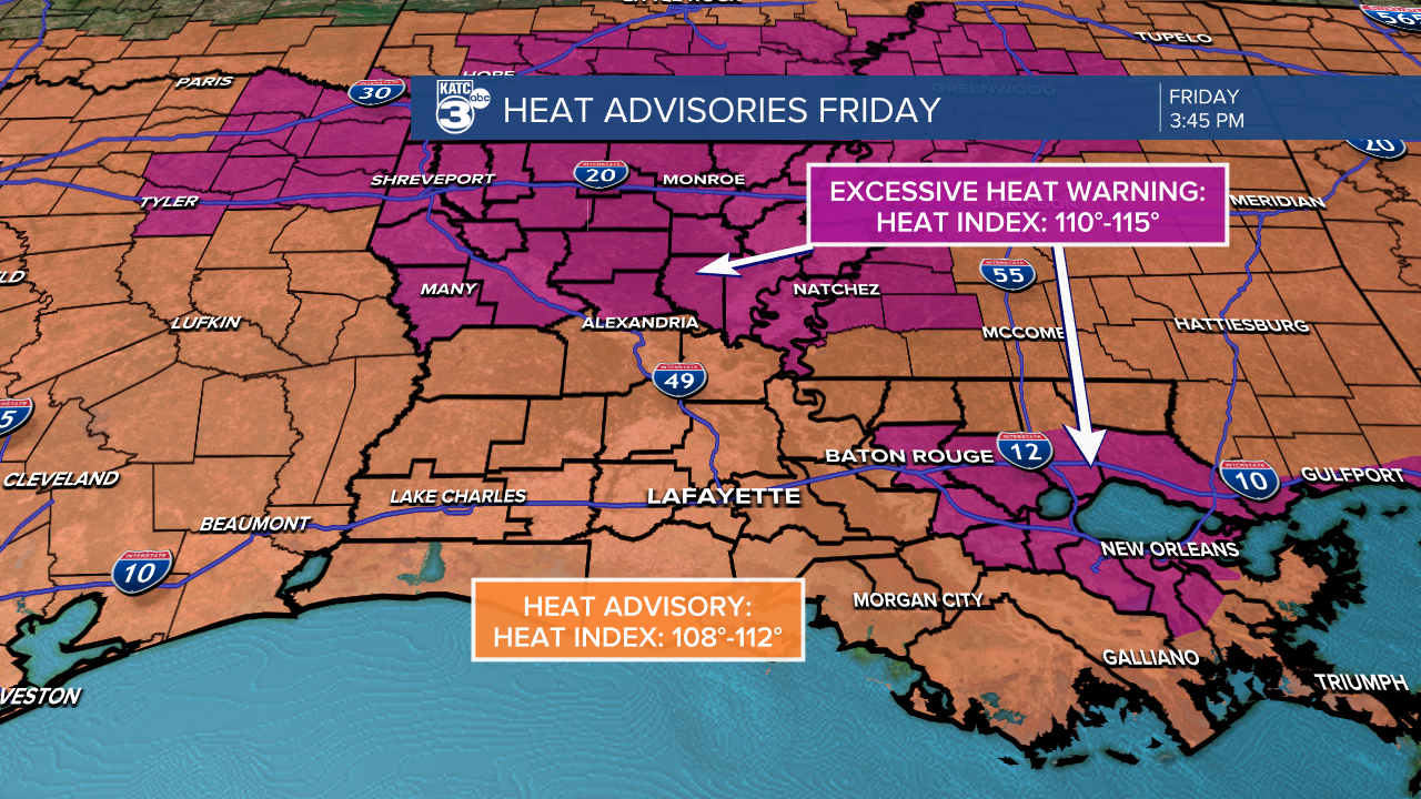
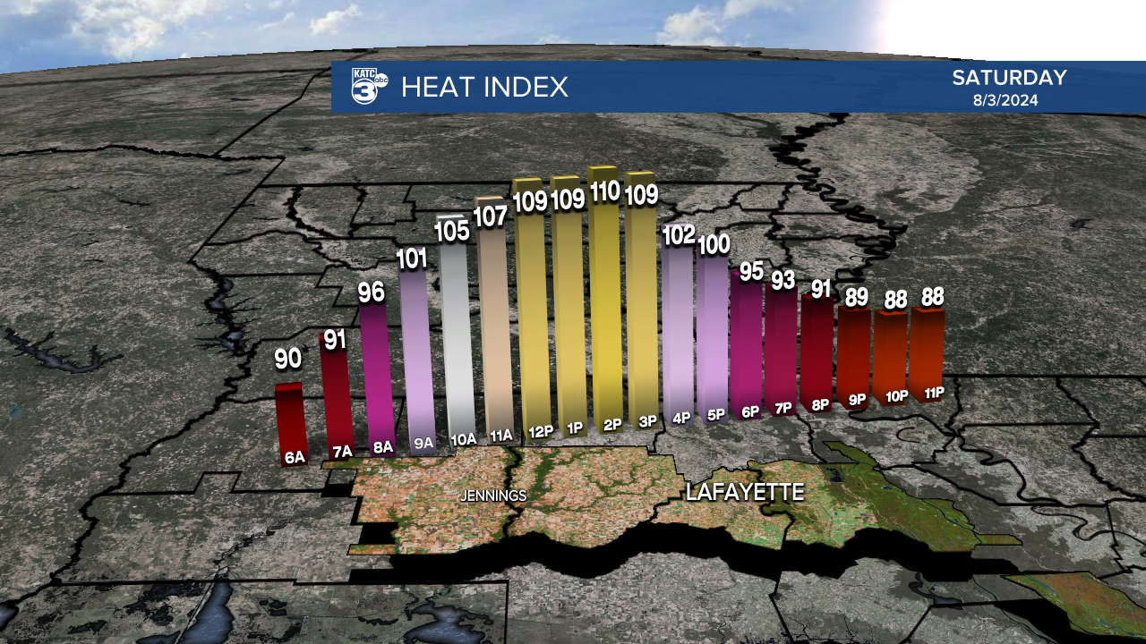
Heat Advisories remain in effect for all of Acadiana Saturday for heat index values near 110-112°.
Thereafter, hopefully slightly drier (less humid air) moves into the region Sunday into early next week, but unfortunately our daytime highs will continue to push the upper 90s, with perhaps a chance at 100° coming up by mid-next week.
See the KATC 10 Day Forecast for the latest.
