
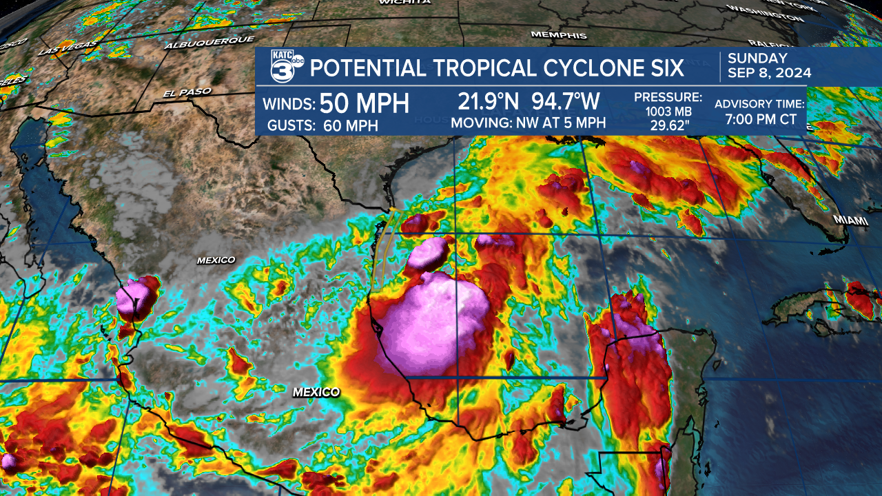
There are currently three systems in the tropics that show signs of developing in the coming days, making the tropics increasingly active. The main focus in Louisiana is on Potential Tropical Cyclone Six, located off the coast of Mexico.

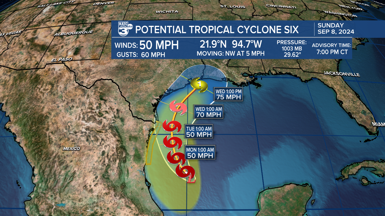
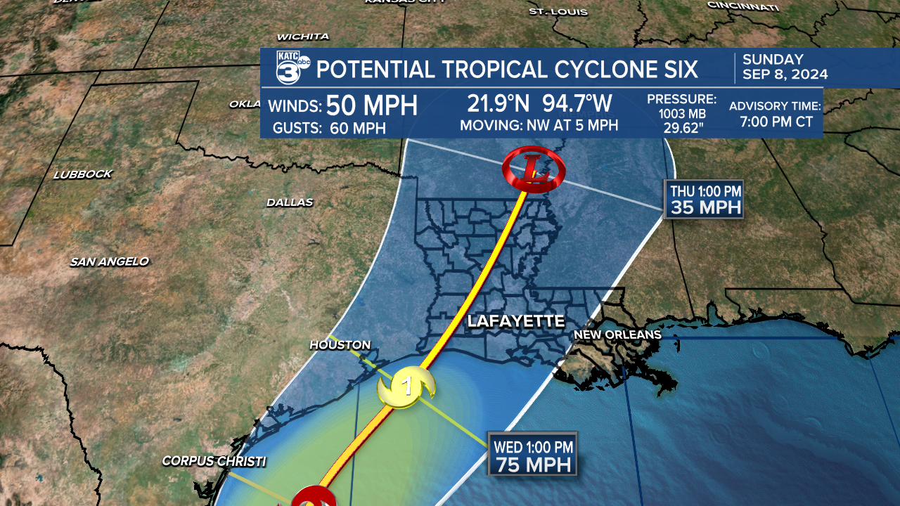
Potential Tropical Cyclone Six (PTC 6) has sustained winds of 50 mph, and with favorable conditions for tropical development, it is likely to become a tropical storm within the day. The next name on the list is Francine. It is expected to remain a tropical storm for a few days before possibly upgrading to a category one hurricane by Wednesday, maintaining a northwest movement at 5 mph.
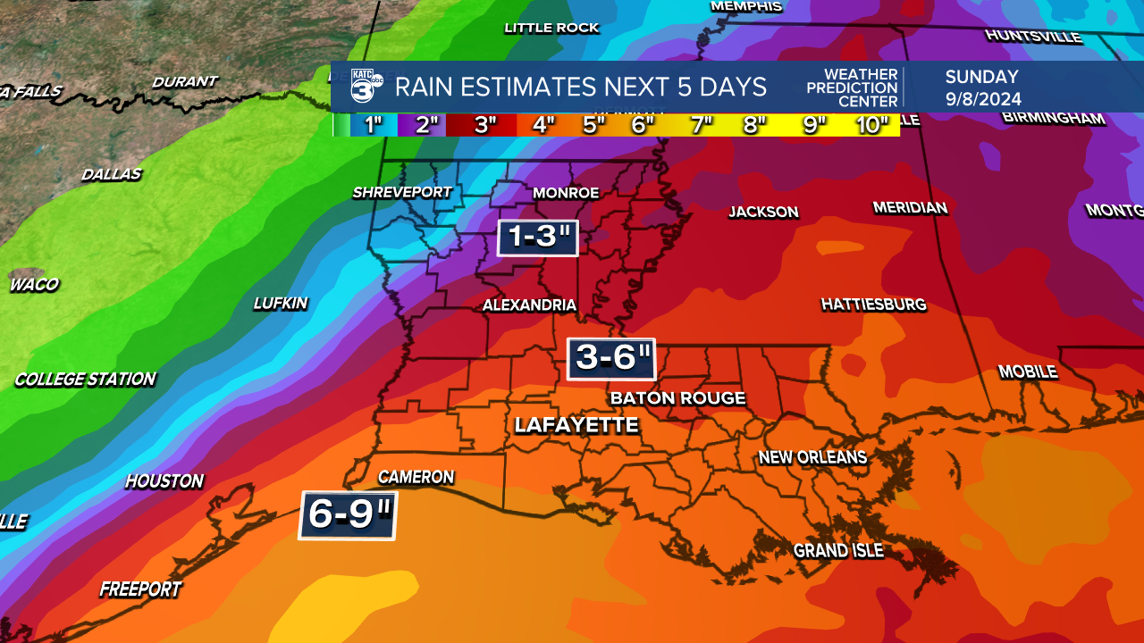
The exact path of PTC 6 is uncertain, but Texas and Louisiana are within the cone of uncertainty as the tropical system approaches the Gulf Coast. Louisiana is likely to receive excessive rain, life-threatening storm surge, flash flooding, damaging winds, and hurricane wind gusts of over 75 mph.
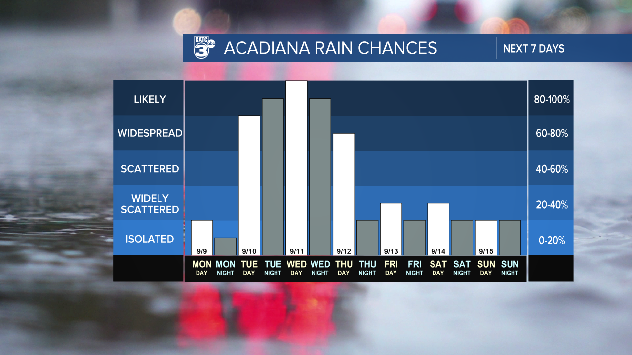
In Acadiana, rain and storms are likely from Tuesday through Thursday. The system is forecasted to move out by Friday, bringing dry conditions in its wake. The region can expect high rainfall amounts ranging from 3-6 inches inland to 6-9 inches along the coast, with isolated amounts of up to 12 inches. It's important to note that all forecasts are subject to adjustment based on updated models.
Follow Meteorologist Breyanna Lewis for further updates.
