


Hurricane Francine slammed into the Louisiana coast Wednesday evening as a dangerous Category 2 storm that knocked out electricity to more than 163,000 customers and threatened widespread flooding as it sent a potentially deadly storm surge rushing inland along the Gulf Coast.
Francine crashed ashore in Terrebonne Parish, about 30 miles (50 kilometers) southwest of Morgan City, the National Hurricane Center announced at 4 p.m. CDT. Packing maximum sustained winds near 100 mph, the hurricane then battered a fragile coastal region that hasn’t fully recovered from a series of devastating hurricanes in 2020 and 2021.
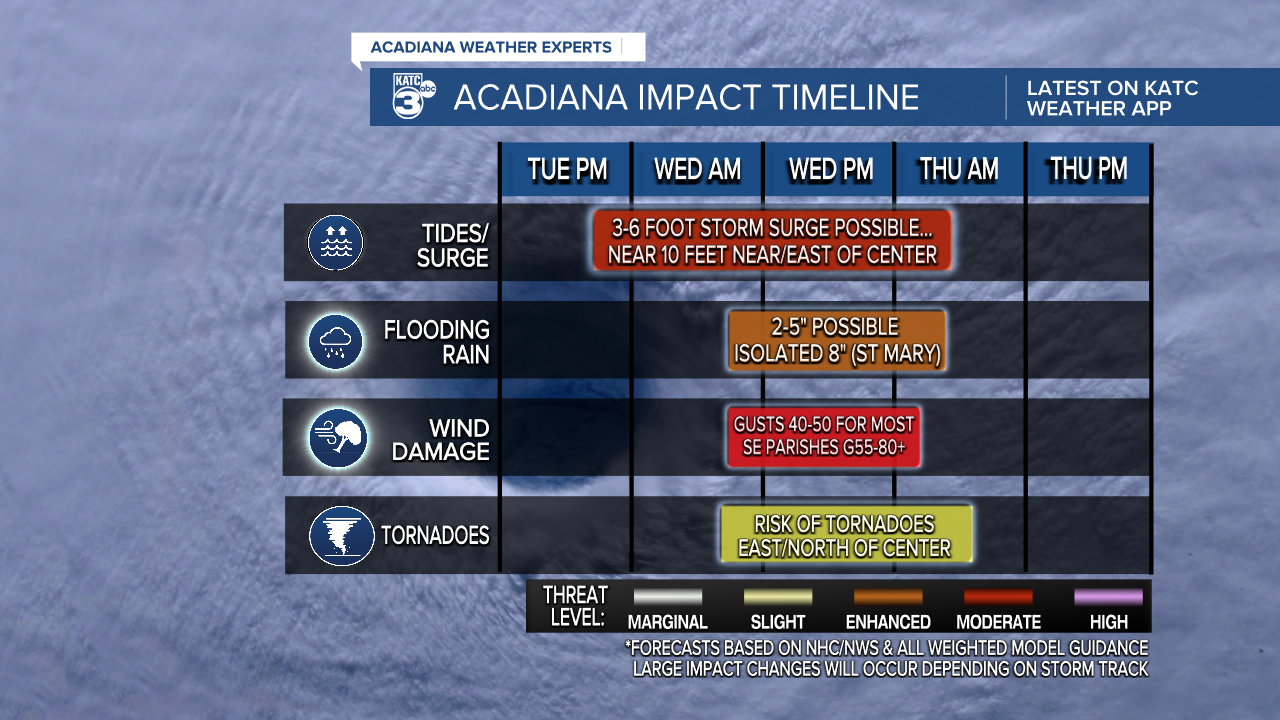
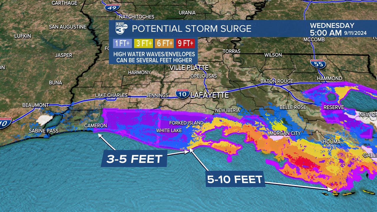
Storm surge will remain the biggest issue associated with Francine and a surge of 6 feet is likely along the Vermilion Bay, with the eastern shore potentially seeing spots as high as 10 feet.
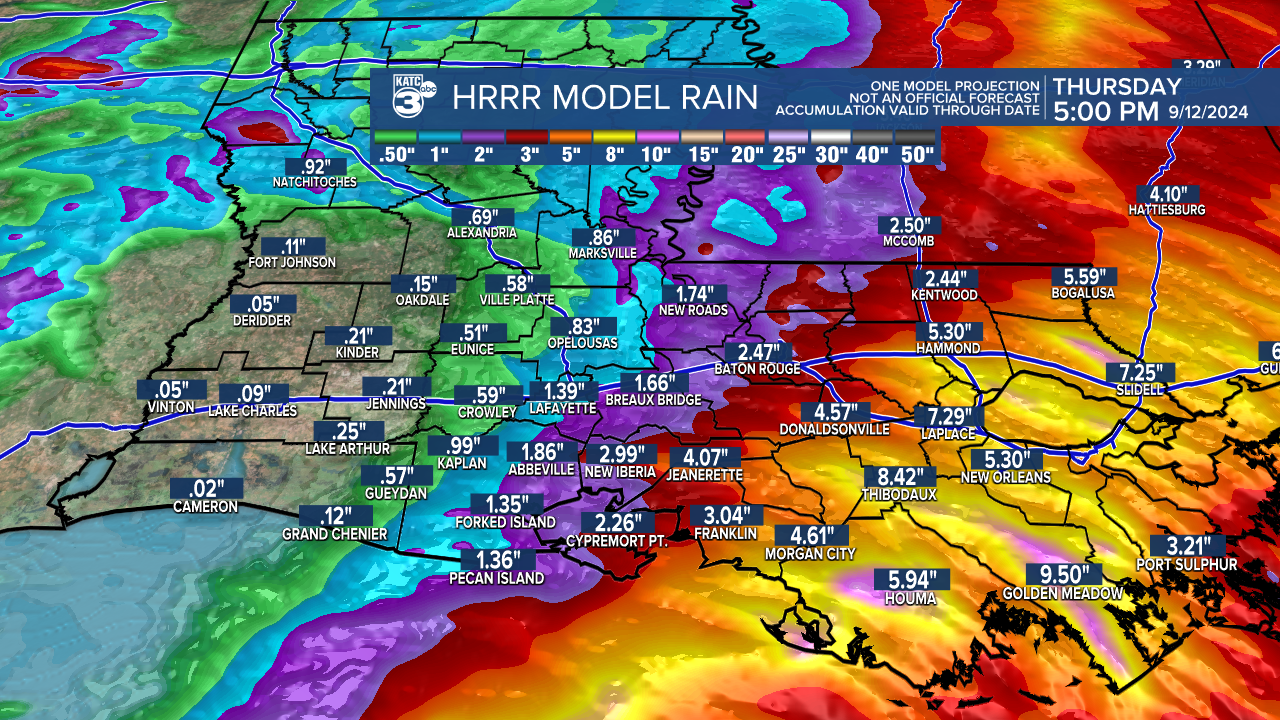
Flash flooding will remain a concern in St. Mary Parish as hot spots of 8" will occur and as that arrives quickly it will be hard for that water to drain out of the area.
Most of the flood threat has shifted to the east and that could include both New Orleans and the Mississippi coast line.
The rest of Acadiana will take on about 2-4" of rain which shouldn't be a major issue outside of some pooling on some of the low lying roadways.
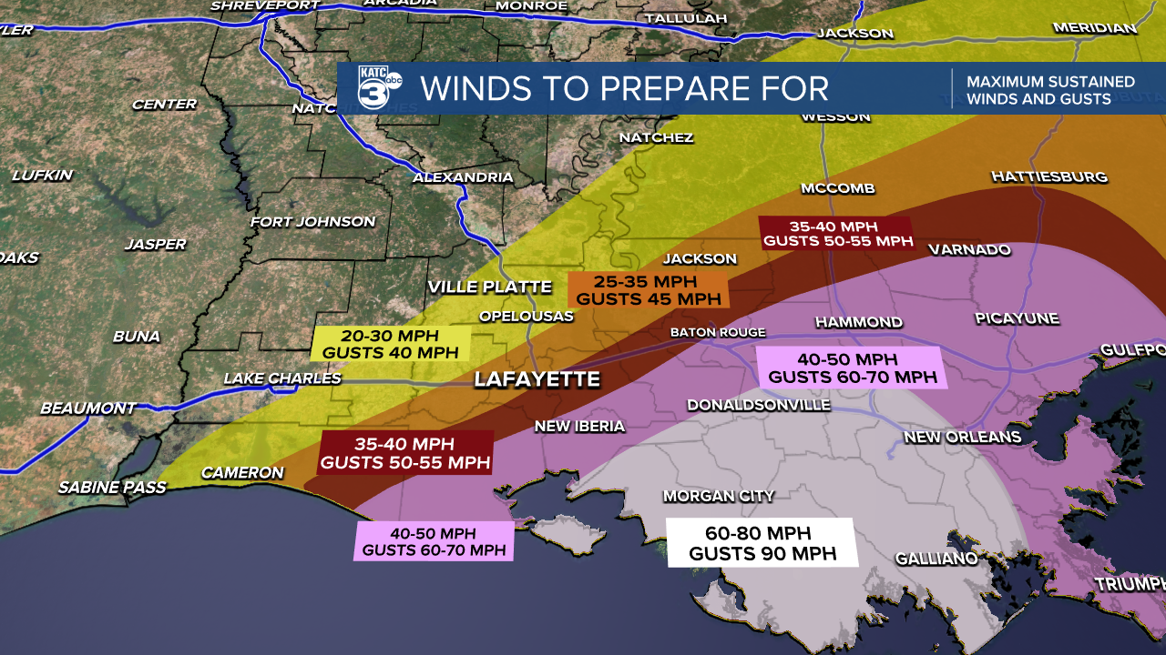
Winds will be most extreme along the coastline and could be pushing 80-90 mph along the center of the storm so power outages will be widespread through south east Louisiana.
As you get further west the winds will sharply begin to drop off and we're looking at tropical storm force winds in the Lafayette area later this afternoon.
This will still be enough to knock down some of the weaker trees and blow around some debris which could cause some power outages but they're not going to be as widespread.
Impacts may not be as intense as we had originally thought earlier this week but that doesn't mean we should not take it seriously.
We'll continue to monitor the storm and as changes arrive we'll be the first to let you know.
