
Acadiana has another round of active weather on the way Thursday as a front pushes across the area from the west.
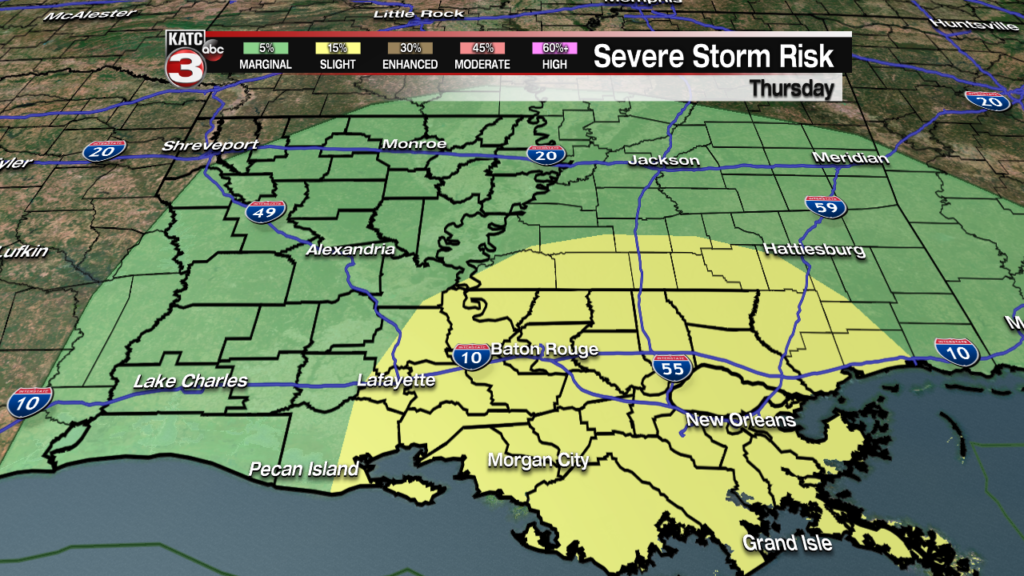
There’s currently a Slight Risk for some severe weather on Thursday morning, with a few isolated severe thunderstorms possible.
Severe weather won’t be as widespread as it was last week but a few areas could experience damaging winds, and a quick isolated tornado can’t be ruled out.
The severe risk will predominately be for the early morning hours as the front starts to push in around dawn.
 Futurecast 3 Hour


As the morning continues the event will slowly transition from a severe weather threat to a localized flooding threat as heavy rains continue into the afternoon.
This doesn’t look like it’ll be a widespread flooding event but low lying roadways may struggle to drain along with full, fast flowing bayous and rivers.
Most of us are all aware of the problem areas so if you typically commute through a road that struggles to drain take an alternate route to work.

The good news is that the worst of the weather will be ending in the early afternoon giving the ground a chance to drain before Festival.
While there could still be a few light, lingering showers for the Thursday evening shows but nothing a poncho couldn’t handle.
