
It’s another round of potentially severe weather this week, as this severe weather season proves to be a particularly busy year.
WHERE: The outlook for Thursday was increased to an “Enhanced Risk” (3 out of 5) for all of southeast Louisiana and into Mississippi.
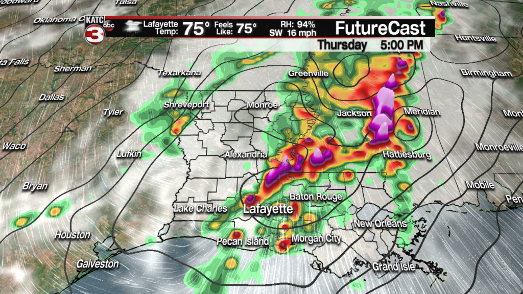
It looks as if the worst of the weather will be in central Mississippi between Jackson and McComb, but that doesn’t mean we won’t get any nasty weather in Acadiana.

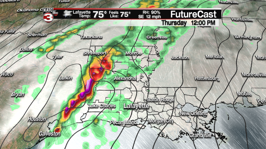
WHEN: A few showers and storms will be possible out ahead of the main line during the early afternoon, but the main event won’t arrive until the late afternoon.
The current window looks to be between 2:00 and 5:00 in the evening in central Acadiana with the storm system moving from west to east.
This could prove to be problematic for evening commuters, but it does mean that the showers will clear overnight and the sun can return on Friday.
IMPACTS: The big issue for Thursday is going to be damaging winds with wind gusts up to around 60 mph possible as the front swings through.
A few tornadoes will also be possible both in individual thunderstorms and embedded along the main front.
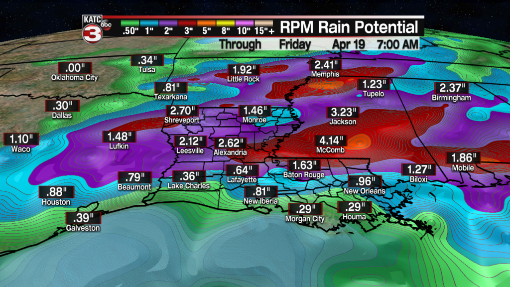
There could be a few hail makers in the mix as well so it’ll be an all modes type weather event, with heavy rain and frequent lightning all in the mix.
While the rain may be heavy at times serious flooding isn’t expected outside of some possible minor street flooding in the evening.

FORECAST DISCUSSION: It seems like the front may not look too intense as it goes from Texas into Louisiana, however, there’s enough instability available that intensity will increase as it gets into Acadiana so don’t be caught off guard.
The last few rounds of potential severe weather have fizzled out, for one reason or another, but that doesn’t make it a guarantee that this front will behave the same way.
It’s easy to get complacent and assume that’s what all the storms will do but it’s not terribly wise so make sure that you do stay vigilant on Thursday.
Forecasts change quickly so stay updated on all the latest weather information.
