
As mentioned before spring can be an especially volatile time in south Louisiana’s weather pattern, and April is when the severe weather season seems to peak.
True to form and the time of year we are looking at our next chance for some severe weather to swing through on Saturday.

An impressive looking system is slated to move through Saturday evening, with the chance for isolated storms during the afternoon.
While all of Louisiana is hatched in for a slight chance of severe weather, the chance for higher impact storms will be just north of Alexandria.
The EURO model has remained pretty consistent over the last couple of days helping build some confidence with the forecast.

Damaging winds and hail will once again be the primary threats to contend with and isolated tornadoes will be possible.
One of the concerns is the amount of energy available for these storms to utilize, which means that even the pop up storms should be closely watched.
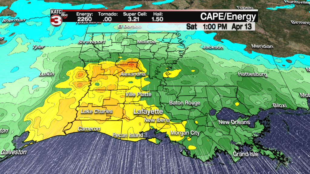
A spike in energy in north Louisiana helps verify the outlook given by the Storm Prediction Center, but a health amount of instability will exist through out the state.
The numbers at the top of the following graphic are for Lafayette, and 2260 j/kg is plenty of energy for storms to utilize, while both the super cell and hail parameters hint at some very nasty storms.
While flooding in Acadiana doesn’t seem to be as great a concern as to the north, we’ve all seen how quickly one storm can produce rainfall.
Keep a close eye on the forecasted numbers the next few days to see if they’re trending up or down going into the weekend.

As always this forecast can, and likely will change and evolve over the next several days.
