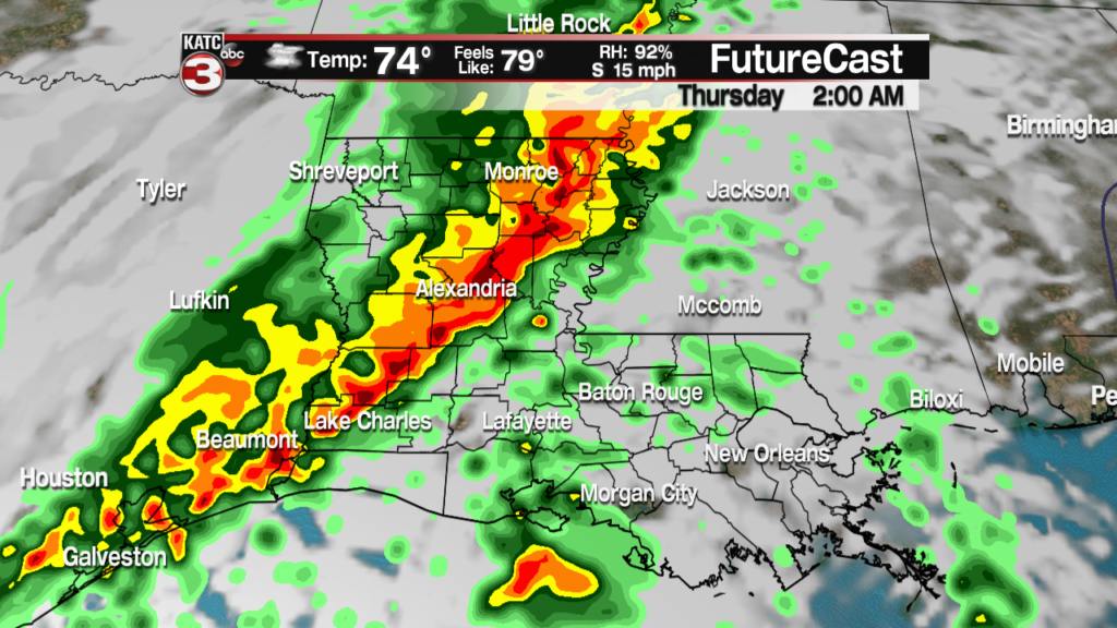
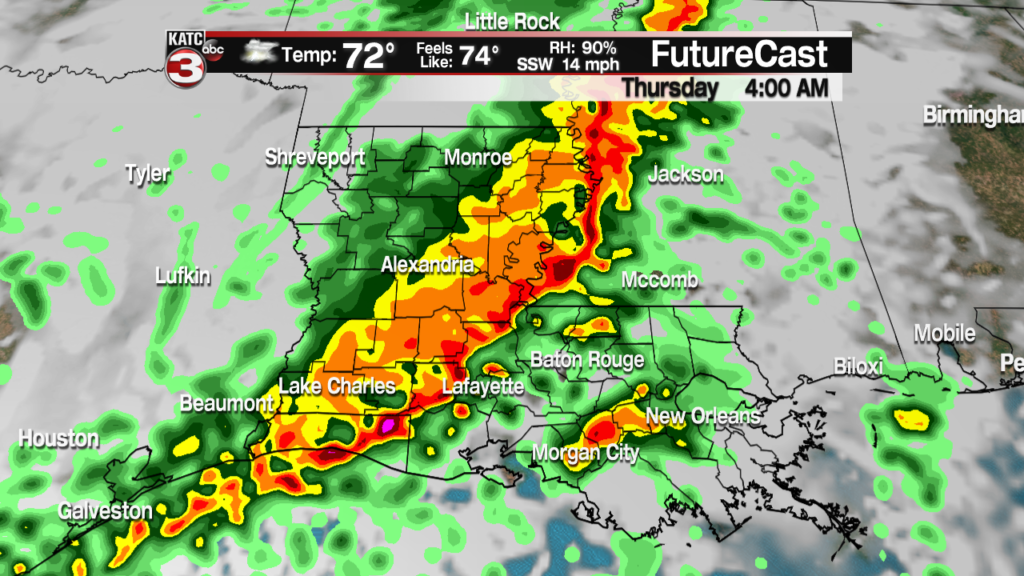
November is the beginning of Louisiana’s severe weather season, and right on cue a strong front is expected to push through the area. This front will likely produce a round of severe weather in the early hours of Thursday morning, which will certainly impact commutes.

The Storm Prediction Center has Acadiana has placed an “Enhanced Risk” of severe thunderstorms, which means widespread severe weather is likely. The main issue with this system is going to be the potential for damaging winds, with gusts up around the 50-60 mph range. Discreet cells that move out ahead of the front will also be capable of becoming supercells, which can produce isolated, strong tornadoes. Along with the wind and tornadoes though will be torrential rain capable of producing 2-3″ of rain in a short amount of time, which means street flooding will be possible for Thursday’s drive to work.

Timing of this front has stayed fairly consistent over the last few days and the front is expected to move through Acadiana. The western fringe of Acadiana will feel the impacts of the front around 2:00 – 3:00 am, central Acadiana (including Lafayette) between 4:00 – 5:00 am, and the eastern edge of Acadiana between 6:00 – 7:00 am. This is good news for trick-or-treaters as it won’t start to pick up until late in the night, however, if you’ll be out late this Halloween you will want to call it quits a little early.


The bulk of these storms will be swinging through the commute time for many people, and if possible it might not be a bad idea to delay that commute. Since that’s not possible for everyone if you do have to be on the road be on the look out for flooded roads, and give yourself plenty of time to get to work. This will be a rapidly evolving system so it will be important to make sure you can stay on top of all the watches and warnings. We will update as necessary and will get all those warnings out as they come along.


