


Showers will be moving across Acadiana over the next few days giving us a really soggy end to the work week.
A surge of moisture will arrive on Wednesday and will even help drive the heat index back into the triple digits before the rain gets going.
The showers will be tropical in nature so they'll be arriving in waves with breaks in between some of the heavier downpours.
Thunderstorms will also be likely although severe weather isn't anticipated at this time.
While major, widespread flooding isn't expected there could be pockets of localized flash flooding especially after the ground is already saturated.
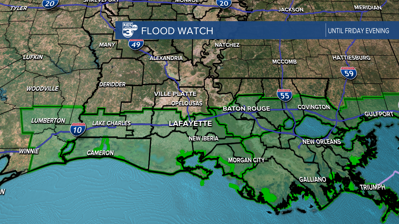
A Flood Watch has been posted for the areas along and south of I-10 until Friday evening when the last of the showers will start to taper off.
Be mindful during the commutes this week, both morning and evening, as water may pool on road ways during and immediately after rounds of showers.
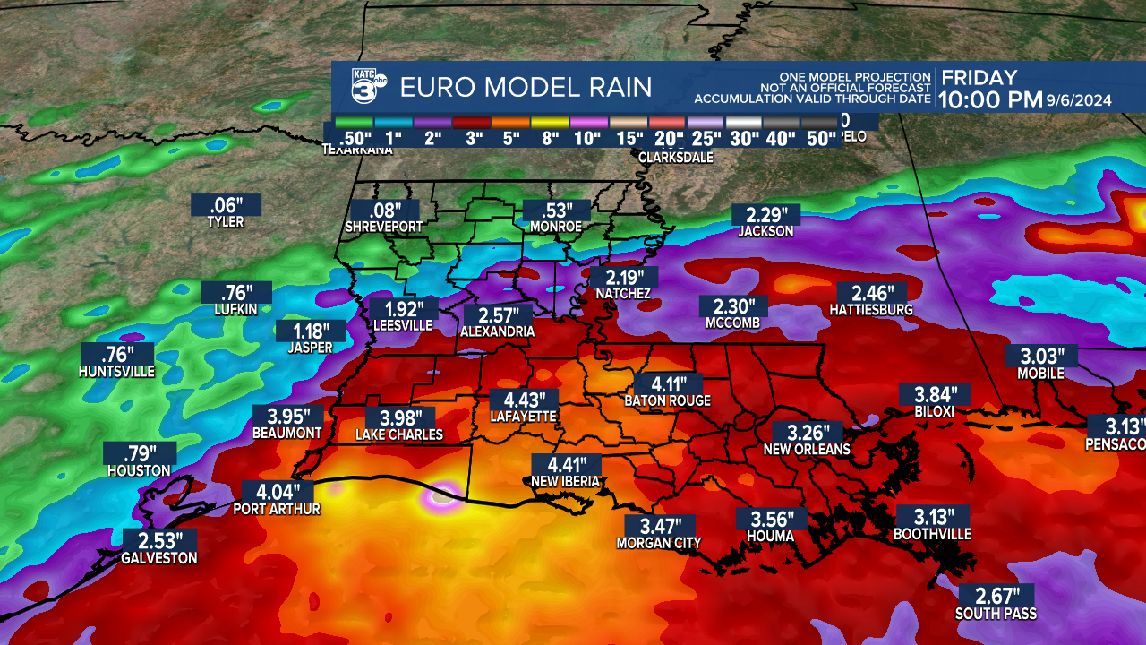
Rain totals on average should sit between 3-5" over the next few days, given the tropical nature of the rain it's possible that some areas may see almost double those number in localized spots.
The good news is that behind this multi-day rain event there's the first front of fall.
Dry air should move in through the day on Saturday and temperatures will stick around in the mid 80s with lows pushing down into the low to mid 60s.
That cooler, drier air mass will be in place for several days and the forecast for next week is looking spectacular.
Temperatures until then will sit in the mid to upper 80s with the rain and lows sticking in the mid to upper 70s with plenty of humidity.
———————————————————-
Wednesday Afternoon Video Update concerning the disturbance in the Gulf of Mexico:
