


We are in the middle of a very wet stretch of weather here in Acadiana, and I wouldn't expect much, if any, sunshine until the weekend.
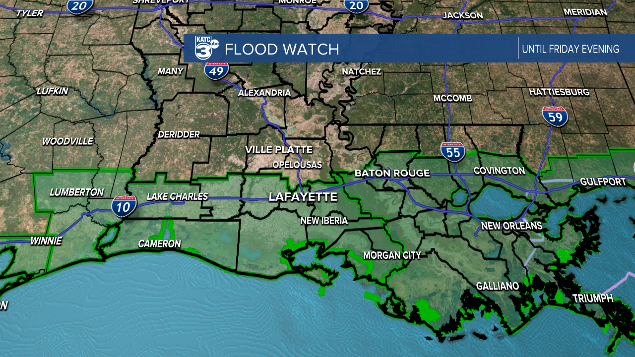
Periods of heavy rain picked up on Wednesday with Lafayette receiving just under an inch of rain and a Flood Watch has been issued until Friday evening.
Spotty showers have persisted in the early hours of Thursday after a quick break and there's an expectation that rain will become more spread out as we go through the morning.
While major, widespread flooding doesn't seem to be likely there will be pockets of localized flash flooding around the heaviest showers so stay mindful of current conditions.
The rain is a product of an area of low pressure that is sitting in the Gulf of Mexico that will slowly drift into Louisiana over the next two days.
This is going to keep the rain firmly in place until Saturday and depending on the strength of the low we may see gustier conditions picking up.
That will be particularly true off-shore near the center of the low where winds will likely be gusting between 20-30 mph.
Since this feature will stay offshore the highest rain totals will be along the coastline, and some of the more extreme rain total numbers will remain out over the Gulf.
If this low drifts a little further north than expected it could change rain totals fairly drastically and flooding would become a bigger concern.
That being said there's a reason why this low will likely stay further south which we'll address a little further down in the discussion.

Short range model projections keep us on track for the original thinking that we'd pick up between 3-5" of rain through Friday, but it is highlighting much higher numbers along the coast.
It's important when looking at these models not to get caught up with specific, individual numbers but to look instead at the bigger picture.
Rain could push closer to 10" for areas closer to the coast, and there's a few spots off-shore that look to be between 15-20" through Friday.
Obviously if we notice those kinds of totals trending further north the concern for flooding would increase, but it looks likely that those numbers will stay off-shore.
Most of the more extreme rain totals inland occur in pretty marshy regions which will help alleviate flooding concerns, with the exception of areas in St. Mary Parish.
Folks in Morgan City and Franklin will want to be mindful of potential flash flooding especially on low lying roads.
Remember there will be breaks in the rain which will help things drain out and is certainly better than getting all that rain at once.
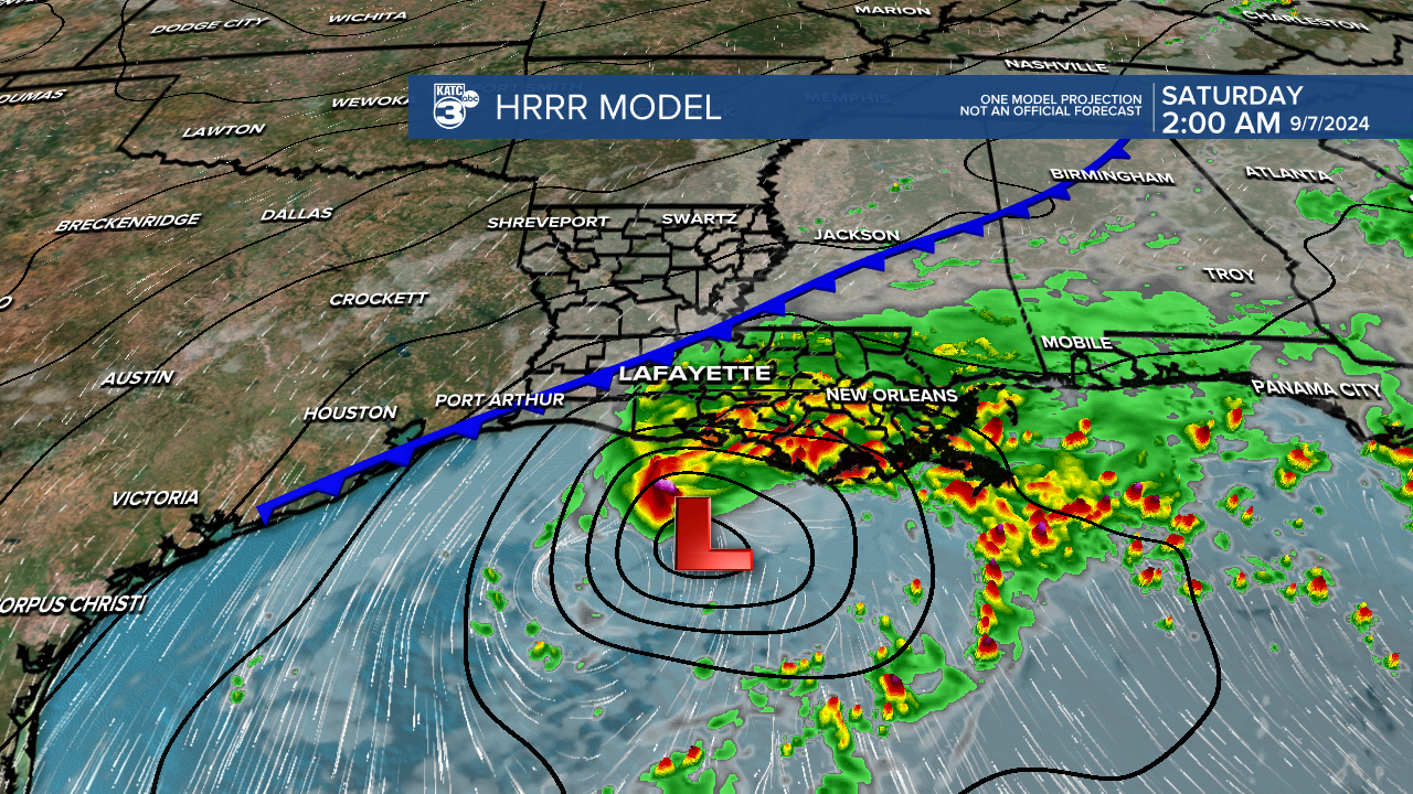
A perfectly timed front is expected to drop down into Saturday and this is going to help us out in several ways.
The first being this is the feature that will keep the low to the south and hopefully prevent the more extreme rain totals from moving inland.
The worry would be if the front slows or stalls at all but models have been consistent in timing and movement so will assume it's able to keep the worst weather off-shore.
It is also preventing the low from really flaring up, this time of year you never want to see a low pressure system in the Gulf of Mexico given their propensity for rapidly intensifying.
This front, however, is going to produce enough northerly shear that any development would probably be limited to a tropical depression or a low end tropical storm as it's strongest possible scenario.
Remember that even if we do see further development that's already been factored into the forecast so we wouldn't see much change as far as impacts go.
The good news is that there's much nicer, drier weather on the way for the weekend and we'll even get a nice taste of fall.
