


It looks like the final days of summer may officially be winding down this week.
While there's plenty of heat the next two days a front is expected to bring in some drier air for the end of the week.
Tuesday, however, will remain hot with highs pushing into the low 90s and the heat index nearing 100.
Mostly sunny skies will be the main order of business, although a few clouds will drift by and even a rare isolated shower will be possible.
There's better rain chances on Wednesday as the front moves through but even then we're mostly expecting a small scattering of thunderstorms.
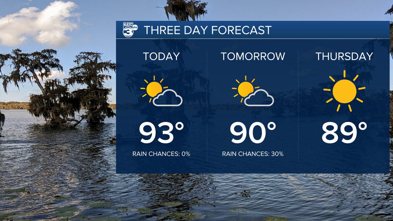
Once that dry air moves in it looks to hang around for a while with beautiful weather expected through the end of the week and into the weekend.
Highs will still be warm with temperatures topping out in the mid to upper 80s but the humidity won't be near as high.
Lows will be allowed to get down into the low and mid 60s which will make for some very nice morning temperatures.
This time it seems to linger a little longer and pleasant conditions should stick around into the first week of October.
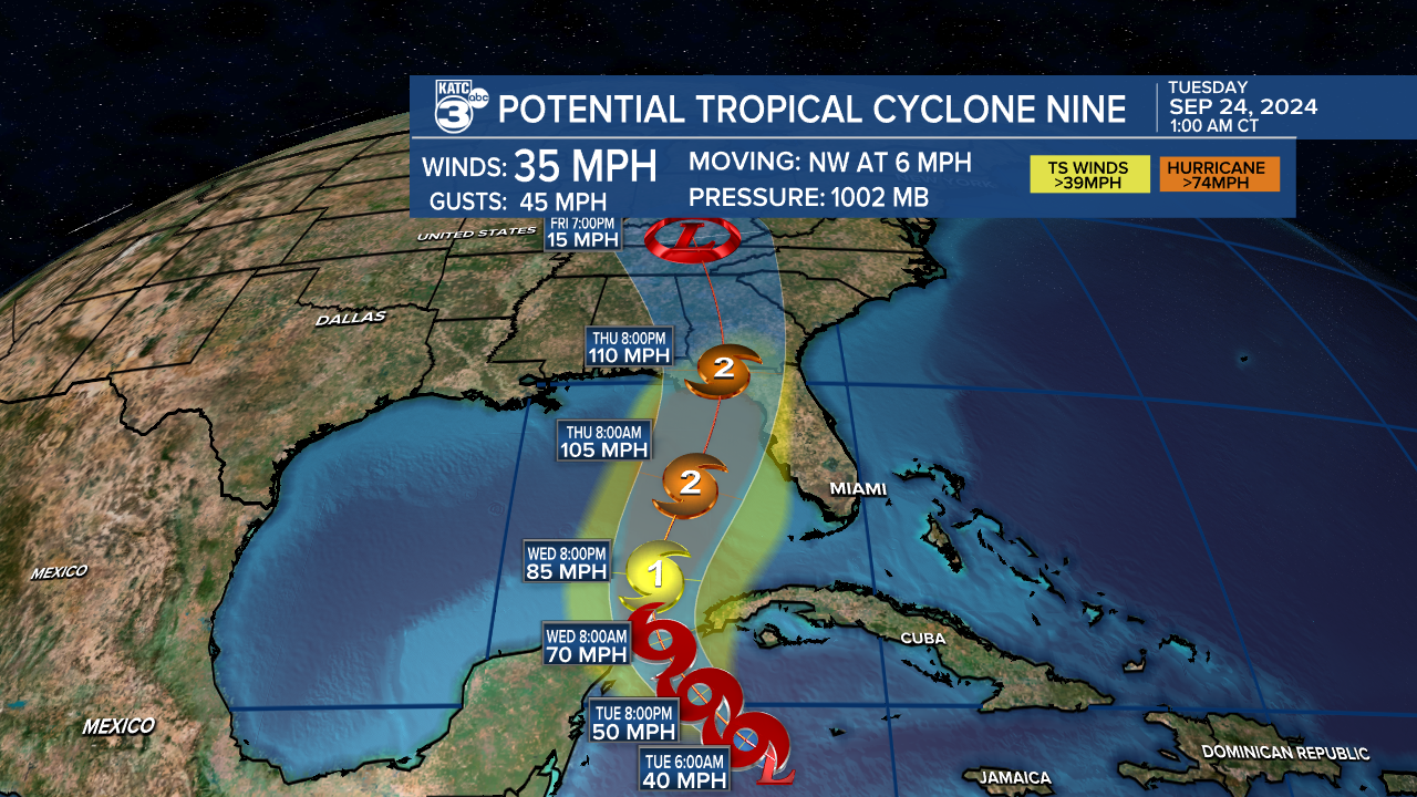
There is tropical weather expected in the Gulf of Mexico this week but it will remain out of our area as it moves toward Florida's Big Bend region.
Acadiana is not expecting any impacts from this system.
