An area of cloudiness over the Bay of Campeche will continue to hold stationary over the next few days. Although there's no signs of development, 92L has a chance for strengthening later this week.

The models for the next three days are pretty consistent keeping the system along the Mexican coast over the Bay Of Campeche, then moving it northward by Thursday and Friday. Once it moves northward, it has a better environment for additional strengthening and could become a tropical depression or tropical storm. The National Hurricane Center thinks there's a 60% chance of that happening over the next five days.

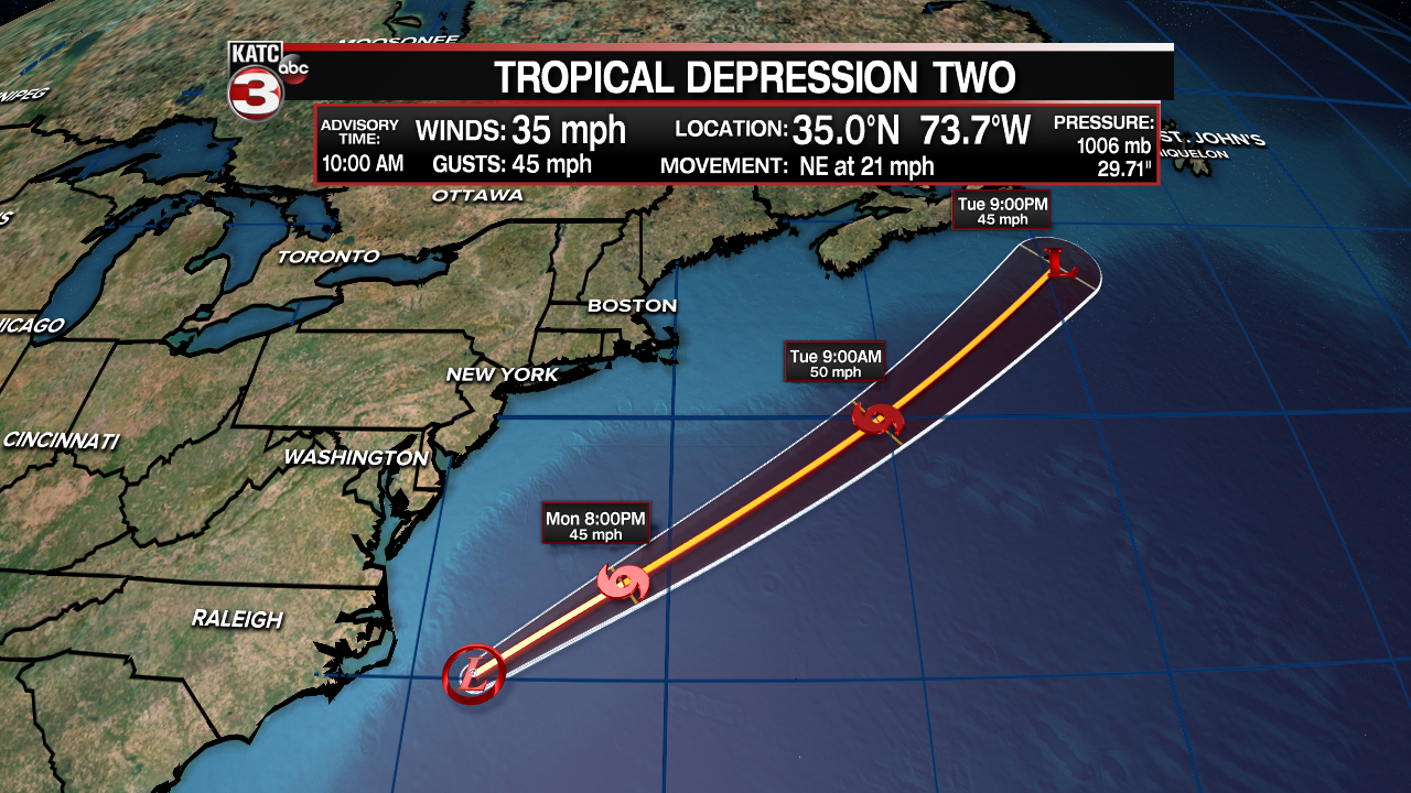
Another disturbance off the Carolina has become Tropical Depression #2 as of 10am Monday. This system is expected to move northeast into the Atlantic Ocean and strengthen into a tropical storm. If it achieves tropical storm status before the gulf disturbance, it will be called Bill.

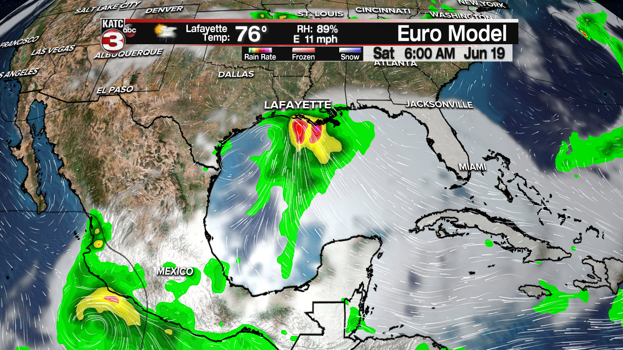
As of now, most models are strengthening the system into a tropical depression or weak tropical storm. The EURO Model shows a tropical depression moving northward and bringing some heavy rain to the Louisiana coast by the weekend.

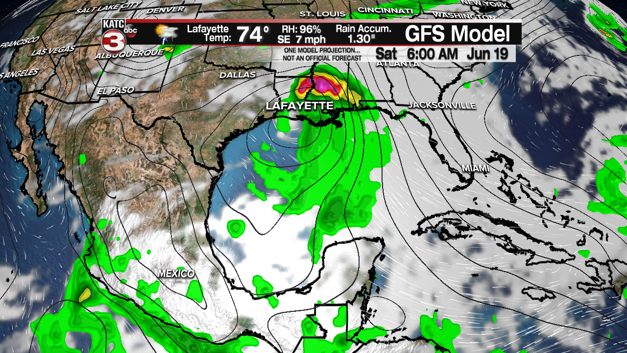
At the same time, the GFS is showing a slightly stronger system, possibly a tropical storm. The GFS also pushes some of the moisture farther to the east. This solution would bring a bit more wind to Acadiana with flooding rains possible toward New Orleans.
Either way, it appears we may have a weak tropical system in the Gulf of Mexico later this week, and rain chances will be increasing toward the Father's Day weekend. You can get the latest tropical forecasts by visiting our Hurricane Page at KATC or downloading the KATC Weather App.


