Tuesday Afternoon Update:
Acadiana still on track for the next weather-maker to impact the area late Thursday into Friday...the Weather Prediction Center has the region in a slight to moderate risk for excessibve rainfall, especially for areas that have received soaking rains across SE Texas into SW/W Louisiana.

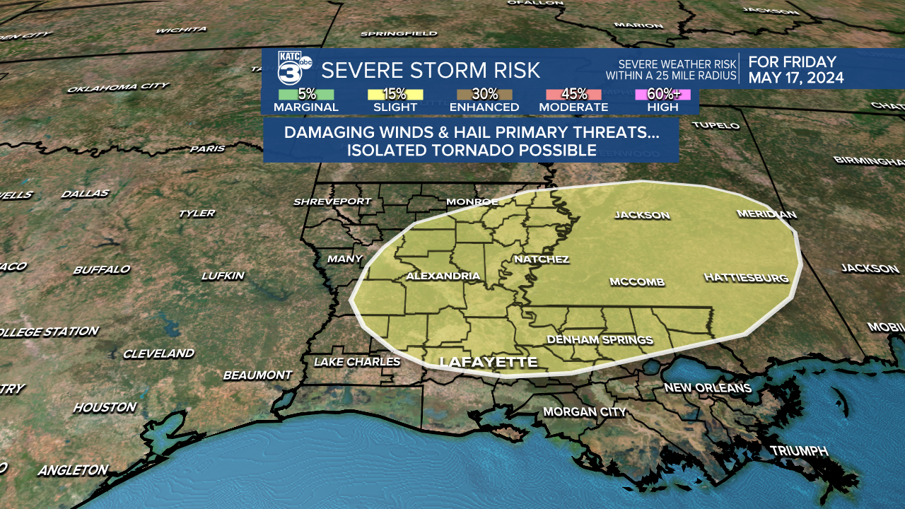
There could be a severe weather threat with the next round of storms that look to arrive by Thursday night into Friday.
NWS Surveys coming in on 3 tornadoes that occurred in the area Monday...
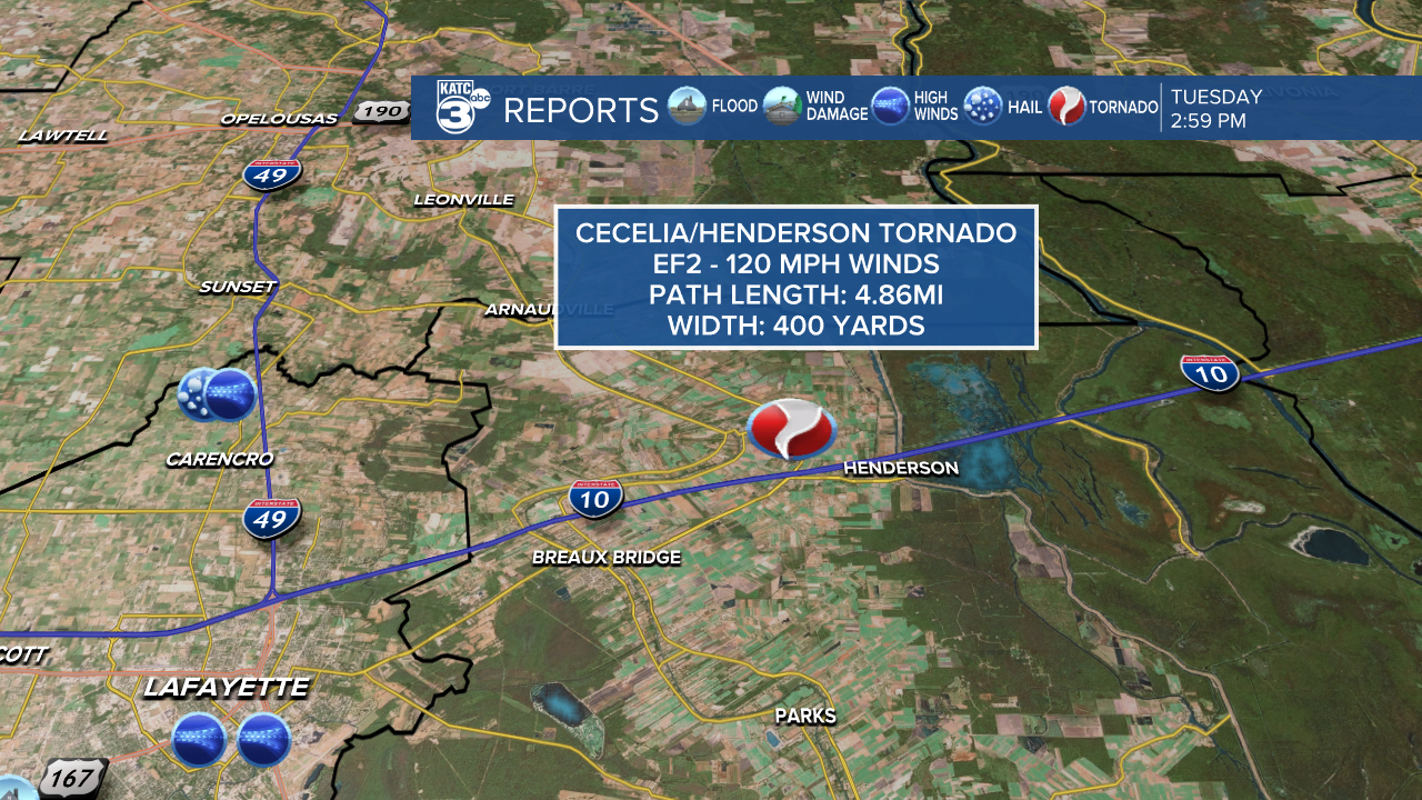
An EF2 hit the Cecelia/Henderson area with 120 mph winds.

Per NWS Survey: "A tornado touched down just west of Bayou Teche causing tree damage. The tornado then tracked across southern portions of Cecilia, crossed I-10, and into Henderson damaging numerous homes and some businesses. Damage consisted of roof damage, rolled manufactured homes and RVs, destroyed outbuildings, and at least one partial wall collapse to a structure. The Motel 6 also had the roof removed. Additional tree and powerline damage was noted in these areas as the tornado reached peak intensity of EF2 120 MPH. The tornado finally pushed east into Henderson Lake/Atchafalaya Basin where it likely ended. There is some uncertainty as to how far the tornado tracked into the basin, due to lack of access. Additional data will be needed to make a final determination."
An EF2 tornado with 120mph winds hit the Sulphur area Monday.

Per the NWS Survey: "An EF-2 tornado touched down north of Orphan Village Road in Sulphur, then tracked southeast damaging homes and businesses. On East Napoleon St. two warehouses were destroyed by the tornado. On N Cities Service HWY a gas station awning was damaged along with a strip mall. In the Maplewood community severalhouses were damaged with trees uprooted or snapped and parts of roofs blown off. The last reported damage was on Bayou Dinde Pass where several trees were snapped. Along the path trees and power lines were also downed."
In addition, an EF1 tornado with 100mph winds was determined in the Westlake area, crossed I-10 and moved through downtown Lake Charles producing some roof damage and downed power lines.
————————————————-
Tuesday and Wednesday will be a chance for us to catch our collective breath.
Storms have pummeled the area over the last few days, and the start of this latest stormy pattern goes all the way back to last week.
Which is why the sunny skies through the middle of the week will feel like a treat.
Clouds have lingered into early Tuesday morning but there's progressively more sunshine expected through the day.
Temperatures will be in the upper 80s in the afternoon but it will feel much drier outside and should ultimately be pretty comfortable.
The dry air will lead to lows dropping into the low 60s making Wednesday morning particularly pleasant.
We're still waiting on that first 90 degree day and it looks like we'll have another shot to get there on Wednesday.
Plenty of sunshine and dry air will increase temperatures for the middle of the week and give us one last day of calm before diving back into an unsettled pattern.
Moisture will build up through the day on Thursday and showers and storms will return to the area Thursday evening.
There's currently a Marginal to Slight Risk for severe weather Thursday into Friday but it doesn't look, at this time, that we'll see storms as strong as the one that moved through Monday.

Showers will persist on and off into the weekend before quieting down again on Sunday.

Next week looks fairly quiet with plenty of sunshine and temperatures consistently pushing into the 90s.
See the KATC 10 Day Forecast for the latest.


