


Mostly cloudy, breezy and warmer weather is on tap for Acadiana Friday ahead of our next weather-maker, that is expected to bring showers and storms back to the region Saturday, with a low-end threat of a few severe storms.

In the near term, expect temperatures to be not as cool with lows closer to the mid-upper 40s to lower 50s courtesy a return of southerly winds.

Friday will bring increased cloud cover along with breezier southerly winds near 15-25 mph.
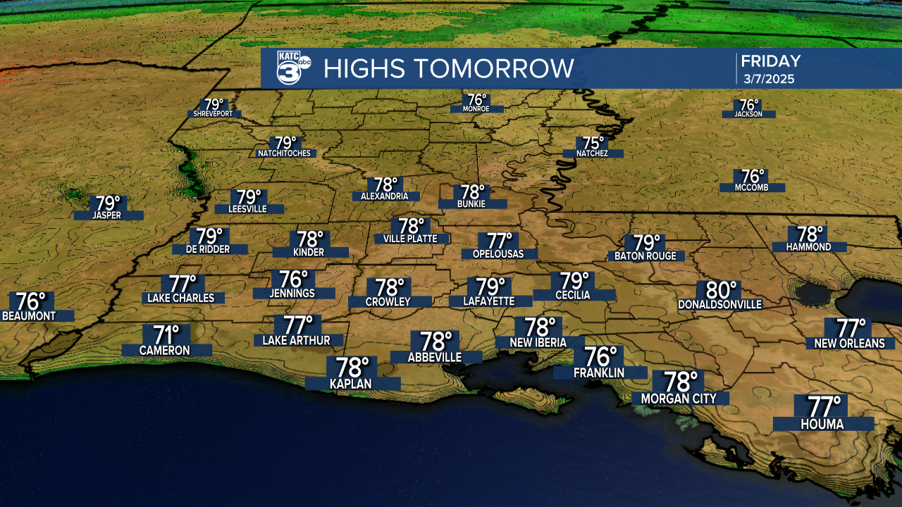
Temperatures will rise into the mid-upper 70s for our Friday.
Friday night into Saturday morning should be milder...in the lower 60s, but there may be a good chance of fog developing toward Saturday morning.

Next on the meteorological menu is a Western storm system that will drape a frontal boundary across the area as low pressure develops to the west and scoots along the Louisiana Coast Saturday.

This feature will bring scattered showers and thunderstorms back to the area Saturday with activity tapering Saturday night into Sunday morning.
New Today: The Storm Prediction Center has added our area to a "marginal risk" (level 1 out of 5) of a few isolated severe storms that could be capable of producing hail and/or damaging winds.

Activity looks to be scattered in nature Saturday and progressive with rain totals expected generally less than an inch for most.

Model data however, may be underplaying some of the rain totals, but flooding rains are not expected.
Thereafter, there will be a slow clearing process with cooler conditions into Sunday followed by sunny and pleasant conditions early next week.
There is a chance of a few storms Wednesday...if they do develop, there could be another low-end severe risk...but that remains a big IF for Wednesday due to the possible lack of atmospheric moisture for an upper level disturbance to work with.
Then the next weather-maker is shaping up for the following Saturday...which may come with perhaps a more substantial severe weather threat...it's that time of year.
See the KATC 10 Day Forecast for the latest.
