


A better chance of scattered showers and thunderstorms are in the forecast for Acadiana overnight into Thursday as a weak frontal trough settles into the area.
Meanwhile, the tropics are looking a little more active as we finish out the month and head into early July.
In the near term, it remains a tricky forecast as to whether strong storms entering the northwestern portions of Acadiana late Wednesday afternoon will hold together enough to give portions of the area some localized soakings and gusty winds tonight.
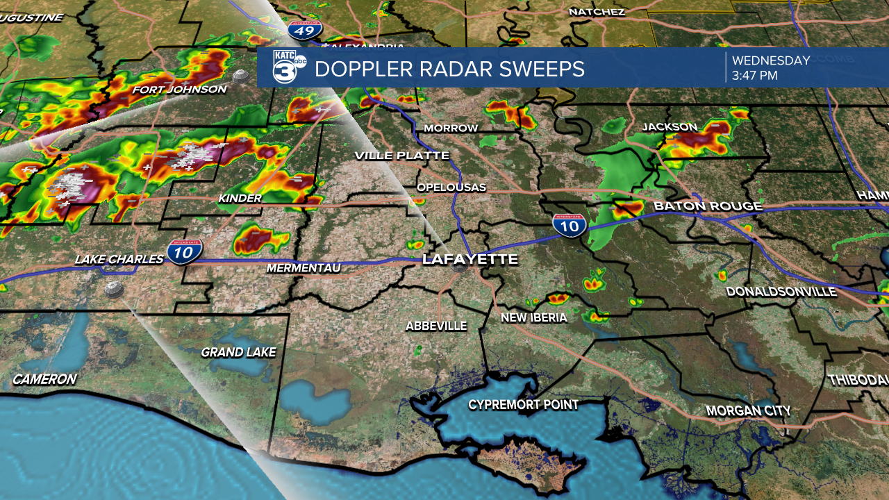
The weak frontal trough associated with the storms should stall near the Louisiana Coast Thursday providing the focus for additional storm development Thursday.

For now, we're going with a 50% chance of storms tonight to near 70% Thursday morning.
Additional scattered activity could develop across the Acadiana region int o Thursday afternoon depending on whether the morning activity does not overly stabilize the atmosphere...so the forecast is wrought with "bust" potential regarding the chance of rain and timing.
Thereafter the pattern should settle down to a hot and humid with scattered afternoon storms scenario into the weekend and for most of next week.
See the KATC 10 Day Forecast for the latest.
Meanwhile in the tropics, the National Hurricane Center tracking two disturbances in the Atlantic Basin.
The disturbance in the Caribbean Sea has a low chance of development as it is expected to traverse the Yucatan & Bay of Campeche on the way to Mexico this weekend.
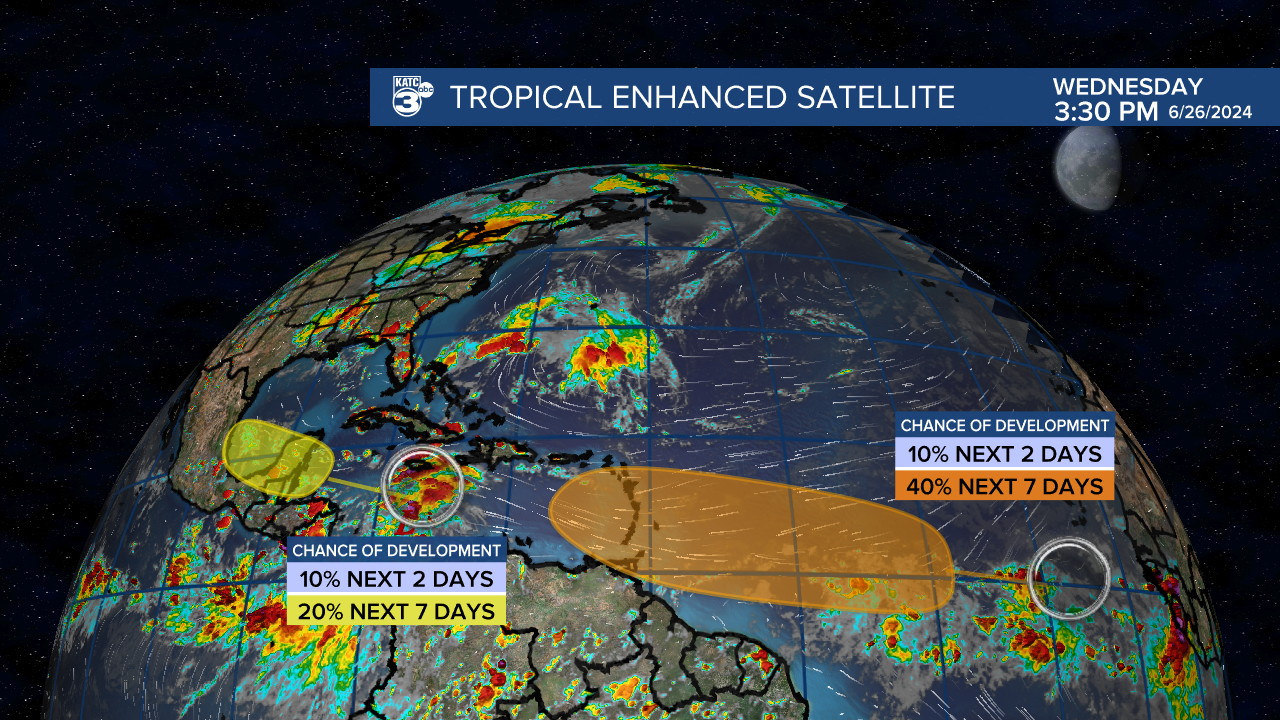
Meanwhile, a disturbance that has emerged in the Eastern Atlantic is gaining more traction for development and could threaten the Eastern Caribbean as legit tropical system by early-mid-next week.

Euro model captures this feature nicely bringing a potential tropical storm into the Caribbean through the next 6-7 days and suggesting thereafter the system could achieve hurricane status in the Western Caribbean.
It remains too early to call on whether this system could be a Gulf threat.
For now NO tropical impacts are expected for Louisiana through the next 10 days.
