The primary threats to Acadiana from Beryl will some coastal flooding mixed with a few tropical rain bands/squalls this Sunday evening through Tuesday morning.
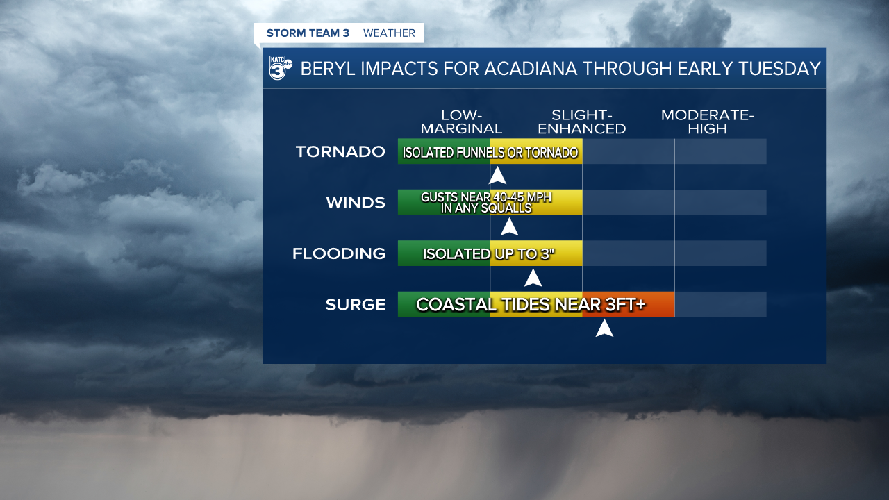
Look for some tropical rain bands to continue into early this evening with another few bands to develop into tomorrow afternoon through Tuesday morning...timing and location of these bands will be impossible to nail down.
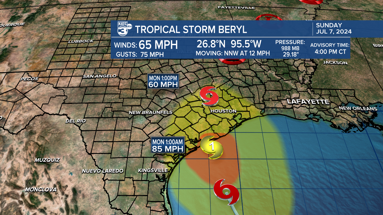
The 4pm Sunday National Hurricane Center Advisory indicated that Beryl still has a very good opportunity to become at least a Category 1 storms prior to landfall predawn hours of Monday.
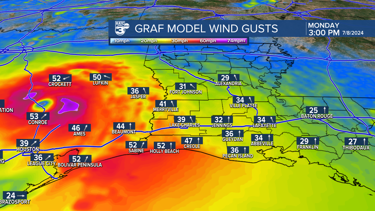
Wind gusts in squally storms will be in the 40-45 mph range...away from storms 20-30 mph.
There could also be some tropical funnels and/or perhaps a low end risk of any isolated tornado in stronger squall activity that may develop.
Expect breezy conditions to develop across our area Monday morning with a mostly cloudy skies, but with some intervals of sun possible too. Rain chances (60%) tonight drop to 30% after 10pm, near 60% into tomorrow afternoon/evening, and 70% tomorrow night into Tuesday morning...we should be drier for Tuesday afternoon.
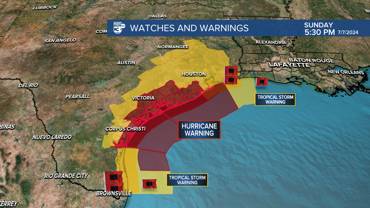
Here's the latest GRAF model including watches & warnings concerning Beryl prior to the 4pm update...

Beryl has roughly 10-12 hours to intensify back to a hurricane...which is still expected, but a rapid intensification cycle does not look imminent at this point.
We'll watch the trends the trends overnight.
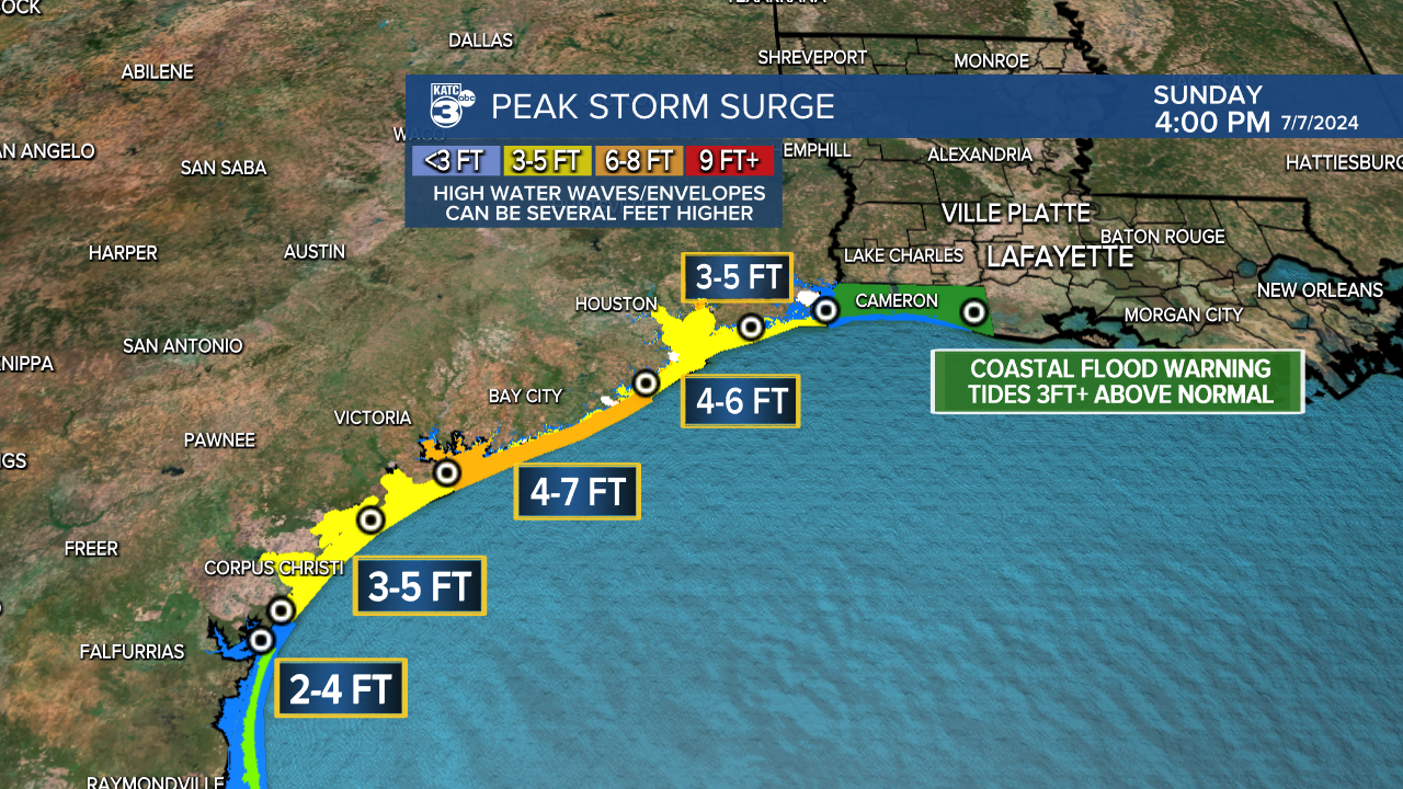
The updated 4pm storm surge forecast for Beryl:

IMO if it's going to be 3-5ft along the extreme upper Texas Coast, it will likely be the same for Cameron Parish.

Coastal Flood advisory has also been issued from Vermilion over to St Mary Parish... calling for 1.5ft above normal tides (imo too low too)
Additional forecast graphics concerning Beryl can be found here:
Rain chances are expected to ease a little bit later this week while the heat turns back up.
See the KATC 10 Day Forecast for the latest.


